Into the wilderness
Let’s go backcountry flying

Suggested airstrips
Sidebar subtitle
A huge array of adventures is available at airstrips in Idaho and Utah. If you’re just getting started, you might want to try Garden Valley or Johnson Creek, both in Idaho. These strips are relatively long, well-manicured, and provide summertime caretakers and facilities that even include bathrooms and hot showers. Nearby creeks and rivers provide great fishing and hot springs. The strip at Cavanaugh Bay, on Priest Lake near the Canadian border, is big enough for large twins. The lake is gorgeous and even has a floatplane base. The Idaho Division of Aeronautics has published helpful standard operating procedures for operations at five of its most popular airstrips, including those above; a sixth is due in 2016. Download the SOPs for free.
Other strips such as Sulphur Creek or Flying B have lodges and cabins, serve meals, and can arrange guided hunting or fishing trips. Really want to get away from it all? Many of Idaho’s airstrips are at the bottoms of deep, beautiful canyons and offer total solitude; primitive camping; and endless hiking, photography, and fishing opportunities. Large groups of aircraft should avoid the less-developed airstrips to preserve the wilderness experience for others.
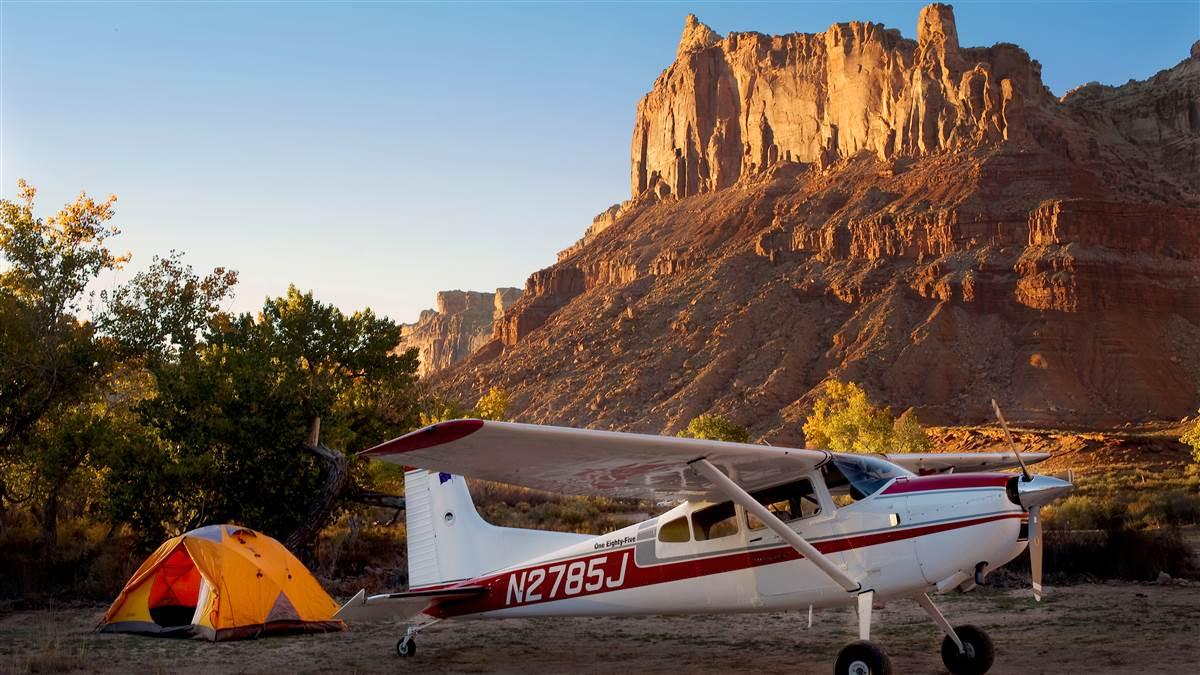
In Utah you’ll find remote airstrips tucked beside desert rivers and surrounded by red rock buttes that invite you to look for ancient rock art or pottery shards left by the Ancestral Puebloans who inhabited these areas hundreds of years ago. Some airstrips, such as Mineral Canyon, are at the bottoms of canyons—while others, such as Hidden Splendor, are perched on top of the buttes, with sheer drop-offs at either end of the runway. Many Utah strips are accessible in winter when Idaho’s mountain strips are covered in snow. —CVW
Backcountry flying tips:
Monitor 122.9 MHz and use it for position reports, not chit-chat.
Experienced backcountry pilots usually scrub the flight if winds at 9,000 feet exceed 25 knots.
Inside canyons, hug the right side, safety permitting, to avoid midair collisions and allow turn-arounds.
Understand drainage. Following a river downstream leads to lower terrain.
Lost and flying upstream? Consider it an emergency; a box canyon could be around the next bend. Turn around and climb to a safe area to sort things out.
In summer, morning ops are best, to avoid turbulence, winds, and density altitude issues.
Fly a pattern above the strip to note the winds and check for obstructions, including wildlife.
Don’t land on muddy runways
Wet grass in the morning can be slippery on touchdown.
Don’t disturb the peace for others: no touch and goes; practice your backcountry techniques at regular airports.
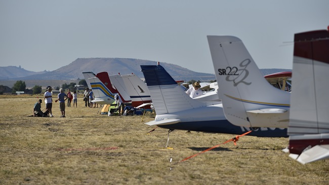
Large groups of airplanes shouldn’t land at the most sensitive airstrips.
Airstrips are seen as trailheads into the backcountry. Land and stay awhile; don’t just “bag” a strip and take off again.
Use caution with prop wash; you could blast another airplane with gravel, blow away a tent, or damage your propeller.
Using rocks as chocks is OK, but move them completely out of the parking area before departure. Grass could grow up around them and the next airplane might run over them.
Many backcountry pilots prefer to take off downhill even with a tailwind, unless it exceeds 15 knots.
Be ready for sinking air above lakes and rivers.
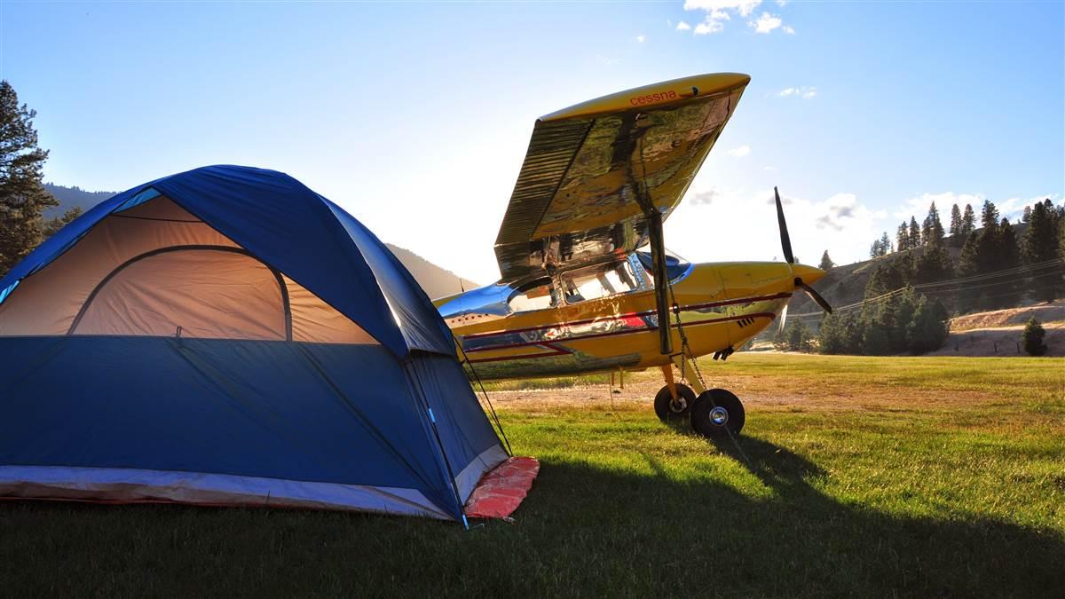
Pack out all your trash; bring extra toilet paper for the outhouse if there is one.
Remember that in the back-country you are an ambassador for all pilots. Be courteous.
So how do you get started on this new adventure, plan the best trip for your skills and interests—and carry it out safely?
Gear
Check your insurance policy to be sure you’re covered for landing on unpaved runways. If not, give your agent a call and see if you can have your policy modified. When you fly over less-inhabited areas, a personal locator beacon or satellite tracker such as those made by SPOT or DeLorme is a smart idea. Many of these devices allow you to communicate when you are out of cellphone coverage. Plus, in an emergency, you can be found quickly. Text messages can be sent and received from deep in the wilderness using a DeLorme InReach; it also accurately shows position to within 12 feet.
A survival kit is recommended. Depending on your plans, you might also bring camping or fishing equipment. Secure it safely before you depart and keep track of your weight and balance.
You might think you need a specialized STOL aircraft to access the backcountry, but that’s not true. While an Aviat Husky with big Bushwheels can get into certain areas that a Cessna 172 or 210 cannot, the 210 and similar aircraft can go into many of Idaho’s backcountry airstrips, among others. Some aircraft, however, such as a low-profile Mooney, should only be flown to the longer, best-maintained airstrips with low-cut, manicured grass and easier approaches. So how do you determine where you can safely land?
Flight-planning information
There’s a wealth of backcountry-specific information out there, if you know where to look.
Three of the best states for backcountry aviation in the Lower 48 are Idaho, Montana, and Utah. Of these, Idaho has the greatest number and variety of airstrips. If you look at a map of the state, you’ll see its entire center section comprises huge mountains and deep canyons with virtually no roads. The major cities lie around the state’s perimeter, on relatively flat land. Aviation has been an essential mode of travel among these cities for a century.
Much of the central portion of the state is now wilderness, but Idaho pilots banded together to protect their wilderness airstrips—and relatively few have been closed. (Backcountry aviation refers to actual airstrips composed of grass, dirt, or gravel, not landing on any open spot—that’s bush flying, which they do a lot of in Alaska. These airstrips are on federal, state, or private land that is open to the public.) The Idaho Aviation Association works to keep airstrips open for all pilots and provides volunteers to maintain them (I edit its monthly publication, The Flyline). Another effective organization with the same goals, based in Montana, is the Recreational Aviation Foundation.
The best sources of detailed, accurate information about available airstrips in Idaho and Utah are the books Fly Idaho! and Fly Utah! You can use these books to decide which airstrips you’d like to visit based on your interests, skills, and equipment.
The third edition of Fly Idaho! is a massive 946 pages, split into two volumes, Air and Ground. The Air section provides two color photos of each airstrip, with runway numbers superimposed, as well as information such as runway length, elevation, and condition. Author Galen Hanselman, a physicist and pilot who is a stickler for accuracy, surveyed and photographed all the strips himself. His system for rapidly assessing an airstrip’s difficulty, a number between 1 and 50 called the Relative Hazard Index, takes into account such variables as the approach and departure environment; runway surface, length, and elevation; slope; and other factors. Plus, you’ll find two more full-page diagrams on each airstrip. One shows the runway slope, and the other depicts the surrounding terrain to help you understand the approach and departure environments.
The Ground volume covers all there is to do at that airstrip: fishing, hiking, hot springs, lodges, camping information, plus stories and history about Idaho’s unique backcountry characters. Miners, early aviators, swindlers, ladies of the evening—you name it and you’ll find it in here. This section makes entertaining reading even if you’re not planning a trip. The Idaho and Utah books are available on the author’s website. There’s even an Idaho Backcountry User Waypoints Database you can download into your ForeFlight app.
Another extremely useful tool when planning your backcountry adventure is a VFR chart. Many backcountry airstrips are not shown on FAA charts, so a number of state aeronautical agencies have commissioned special full-state VFR charts. Lay out the chart and you can see the entire state at once (they’re at WAC scale). Folding charts are made of a special tear- and water-resistant material, and wall charts can be framed and hung.
Specialized instruction
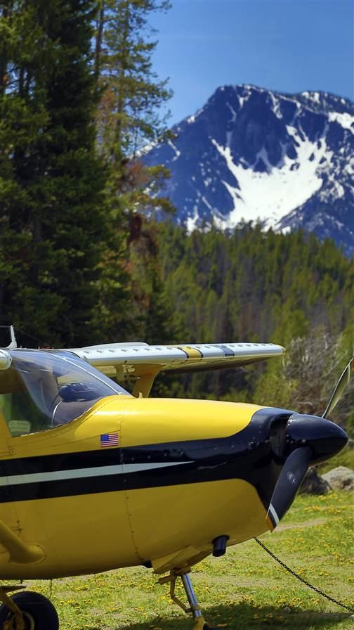 Flying in the backcountry requires specialized skills. You need to be able to maneuver at slower speeds and put your airplane down at a specific spot on the runway. Short- and soft-field skills will be used on every landing and takeoff. Less-than-full fuel tanks help keep your weight lower. Density altitude can be a factor in summer, when early morning or late-afternoon ops are standard practice. You’ll need to get comfortable flying inside canyons, with mountaintops and even treetops rising above you. Reading the winds, avoiding turbulence and downdrafts, flying on the right side of the canyon, and understanding drainage and rising terrain all are essential.
If you’re not already well-versed in these skills, the good news is that numerous instructors specialize in them, and they can train you quickly and in your own airplane. Lori MacNichol’s McCall Mountain and Canyon Flying Seminars at McCall Municipal Airport (MYL) is convenient if you’re arriving from the west. From the east, you could stop at Jeanne MacPherson’s Mountain Airdance in Helena, Montana. You can find a list of backcountry CFIs on the IAA website (www.IdahoAviation.com). In Utah, CFIs at Redtail Aviation’s Canyonlands Field Airport (CNY) office are familiar with Utah’s backcountry airstrips.
If you’d like to get out into nature on your next flying trip, come see what backcountry aviation is all about. Order a couple of books, lay out a chart, make an appointment to brush up your skills, and then get out there. You’ll discover a whole new facet of utility with your airplane and you’ll get to explore some of America’s most scenic landscapes in a way only a very lucky few can.
Author Crista Videriksen Worthy is managing editor of Pilot Getaways magazine.