Creating a PIREP
Safety Spotlight: Sky Spotter

What information should be included when you give a PIREP?
Remember that the PIREP format is “who, where, when, and what.” The “who” is straightforward. For “where,” use your altitude and position relative to an airport or NavAid. You can also use latitude and longitude. The “what” requires a little more thought and may include:
- Cloud coverage and altitude
- Flight visibility
- Precipitation
- Restrictions to visibility
- Temperature
- Wind speed and direction
- Turbulence
- Icing
- Remarks given by the pilot
Remember that the PIREP format is 'who, where, when, and what.'
Tip: Not all items are required—you can give a PIREP with only one item! Any and all information is helpful!
Because filling in the “what” portion of a PIREP is not immediately intuitive, here’s some additional information to help.
Estimating Visibility
There are a couple of ways to estimate visibility.
- Use your sectional chart and plotter to determine visibility by measuring from your current position to the most distant landmark you can see in front of the aircraft (and can find on the sectional chart). The distance rings on an EFB or GPS can be particularly helpful!
- Use the GPS to calculate the distance from your present position to the most distant landmark you can see or record the time it takes to get to that point and calculate the distance based on your approximate groundspeed.
Estimating Cloud Height
Estimating cloud height can be a little more challenging than estimating visibility. If the clouds are relatively close to your current altitude, you can add or subtract the estimated distance above or below you from what you read on the altimeter. Another method is to note how fast the clouds appear to be moving. The faster they seem to be moving, the closer they are to your altitude.
Estimating Cloud Coverage
In an AWOS or ASOS broadcast, the “sky conditions” are measured by a ceilometer. This device only reports the cloud coverage as observed in the immediate area above the weather station. Similarly, you can only describe the cloud coverage you observe in your immediate vicinity.
Clear=no coverage
Few=>0 to 2/8 coverage
Scattered=3/8 to 4/8 coverage
Broken=5/8 to 7/8 coverage
Overcast=8/8 coverage
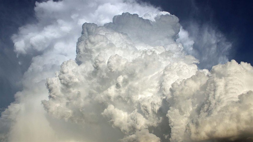
Cloud Type
If you know the cloud type, report it. The basic cloud types are:

Stratus

Cumulus

Towering Cumulus

Cirrus

Cumulonimbus
Photos courtesy of NOAA
Reporting Turbulence
Light: Momentarily causes slight, erratic changes in altitude and/or attitude.
Light Chop: Slight, rapid, and somewhat rhythmic bumpiness without appreciable change in altitude or attitude. Occupants feel a slight strain against their seatbelts.
Moderate: Changes in altitude and/or attitude occur but the aircraft remains in positive control. It usually causes variations in indicated airspeed.
Moderate Chop: Causes rapid bumps or jolts without appreciable changes in altitude or attitude. Occupants feel a definite strain against their seatbelts, and unsecured objects will be dislodged.
Severe: Causes large, abrupt changes in altitude and/or attitude. It usually causes large variations in indicated airspeed and the aircraft may be momentarily out of control. Occupants are violently forced against their seatbelts, and unsecured objects are tossed throughout the cabin.
Extreme: Aircraft is violently tossed about and is practically impossible to control. It may cause structural damage.
Tip: The terms intermittent (INTMT), continuous (CONS), and occasional (OCNL) can and should be applied to turbulence reports, too.
Reporting Ice
There are also specific definitions used for reporting ice. Most light GA aircraft are not certified for flight in icing conditions—for good reason! If your airplane is in this category, all you need to remember is that all ice is bad news. Outside air temperature should always be reported whenever ice is included in a PIREP.
Accident Case Study: Airframe Icing
Watch Accident Case Study: Airframe Icing. The absence of PIREPs for use in forecast validation (or invalidation) may have played a pivotal role in the accident.
Reporting Precipitation
The type of precipitation is usually easy to determine:
- Rain
- Snow
- Hail
Remember to include the intensity level:
- Light
- Moderate
- Heavy
Technically, virga isn’t considered precipitation because it evaporates before reaching the ground. It’s included in the “Remarks” section of a PIREP.
Don’t Worry
It’s helpful if you can give a PIREP in the proper order, but the main objective is to get the information reported. The person recording the PIREP will put it in the correct format.
To become comfortable giving PIREPs, and to help your fellow pilots, give a PIREP on every flight outside of the traffic pattern.
Tip: Consider giving one PIREP per flight; ASI’s handy PIREP form makes it easy!
Here are some examples of giving PIREPs
Turbulence PIREP:
Pilot: Casper Radio, Baron 813WB, receiving Worland VOR, with pilot report.
FSS: Baron 3WB, Casper Radio, go ahead.
Pilot: Uh, we hit some pretty big bumps coming from Johnson County en route to Worland—I’d say moderate to severe turbulence up here at 9,500 feet.
FSS: Baron 3WB, thanks for the report, hope you have a better day.
Precipitation PIREP:
Pilot: Burlington Radio, Cessna 8121K, receiving Watertown, 122.2, with a pilot report.
FSS: Cessna 21K, Burlington Radio, go ahead.
Pilot: Cessna 21K is a Cessna 172, 30 miles out on the 190-degree radial of the Watertown VOR. It was raining heavily to the north, but it’s letting up now, looks clearer ahead down south.
FSS: Cessna 21K, report’s on file.
Snow and temperature PIREP:
Pilot: Wichita Radio, Cessna 917Z, receiving 122.45, with a pilot report.
FSS: Cessna 17Z, Wichita Radio, go ahead.
Pilot: 17Z is a Cessna 182 at 7,500 feet, 25 miles southwest of Forbes Field. Wanted to report some light snow showers, negative ice, temperature minus six degrees Celsius.
FSS: Cessna 17Z, roger, pilot report’s in the system. Anything else I can do for you?