April 2017
Looking for light at night
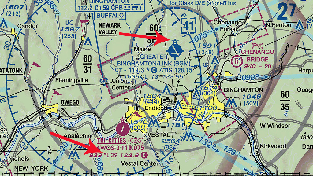
 If you plan to fly night VFR, it’s wise to check the sectional chart for lighted airports along your route.
First, look for an airport beacon, indicated by an open star located at or near the top of the airport symbol. That guiding light welcomes you to its haven from sunset to sunrise. Next, the letter “L” preceding the runway length confirms that runway lights operate from sunset to sunrise. But be careful; a small solid star preceding the “L” denotes lighting operation limitations—for example, that lights are activated part-time, or via pilot-controlled lighting at nontowered airports or after tower hours. This is your cue to consult the FAA’s chart supplement and determine light operation details, such as intensity and runways served.
What should you expect at towered airports during tower hours? The tower generally controls runway lights. Not all runways may be lit, but the tower can modify illumination upon request.
Email [email protected]
February 2017
The art of the IFR chart
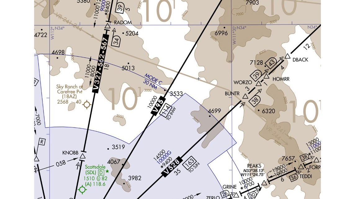
 En route charts, which are practical and focused on IFR airway navigation, seem bland compared to colorful sectional charts. While they provide minimum altitude clearances for off-airway airspace, it is sometimes difficult to visualize terrain or obstructions. So for the big picture of what lies below and near your flight path, you resort to terrain and obstruction details found on the sectional chart.
Did you know certain en route area charts (large-scale insets for congested terminal areas) also include brown shaded terrain contours for areas rising at least 1,000 feet above the primary airport's elevation? Contours start at 1,000 or 2,000 feet above the airport elevation, and subsequent intervals are in 2,000- or 3,000-foot increments. Spot elevations are shown in solid black to supplement the contours.
Give en route area charts a look—they can be a lifesaver! Learn more about terrain avoidance.
Email [email protected]
January 2017
Finding sunken treasures
 Are you escaping winter by visiting southern Florida? When you look at the Miami sectional chart, you’ll find interesting symbols in Key Largo’s waters. Note the large special conservation area identified by blue dots inside a solid blue line. When overflying this region, avoid altitudes below 2,000 feet agl to protect the environment. Note also the star-like symbols dotting the coast line to the east of Key Largo. The hydrography section in the FAA’s Aeronautical Chart User’s Guide says these are isolated rocks that may be bare or awash. Pay attention in the event you need to make a water landing. The Florida Keys are well known to scuba divers for their coral reefs and intriguing shipwrecks. Need confirmation? Look at the exposed shipwreck, identified with a red arrow on this chart excerpt.
Email [email protected]
November 2016
Are TFRs charted?
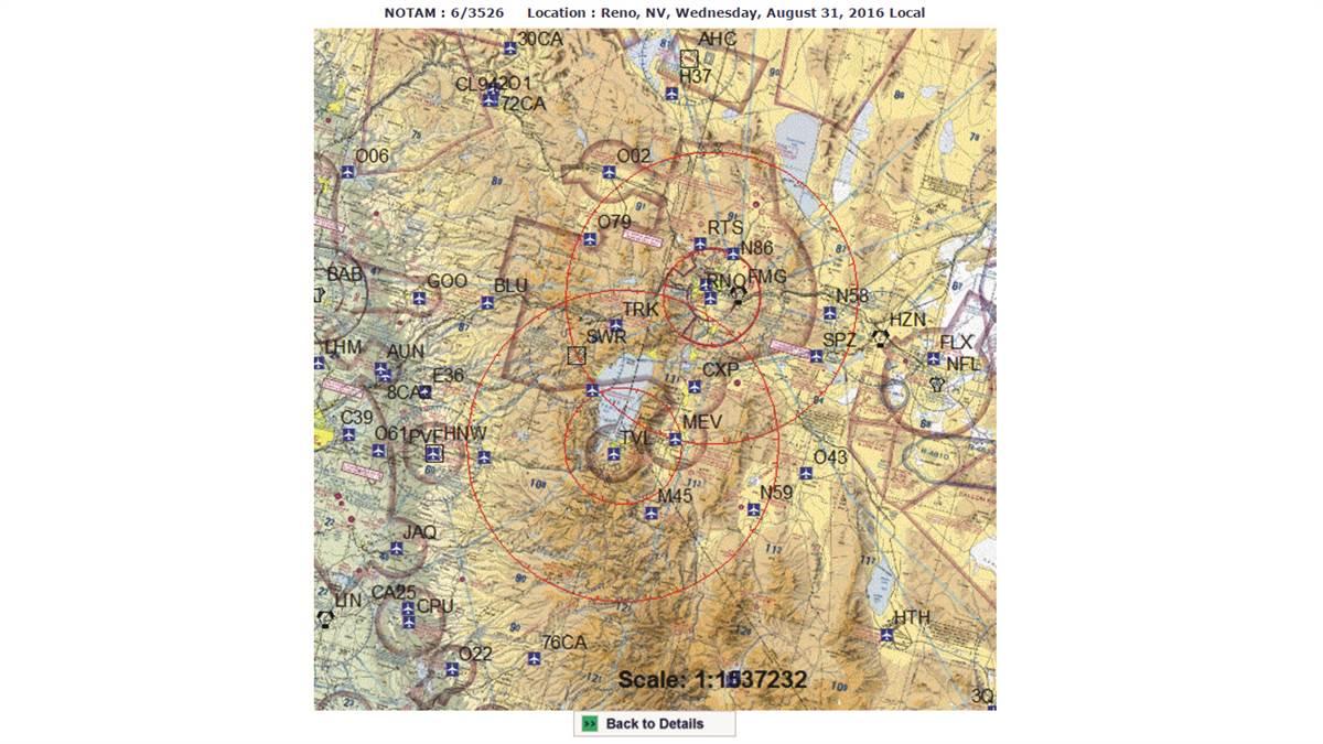
 Yes, and no. Sectional charts depict a handful of national security temporary flight restriction (TFR) areas. However, non-charted TFRs defining restricted areas because of hazardous conditions, a special event, or to protect the president and other VIPs pop up unannounced, so consult flight service and other sources before takeoff (1800wxbrief.com, tfr.faa.gov, and aopa.org/go-fly/tfrs). TFRs may have an inner and outer ring—the latter often is accessible to GA operations, but the inner ring usually is prohibited airspace. TFR notam text contains the fine points, such as in this excerpt from a recent VIP TFR at Reno, Nevada. “Operations within the airspace between the 10/12 nmr and 30 nmr area(s)… All aircraft operating within the outer ring(s) listed above are limited to aircraft arriving or departing local airfields, and workload permitting, ATC may authorize transit operations. Aircraft may not loiter. All aircraft must be on an active IFR or VFR flight plan with a discrete code assigned by an air traffic control (ATC) facility.”
Check for active VIP TFRs during this fall’s presidential campaigns. See “Tiptoeing Through TFRs” for additional insights.
Email [email protected]


