Florida feels hurricane's wrath
Airports closed, damage assessment underway
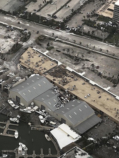
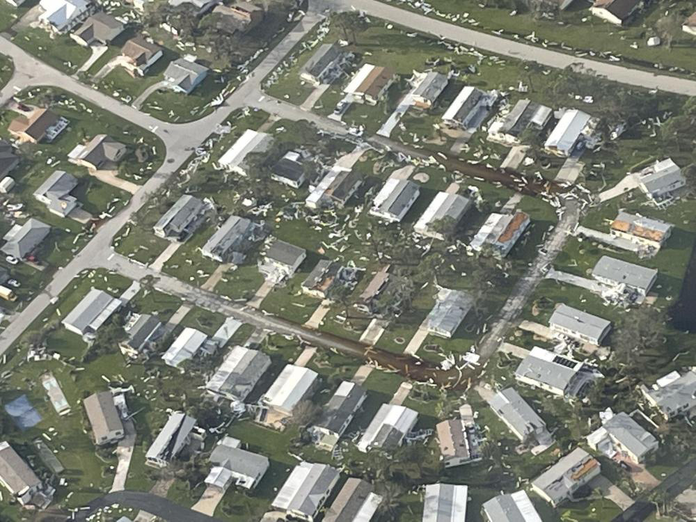
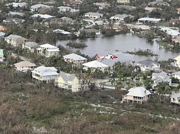
Southwest Florida communities flooded and lashed by Hurricane Ian faced years of recovery and unknown loss of life, with rescue efforts still underway on September 30 as the storm, reinvigorated by warm ocean water after tearing across Florida, took aim at a second U.S. landfall in South Carolina.
General aviation relief organizations announced September 30 that operations bases were being established or surveyed. Operation Airdrop announced a response was planned, and the group was "collecting availabilities" of pilots with and without aircraft, as well as volunteers to help with ground operations. (Donations and volunteer signups were directed to a purpose-built website.)
AERObridge, another established GA disaster response organization, reported communication with local officials and search-and-rescue teams on the ground:
"Present intelligence indicates alternate supply chains may be operating efficiently. A recon flight is being launched by AERObridge this morning to provide first-hand insight if a critical need to activate air assets exists," the organization wrote on Facebook. "While we recognize and appreciate our volunteers standing by ready to assist, we want to ensure we respect our [members'] time and resources by only activating if there is a real need to serve the community in this manner. Thank you for your willingness to serve, an update will follow with a definitive activation/non-activation status decision early this afternoon today."
The storm regained hurricane strength after spending the night over warm Atlantic Ocean water and barreled toward South Carolina on September 30, with its second U.S. landfall expected in the afternoon. Officials linked 21 deaths to the storm in Florida, a grim tally expected to increase in coming days. Hundreds of people had been rescued from flooding across the state, officials said.
With water rescues still underway in Florida on September 30, Myrtle Beach, South Carolina, began to flood as Hurricane Ian arrived, pushing the fourth-highest storm surge on record. Local streets flooded as the Springmaid Pier gauge measured 4 feet of water above normally dry land, a level eclipsed by only three other hurricanes in the past 35 years, The Washington Post reported.
Florida Gov. Ron DeSantis said on September 29 that the storm caused flooding from the Gulf Coast to the Atlantic Coast: "It's basically a 500-year flood event. This storm is having broad impacts across the state."
Dan Allers, a member of the Town Council in Fort Myers Beach, a community on a barrier island that bore the full brunt of the storm surge, told CNN by telephone on September 29 that his own home, along with many other businesses and homes, had been wiped out.
"It's gone," Allers said, referring to the community as a whole. "There's literally nothing to come back to."
Allers reported still-unknown loss of life, and survivors still trapped in wrecked buildings. Emergency responders struggled to reach people with virtually every road blocked by debris including displaced homes. "They're still doing everything they can, but to get to them is hard."
Airports from Sarasota down the coast to Naples were closed, or operating with limited service, on September 29, according to FAA notams. Punta Gorda Airport, which was directly in the storm's path, indicated with an updated notam on September 29 that while several taxiways remained closed, the airport was operational. By September 30, the airport was still operating with one of two runways and various taxiways closed.
Southwest Florida International Airport in the heavily flooded city of Fort Myers just south of the hurricane's center at landfall, where onshore wind was strongest, was open for humanitarian relief operations only according to a notam that expires October 7. Naples Municipal Airport, serving another community that saw heavy flooding (including a fire station), remained closed on September 30, according to a notam that expires October 4.
“NBAA and its members are mobilizing with Floridians to respond to the challenges caused by Hurricane Ian,” said NBAA President Ed Bolen. “The ability of business aviation to provide humanitarian assistance in times of crisis is a hallmark of our industry, and our association is coordinating with government and nonprofit organizations on guidance for relief assistance.”
Hurricane-hunting aircrews from the U.S. Air Force Reserve and National Oceanic and Atmospheric Administration reported unusually rough rides through the storm. NOAA crewmember Nick Underwood reported that his September 28 sortie aboard Kermit, a Lockheed WP-3D Orion, was "the worst I've ever been on," posting video on social media depicting a very turbulent ride. The video, he noted, was "edited for language."

Airports across southern Florida felt Ian's wrath well ahead of the arrival of hurricane-force winds, as tornadoes spawned by the outer bands of wind and rain flipped parked aircraft at North Perry Airport in Hollywood in Broward County, on the southeast coast of the state.
The storm’s maximum sustained winds were clocked at near 155 mph (just 2 mph short of Category 5) with higher gusts as it approached landfall, and the National Hurricane Center warned of "life-threatening storm surge, catastrophic winds and flooding in the Florida Peninsula."
The storm turned south of the previous projections in its final approach to Florida, sparing Tampa from potentially catastrophic inundation, but redirecting the highest storm surge squarely at communities to the south, from Port Charlotte and Fort Myers south to Naples.
Nearly 2 million Floridians were still without power as the storm made its final landfall in Georgetown, South Carolina, at 2:05 p.m. on September 30 with 85 mph winds.


![Video taken by crewmembers aboard the Lockheed WP–3D Orion hurricane hunter aircraft captured reactions to heavy turbulence that National Oceanic and Atmospheric Administration engineer Nick Underwood described as "the worst [ride] I've ever been on." Image courtesy of NOAA.](/-/media/Images/AOPA-Main/News-and-Media/2022/September/ian/220928_hurricane_ian_noaa.jpg?mw=1200&mh=675&as=1&hash=16A81A1F9F48C43D4E51AECB1EDB0319)


