Glacial climb
One summer, 4,000 glaciers, a Cub Special, and a quest
By Garrett Fisher
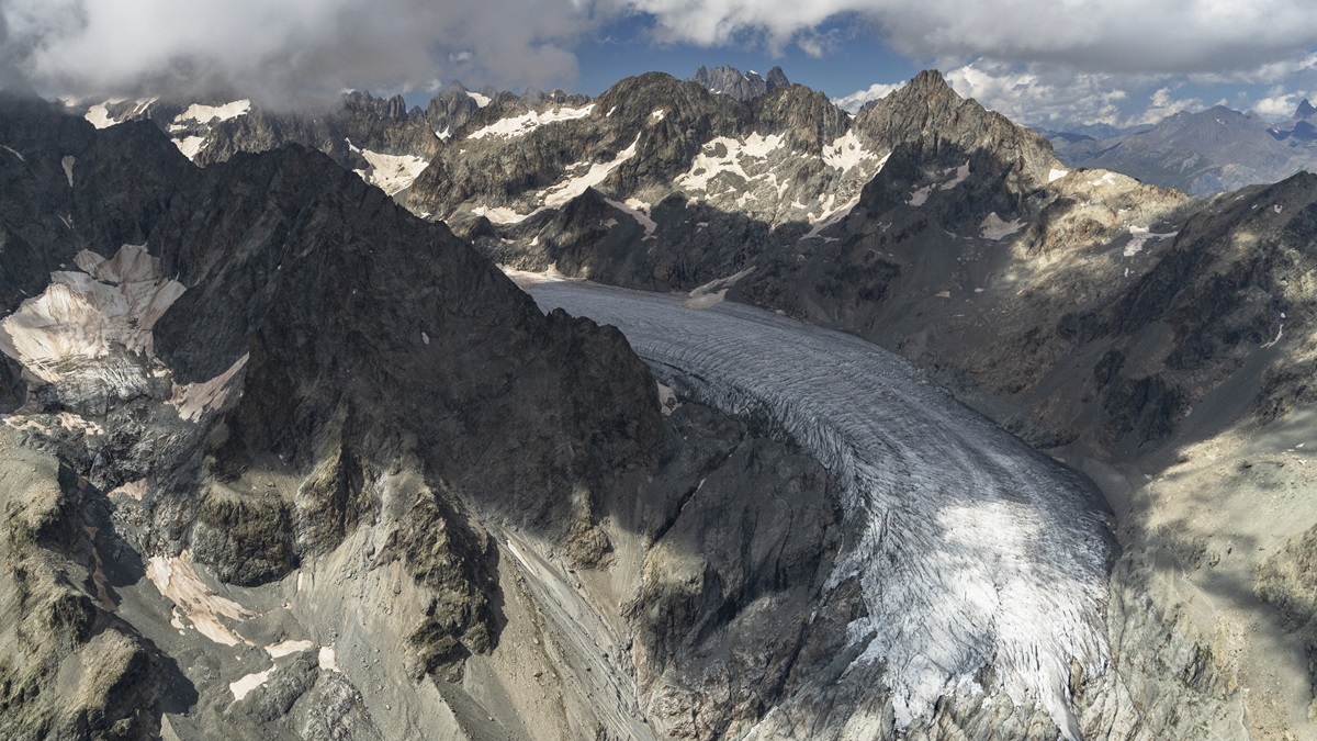
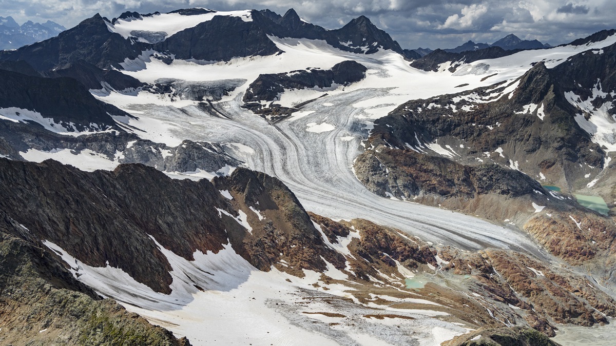
In 2021, in the depths of a cold winter in the Alps, with borders largely closed and COVID-19 at its worst, I decided to devote myself to flying to as many nonpolar glaciers on Earth as possible, to photograph them for future generations.
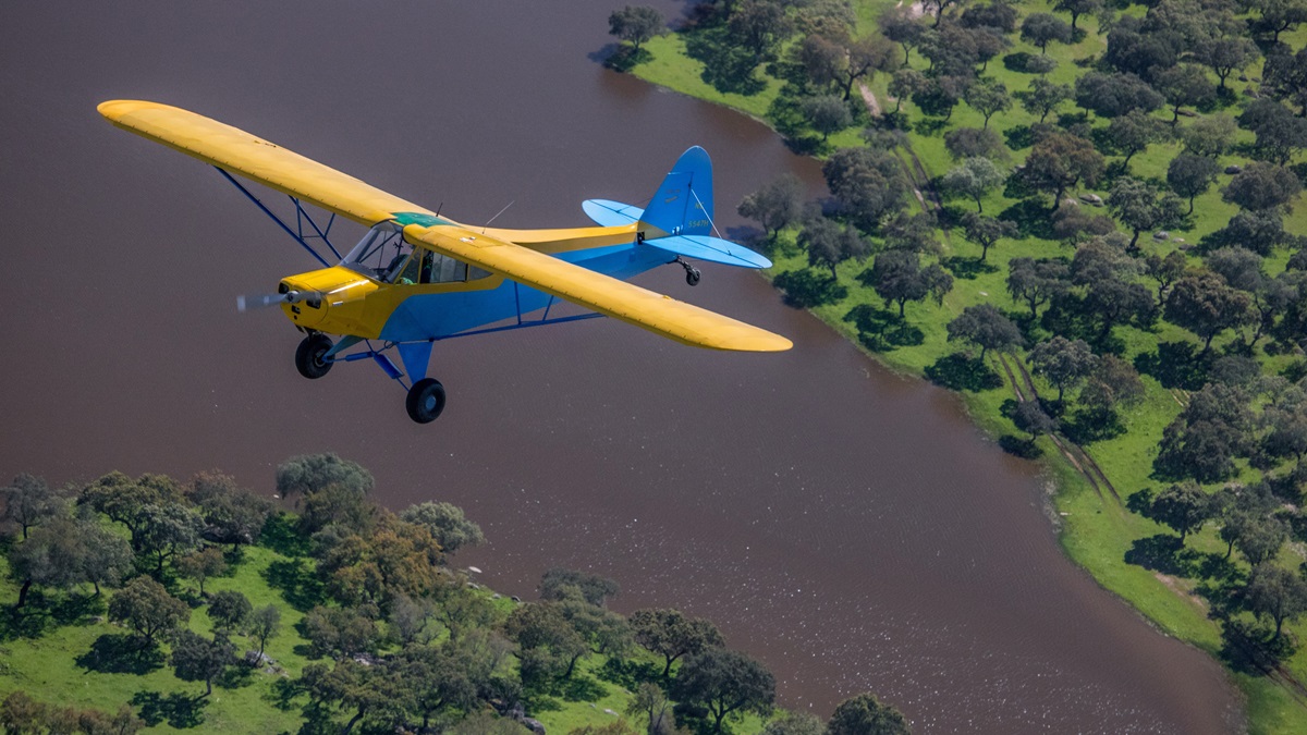
While satellites and scientific measurements furnish data, and iPhone photographs can show glaciers mostly from common tourist vantage points, there is much that is missed by the public, as glaciers are either very high, close to the poles, or both. Terrain is generally quite harsh, with uncooperative weather. The views from my Piper PA–11 are nothing short of transcendental, and I wanted to share those experiences for generations that will never see some of these glaciers.
My passion for photographing glaciers began two decades prior, when one of the first studies indicated a projected melting date of the glaciers in Glacier National Park. I simply had to see them all before they were gone. I began a slow project to photograph the glaciers of Montana, Wyoming, and Colorado. When I decided to move to Europe with my Piper PA–11 in 2015, a wave of panic ensued: If I do not photograph them now, I may not be back before they are melted. That set off a binge of flying, culminating in 65 hours in the Cub in the month of September 2015 alone, where all the glaciers in question were photographed.
The decision to undertake an even more ambitious project in 2021—the world’s nonpolar glaciers—set off a flurry of project management, application paperwork for the formation of a nonprofit, and many nights unable to sleep, wondering how I would conquer far-reaching mountain ranges and uncertain geopolitical locales. I would need something other than a 1949 Cub Special with 18 gallons of fuel, 70-knot cruise, and a 100-horsepower engine. Despite it carrying me to the highest peaks of multiple countries and mountain ranges, the machine (and its pilot) has limits. The quest for a Super Cub began in the spring—and it continued into the midpoint of summer, which is when glacier season begins.
Glaciers are hard to distinguish when covered by annual snowpack. While they’re still beautiful from the air, the majesty of their features is masked by the majesty of winter in the mountains. The best time to show the glory of the glaciers is from midsummer to early autumn, when details of prior centuries of snowfall are revealed. That posed an immediate problem: With borders a mess, a Super Cub not yet in the hangar, and the clock ticking on only so many short glacier seasons left in my lifetime, what was I going to do for 2021?
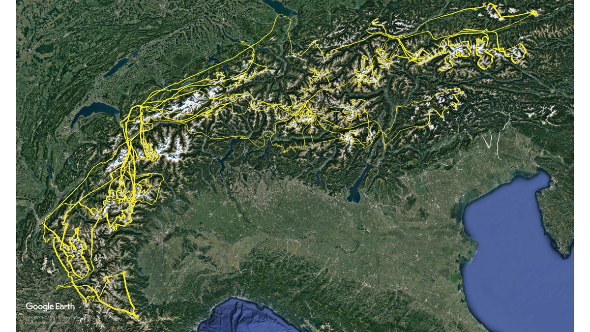
The only option was to photograph what was under my nose: the Alps. I had covered 250 square miles of the heaviest glaciated terrain in prior summers, enough to build up my skillset to work on the rest, which consisted of glaciers interspersed over a 24,000-square-mile area. There are more than 4,000 glaciers in the Alps. I briefly contemplated spreading the project over two years, only to face the reality that, if I took things that slowly, old age would beat me to the glaciers. I was determined to finish off the Alps.
The idea was all well and good, until one considers the reality of the mountain range, weather, and a PA–11. I finally decided that I can predict little, yet I can give it my best attempt. A moderate maintenance problem would be enough to torpedo the whole plan, so what was the point overthinking it?
To the east
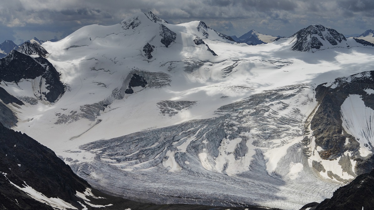
On August 10, a preview flight indicated that the prior season’s heavy snowpack had finally melted enough to get adequate photographs. Just then, a heat wave was forecast, which meant a few days of high pressure. I was faced with a choice: Do I go south to the Maritime Alps, where the glaciers surely will be presenting themselves with the least snow, or do I go east, and get the worst over with? The glaciers of Austria are, at their farthest, 350 miles from where I keep the Cub, with rugged terrain and few airports in between. I loaded up the airplane and took off for Samedan Airport in St. Moritz, Switzerland, the highest airport in Europe, with a field elevation of 5,600 feet msl. The next morning, I flew through a rain shower into the Ötztal Alps of Austria, sandwiched between orographic overcast above and terrain below, with 30 knots of wind in between. It was an apropos introduction to a complex project, to get beaten up at 12,000 feet by the rotors. I realized I might have bitten off more than I could chew: There was much more aerial work involved than I thought from viewing satellite maps.
With borders a mess, a Super Cub not yet in the hangar, and the clock ticking on only so many short glacier seasons left in my lifetime, what was I going to do for 2021? photographed half of what I had in mind before fuel became a concern, so it was 10,500 feet down to Innsbruck, from freezing cold to hot summer weather. On the way back up, climbing for 45 minutes, it was evident that my suitcases, full fuel, and the heat meant I had less range than I was used to. That left plenty of time to terrorize myself staring at increasing oil temperatures, wondering if I’d ever get the project done with such climb, fuel, and range limitations. I could fly two and a half hours, instead of my typical three, before I needed to be back in the circuit for landing.
So I flew the glaciers in two-and-a-half-hour sessions: 10,000 feet up in the cold, back down in the suffocating heat. The next day featured the attack of the Höhe Tauern National Park in Austria, which contains the highest peak in the country, abundant glaciers, and…a restricted area requiring 2,000 feet agl ground clearance, which irritatingly placed the aircraft right at the cumulus layer. With some creative flying over deep alpine valleys, I was able to exchange the cloud problem for a longer flight path.
The next day, I flew almost two hours back east, swinging through the Berchtesgaden Alps in Germany before photographing the easternmost glacier in light rain after a thunderstorm. In four days, I put 23 hours on the tachometer.
Glacier flying involves flying up and down mountain ranges, often on both sides, with curved flight paths into and out of cirques, steep basins created by glacial erosion. It is impossible to plan a specific flight path, or measure in advance with any precision how much I will get done. I calculate distance to and from the glacier fields in question and the airports in use, subtract the time from my two-and-a-half-hour limit, and leave the rest as available for wandering around the glaciers. When the clock runs out of time, I point the nose back to the airport. That can create some frustrating situations with borders, flight plans, and controllers, although the hardest part is the simple reality that 18 gallons is not enough for this kind of endeavor.
Before long, I was back in St. Moritz to complete the eastern expanses of glaciers. The glaciers around St. Moritz were more convenient, owing to a 5,600-foot starting point, but clouds from Mediterranean moisture, typical of August, required wildly variable flight paths—to the point that the handful of glaciers east of Bolzano, Italy, were covered entirely. I would have to come back in early autumn.
Even though from the satellite maps it looks straightforward to photograph all the ice features in a certain area, experience indicates otherwise. Circling around mountains, checking deep valleys, and getting around ill-placed clouds added tremendous flight time to the endeavor in eastern Switzerland.
To the south
With the east mostly out of the way, it was time to turn my focus to the south, where the glaciers closest to the Mediterranean can be found. It is drier and warmer, with correspondingly smaller glaciers; yet, in a twist of irony, the Mediterranean would prove to be a source of great frustration as “fair weather” orographic clouds defied forecasts, requiring three separate trips to return to get what I was unable to see. Sparse airports, complicated French airspace with 3,300-foot clearance requirements, and Italian airspace rules did not help.
The season thankfully held out into late September, as snows were late to arrive, so I overnighted again at St. Moritz, getting within 50 miles of the Slovenian border to photograph a handful of smaller glaciers around Cortina d’Ampezzo, Italy. Visibility was an astonishing 170 statute miles, in brilliant early autumn air, which meant I could simultaneously see the glaciers of Gran Paradiso, Italy, near the French border, the ice cap of the Dufourspitze, Switzerland’s highest peak at 15,203 feet, and the Höhe Tauern of Austria. I then realized just what I had signed up for and couldn’t believe I had done it. On the flight back the next day, that clear autumn air came to a resounding conclusion as I flew into dust that had blown up from the Sahara.
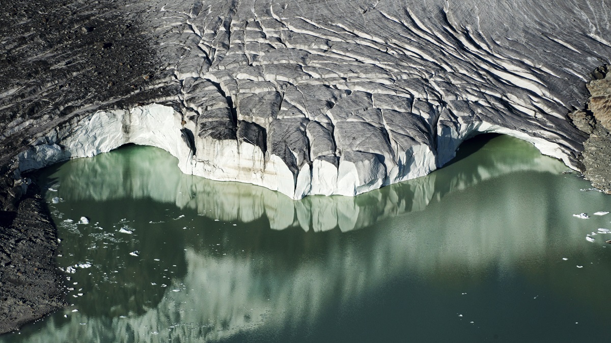
When it was all said and done, more than 80 hours were put on the tach in roughly six weeks and the glaciers of the Alps were photographed, all from my heinously slow PA–11. As soon as I set the camera down, I traveled to three countries in Europe hunting for Super Cubs, eventually purchasing one in Norway. If things go as planned, it shall return to Scandinavia next summer to photograph more glaciers. In any case, my original reason for photographing them became more solidified than ever; while the glaciers of the Alps are majestic, aerial observations showed that many of them are a small fragment of what they used to be.
Garrett Fisher is the founder of the Global Glacier Initiative, and an author of 31 books.
