WX Watch: Nowcasting thunderstorms
Modeling the short-term weather

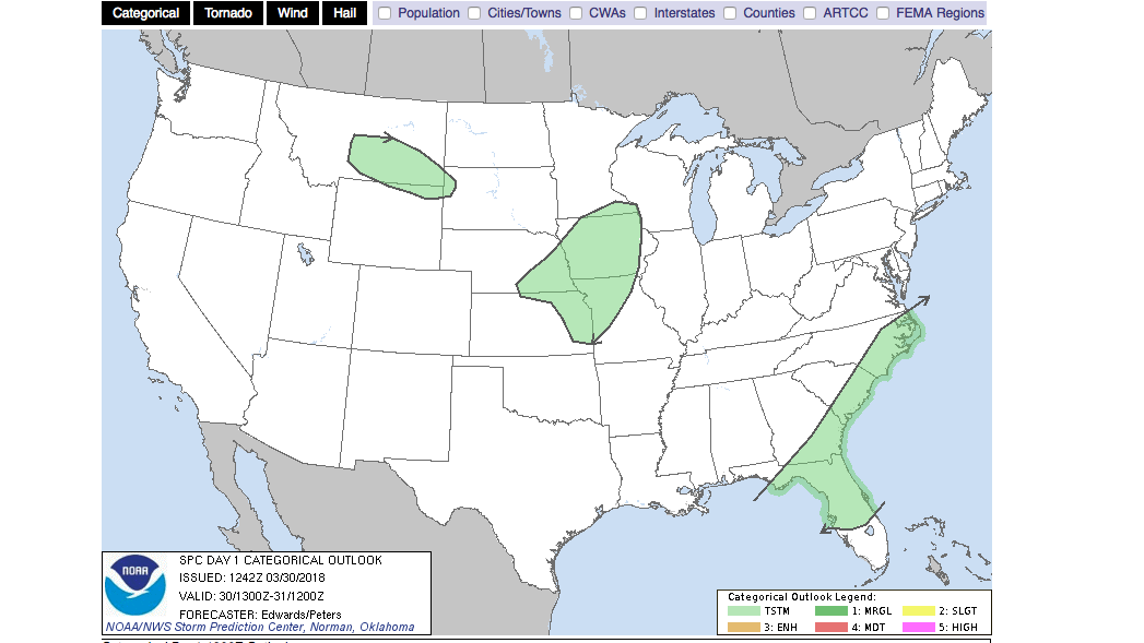
Thoughts like these run through our minds during preflight planning sessions. We want to know exactly where thunderstorms may crop up along our routes of flight, but all we see in sources—such as convective outlooks, sigmets, and airmets—are vast areas of possible coverage, spanning several states in many cases. Some areas within warning boxes may experience thunderstorms, but others can remain storm-free. If you’re equipped with gear that shows datalinked Doppler weather radar imagery, or airborne weather radar, you have some very useful information sources at hand once in flight—as long as you know their limitations. But the main rule remains: The only way to avoid thunderstorms is to remain well clear of any buildups. That means keeping at least a 20-nm distance between you and any menacing clouds.
In the preflight go/no-go decision-making stage, it’s best to explore some tools that can provide a “nowcast” for the conditions you can expect in the next, say, two to four hours or more. Here are just a few.
Mesoscale discussions (MDs)
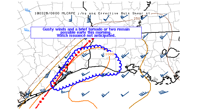
Mesoscale discussions are analyses by and for meteorologists, and they are found on the National Weather Service’s Storm Prediction Center website. Click on the “MD” box right above the stack of charts and convective outlook links. MDs employ a lot of meteo-jargon, but you know enough as a pilot to understand the gist of the situation at hand. They are put out roughly one to six hours before a significant weather event is expected. They don’t imply that another area within a larger advisory area—say, a convective outlook or convective sigmet—won’t experience dangerous conditions. Instead, they identify areas that show promise of strong convection or other dangers, and can sometimes cover rather small areas.
Traffic Flow Management Convective Forecast (TCF)
These forecast coverage areas show areas of convection that could affect high-altitude air traffic flows—and therefore the biggest storms—and cover time frames four, six, and eight hours in the future. Cloud tops and density of storm coverage are shown, along with any expected lines of thunderstorms. You can see them under the Aviation Weather Center Forecasts dropdown menu, under Convection. The Convection menu also contains the National Convective Weather Forecast, which shows current and extrapolated locations of convection—but warns that it does not serve as a substitute for convective sigmets. Another product is the Extended Convective Forecast Product, which forecasts 72 hours in the future. Center Weather Service Unit (CWSU) advisories, located under the AWC’s Advisories dropdown menu, also can provide detailed, near-real-time graphic analyses and forecasts; be sure to click on a CWSU link at the bottom of the page to see radar imagery.
High-Resolution Rapid Refresh (HRRR) models
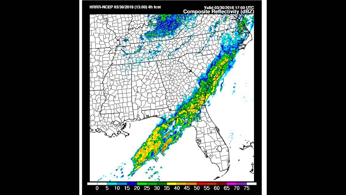
The National Oceanic and Atmospheric Administration Earth System Research Laboratory’s Rapid Refresh site shows these views of anticipated areas of precipitation. The operational products go out up to 12 hours, and include not just radar reflectivity projections, but also satellite imagery (infrared and water vapor projections), lightning, winds near the surface, pressure change, and variables relating to the strength of convection. These include CAPE (Convective Available Potential Energy—values above 2,500 joules per kilogram indicate potentially severe thunderstorms), one of the more popular predictors. By clicking on the Domain dropdown menu at the top of the HRRR webpage, you can zoom into various regions of the United States.
Twisterdata.com
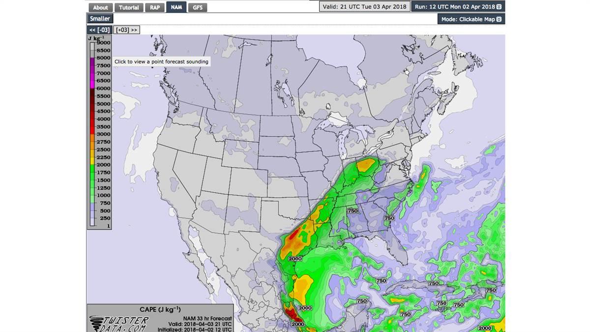
This website lets you choose among three different models to examine the future—the RAP (Rapid Refresh), the NAM (North American Mesoscale), and the GFS (Global Forecast System). These all predict a huge number of variables, including CAPE and radar reflectivity. The NAM predicts in one-hour intervals out to 21 hours; the GFS has the longest legs, extending to a whopping 17 days into the future for some products.
Click on the model you want to see across the top of the webpage, then select among the dropdown menus along the left side to see the variables. CAPE is under “Instability,” and composite radar reflectivity is under the RAP and NAM “Precipitation” menus. Try a little exploring to see each models’ ideas of future winds, moisture, and vorticity (the atmospheric “spin” that intensifies thunderstorms) and you’ll be surprised what you can learn.
Just bear in mind that these forecast models are fallible, more so the further into the future you demand of them. They’re artificial constructs created by equations and observations fed into computers, and simply can’t precisely duplicate or project what nature will actually create in the atmosphere. They’re subject to the same chaos that plagues any prediction where assumptions about interactions among initial conditions—say, temperature, pressure, or moisture—turn out to be false, or change in random ways.
The good news is that forecasts are becoming more accurate all the time. There will be exceptions, of course, but you can be fairly confident about most model forecasts up to three to five days into the future. Which means they’re well worth a look when planning a flight later today, tomorrow, or beyond.
Email [email protected]


