Island time
Get away from it all by flying yourself to these GA-friendly US destinations
Santa Catalina Island, California
Airport in the Sky


Santa Catalina Island is a year-round destination located approximately 20 nautical miles off the coast of Los Angeles, and home to the most iconic $100 hamburger in Southern California. The nearest mainland airport is Zamperini Field (TOA), but the island is easily accessible from all LA-area airports. The overwater flying distance is longer than some of the other islands in our guide, so glide range and life jackets should be a consideration. Flying at a higher altitude will give you more options in the event of any engine trouble, and you will want to have high-quality life jackets with you for each person on board.
The Airport in the Sky (AVX) is a private field owned and operated by the Catalina Island Conservancy, and there is a landing fee for this airport that is only open during daylight hours. Joining the Catalina Island Aero Club (also for a fee) will waive landing fees for a year, and makes sense for locals who plan to visit more than five times a year. It is well worth the investment for the locals as it is the most beautiful airport to take out-of-town guests to.
The 3,000-foot by 75-foot field is perched at 1,602 feet msl with a significant drop-off on the approach and departure ends of Runway 4/22. There is also a charted, although little-used parallel dirt runway—call ahead to make sure it is in good enough condition and to get permission to land on it. The dramatic approach combined with its slope and crowning approximately two-thirds down Runway 22 can create several visual illusions that landing pilots will need to overcome by landing on speed and being ready for a go-around. Conveniently and by design, wind typically favors the slightly upsloped Runway 22, which has right traffic. Runway overruns can be disastrous. Don’t be afraid to go around, and in fact be inclined to!
Conditions are generally VFR at Catalina, but special consideration should be given to any gusty winds, which can be challenging because of nearby terrain-induced mechanical turbulence and the potential for downsloping winds on final approach. Two circling instrument approaches, one VOR and one VOR/DME or GPS-B, can get you in as low as 700 feet agl, but the real joy of flying to Catalina is taking in the view on a beautiful sunny day.
Once on the ground, enjoy the scenery, a buffalo burger from the airport restaurant, hiking (there’s a short airport loop and every challenge beyond), and even on-field camping if you plan ahead. Catalina’s only incorporated town, Avalon, is about a 45-minute shuttle or very expensive taxi drive away and is best for overnight visits.
On the way in and out, make sure to take in the sights and circle the island, making calls on common traffic advisory frequency as you do. Check out the west end of the island with its dramatic view, overfly the turquoise waters of Two Harbors, and see the iconic Avalon Casino from the air. Typically, I circle the west end of the island on my way in, setting up for entry to the pattern at this nontowered field over Two Harbors (which puts you on an almost perfect 45-degree entry to right downwind for Runway 22). On the way out, I’ll follow the eastern part of the island all the way around, climbing all the way, before departing after a circle or two over Avalon. Catalina is always a delight, and in my opinion, should be on every pilot’s bucket list.
Beaver Island, Michigan
The Great Lakes' Emerald Isle


Beaver Island is a Brigadoon-like setting that floats in the top tip of Lake Michigan. Like the story of a town that only appears every 100 years, Beaver Island lies shrouded in fog from November to April, bursting out with glorious blue skies and boasting pristine beaches and great hiking trails when that fog lifts. It’s a challenge to fly into one of the two airports on the 54-square-mile picturesque island. Beaver Island Airport (SJX) and privately owned Welke Airport (6Y8) are less than 30 nautical miles across the lake from Charlevoix Municipal Airport (CVX) on the mainland. Served by Island Airways for tourists and mail deliveries, the pilots (and regular passengers) at Charlevoix bound for Beaver Island can tell whether they’ll be able to fly by the 200-foot-tall cement plant located at the end of the runway. If the plant tower can’t be seen because of fog, no flying for you today.
It’s the largest island in Lake Michigan but only has about 600 year-round residents. Property is hard to find here as during the COVID-19 pandemic many said let’s go live on an island, and the year-round population boomed. Tourism is still a big draw during the summer. Beaver Island is a part of the Michigan Islands National Wildlife Refuge, so expect hawk, crane, loon, and heron species. Also, the native white-tailed deer have become overpopulated on the island, so they are to be considered on landing. The island’s isolation and lack of light pollution make it one of the best “Dark Sky” sanctuaries in the country. The aurora borealis (or northern lights) can often be seen here, especially in the cooler months. Also called the Great Lakes’ Emerald Isle, there’s a Donegal Bay and the town watering hole is The Shamrock.
Weather is a constant challenge for pilots flying to the island. In the spring, the cold water meets the warmer air temperature, creating fog; in the fall, the warm water meets the colder air, and, you guessed it, you get fog. There’s a ferry that runs daily in the summer, which takes two and a half hours from Charlevoix. But the ferry only operates from April through November. Island Airways supplies the island in the winter.
Welke Airport, which has been operating for more than 75 years and is family owned, welcomes pilots who call in and has tiedowns but no published instrument procedures or lights. It is the closest of the two airports to the only town, St. James, and has courtesy cars available. Beaver Island Airport is a newer facility with three runways. There is self-serve fuel, and you must call for rental cars. SJX is four miles from town.
Block Island, Rhode Island
Pristine New England beaches


In clear weather, Block Island is visible from the moment you cross the mainland coast on your way to it.
Montauk Airport (MTP) on the eastern tip of Long Island, New York, is 16.5 nautical miles away; Westerly State (WST) and Quonset State (OQU) airports in Rhode Island are 14.9 and 26.8 nautical miles respectively.
Block Island State Airport (BID) is at the center of the island at an elevation of 108 feet. The nontowered, state-owned facility has a single, paved, east/west runway (10/28) with standard left-hand traffic patterns in both directions. The runway itself is relatively short at 2,502 feet long and 100 feet wide.
These unusual proportions can create the illusion that pilots are lower than they actually are on final approach, so trust the four-light precision approach path indicators to put you on a normal, 3-degree glideslope. Southwest winds are the most common, so expect a crosswind on Runway 28. Also, the slope of the terrain means that aircraft frequently encounter downdrafts on short final to Runway 28.
There are RNAV approaches to Runway 10 and 28 as well as a VOR/DME approach to Runway 10.
The north half of the island is a wildlife area so, if you’re going to overfly it, make sure your altitude is at least 2,000 feet agl. There are also a pair of tall towers north and northeast of the airport. If you avoid the north half of the island, you’ll remain clear of both the wildlife area and obstacles.
There’s no aviation fuel for sale at Block Island. Also, the paved portion of the ramp fills up on weekends, so bring your own tiedowns and be ready to park in the grass. When leaving, using the full length of Runway 28 requires back-taxiing, and the airport can be so busy at peak times that finding a break in the action takes patience.
The town of New Shoreham and its restaurants and attractions are within walking distance of the airport. There are also bikes, mopeds, and scooters for rent that can cover the entire island in a few hours.
Providence Approach can provide radar services including VFR flight following to and from Block Island State Airport. Even though tourism at Block Island is concentrated in the summer months, the airport is open all year.
Orcas Island, Washington
You don't need a seaplane to enjoy this archipelago
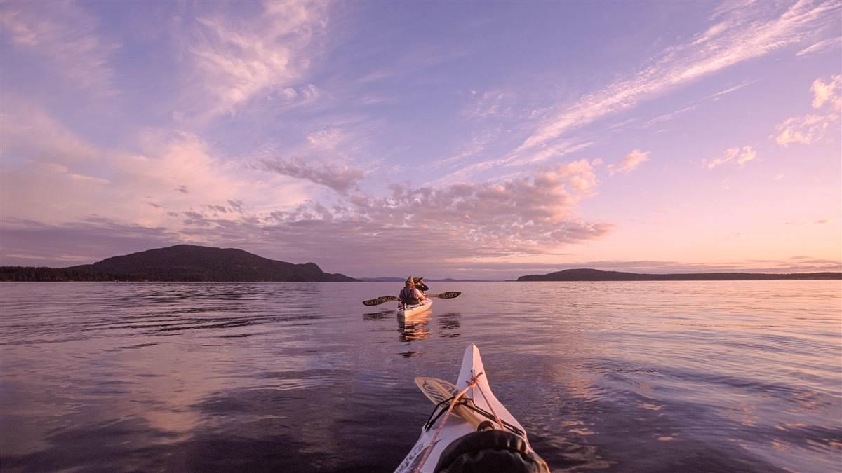

The flight from the college town of Bellingham, Washington, on the mainland to Eastsound, Orcas Island, is so short that as the pilot, you will hardly have time for sightseeing. So, if the weather is fine, pull the throttle back once you reach altitude and take a couple scenic laps around this stunning horseshoe-shaped island. Mount Constitution frames Cascade Bay to the east, while slightly lower Turtleback Mountain spills west into Deer Harbor.
Eastsound, the largest town on Orcas, which is one of the larger of the San Juan islands, sits in the middle of the two bumps and includes Orcas Island Airport (ORS) with a north-south oriented runway that is canted slightly (0.8 percent up on Runway 16). Coming in from the north, the long, relatively skinny runway slopes up, creating an enticing visual illusion. An upsloping runway can create the illusion that the aircraft is higher than it actually is, leading to a lower approach. So does a narrow runway. Because Eastsound has a little of both, pilots should heed this warning: Don’t get suckered off your glideslope. Coming in from the south? You get to run the gauntlet between the two mountains and deal with the downslope illusion. The good news is that the runway is long enough for most general aviation airplanes.
Weather in the summer consists of the occasional cool front (a summer cold front) bringing wind and rain, rarely lasting long. There is often fog in the mornings, followed by clear, hot afternoons, and warm, lingering twilights.
Nearby island runways have their own quirks, so take the time to research local knowledge before you arrive. You might also discover tips for better lodging or rental wheels.
Amy Laboda has been flying airplanes since she was 15 years old. She is the former editor in chief of Aviation for Women magazine for nearly 13 years before returning to her freelance writing and multimedia career.
Related Articles


