Coast to coast
Lessons learned on a transcontinental ferry flight

The journey would span nearly the whole gamut of what general aviation has to offer—from mountain flying and unanticipated diversions to preheating an engine with a camp stove in freezing temperatures. For me, a relatively low-hour pilot, the ferry trip would serve as a sort of accelerated GA boot camp, exhibiting the limitations of small aircraft and the seemingly limitless possibilities one can enjoy while flying them.
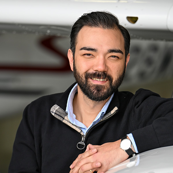
I had never flown the 182 and somehow managed to avoid Cessna aircraft until this point in my flying life. The prospect of commanding this celebrated workhorse on a 2,400-nautical-mile adventure was both exhilarating and, admittedly, intimidating. I had logged a respectable amount of time in the Piper Cherokee and Warrior, and after a 10-year hiatus from flying, I was just beginning to get comfortable in the feather-like Van’s RV–12—all lighter than the 182, all low-wing aircraft, all sporting fixed-pitch propellers. We tossed in the ambitious goal of attaining my high-performance endorsement, and the constellation of impending challenges kept my nose down in the books for more than a few nights before our departure. My thinking was this: There may be no better way to grow as a pilot than by catching a one-way commercial flight to the other side of the country and forcing myself to navigate home using the tools and resources available. Sitting left of Hirschman, a well-seasoned pilot and instructor, wouldn’t hurt my chances of success.

The get-go
Forecasts predicted cooperative weather along our planned route. If we began our first leg the morning of New Year’s Day, we’d beat a massive snowstorm headed to the East Coast before the following weekend. If we missed our window, we’d be stuck, possibly for days, waiting for the weather to clear.
After a full day’s worth of commercial travel, we arrived at San Martin Airport (E16) to inspect the airplane—and it was gorgeous. You’d be forgiven mistaking it for the same Skylane that appeared on the inaugural March 1958 issue of The AOPA Pilot. Buckling into the cockpit, we were greeted by a sleek yet simple all-Garmin panel; GI 275s for the horizontal situation and attitude indicators and a GTN 650Xi were among the onboard cockpit candy. We briefed with AOPA Sweepstakes Manager Niki Britton, circled the pattern, and sat it down for the night. With a delayed fuel delivery in San Martin, we made a short hop to Hollister Municipal Airport (CVH) the next morning to fill up for the long trek ahead.
Across the desert, over the mountains
Our first leg saw us traversing landscapes I’d only seen in movies. We climbed above a thick layer of tule fog, unique to the region, that blanketed much of the Central Valley. Leveling off at 9,500 feet, I set cruise power to achieve readings of 20 inches of manifold pressure and 2,300 rpm respectively on a third Garmin GI 275 serving as an engine monitor. Carefully leaning the mixture rewarded us with a 10.5-gph fuel flow, and a tailwind carried the aircraft along at a healthy 140-knot groundspeed. Hirschman then walked me through setting up the intuitive Garmin GFC 500 autopilot to help manage our workload.
As we approached the Lemoore military operations area (MOA), we requested VFR flight following through, rather than circumnavigating, the special use airspace (SUA). It’s tempting to fly GPS waypoints around an MOA, but you might save time and fuel by simply contacting the controlling agency and asking for clearance. VFR pilots can legally proceed through MOAs without clearance, but there could be high-speed military aircraft in the area. It’s good practice to check with the center frequency in advance and ask if the airspace is active. Better still, contact them before your flight to avoid having to make a quick decision in the air.
We continued over the Mojave Desert, toward a cluster of MOAs and restricted airspace that cradles Death Valley and Edwards Air Force Base (EDW), a well-known site for space shuttle landings and where Chuck Yeager became the first human to break the sound barrier. We traced the contour of the SUA and flew direct to Needles (EED), a small, sunbaked airport five miles south of its namesake city. Long ago a pillar for the once-bustling, now-defunct U.S. Route 66, Needles sleeps on the west bank of the Colorado River.
Misjudging our initial rate of descent, I began a circling descent to enter on final for Runway 11, advancing the prop lever full forward to ensure maximum thrust could be produced in the event of a go-around. Above pattern altitude and with two notches of flaps, a forward slip lowered us to an appropriate approach path. It was not my finest landing, but to quote Yeager: “If you can walk away from a landing, it’s a good landing. If you use the airplane the next day, it’s an outstanding landing.” We taxied past the bones of a stripped Grumman Cougar and Beech 18, refueled, and admired the sand and stillness.
The day’s final 390-nm straight shot to Double Eagle II Airport (AEG) in Albuquerque, New Mexico, was three hours in duration. We crossed over the red rocks of Sedona with clear skies and uncharacteristically smooth air for a mid-afternoon flight over the high desert. The sun behind us began a lazy dive toward the horizon and cast long shadows over intricate strokes of ridges and valleys, exciting the rusty hues in the iron-oxidized sandstone below.
Happy New Year
The FBO’s crew car was unavailable, but Bode Aviation loaned us a van overnight so we could make the 20-mile drive to our hotel. We parked and spent New Year’s evening searching for food on foot. Dave closed his eyes and pointed at the nearest sign: Tucanos Grill. We enjoyed a towering Brazilian feast and made good use of the free dessert coupons laid out at the host stand—I ordered a fudge brownie with a scoop of vanilla ice cream. “I’ll have the same,” Hirschman sung, consigning us to a new weight and balance calculation.
The following morning, we made our way back to Double Eagle. The temperature had dipped to minus-8 degrees Celsius, and we needed to take full advantage of the airport’s engine preheater.
When the ambient temperature decreases, oil becomes thicker, and its higher viscosity makes it more resistant to flow. This can be mitigated by thinning the oil with heat. However, the primary reason to preheat your engine is to prevent the clearances between critical components from exceeding tolerances. Because different metals contract at different rates in colder temperatures, starting a cold engine risks damaging those components. In freezing temperatures, it is essential to preheat your engine before startup, allowing oil to thin and components to expand evenly.
The Heartland
Pilots departing Double Eagle to the east are immediately tasked with negotiating the Sandia Mountains. A popular launching point for hang gliders, the west-facing side of the range is steep and favorable to turbulent mountain waves when leeward. We snaked through the closest notches as we continued our ascent to 11,500 feet. Clearing the mountains, we encountered sizeable pitch and airspeed oscillations. Each ridge bullied the airplane into a nose-high attitude coupled with a notable decrease in IAS until a subsequent trough would push the nose down and increase airspeed by 15 to 20 knots. We rode this seesaw for well over 50 nm, until it delivered us into the High Plains.
A brief stop at Shawnee Regional Airport (SNL) in Oklahoma allowed us to refuel and review our planned leg to Tennessee. We took off for clear skies reported over Nashville, and an eye-popping 159-knot groundspeed hurried us over the flooded rice fields that pepper Eastern Arkansas and right up to the banks of the Mississippi River.
The forecast proved unreliable. High cloud tops and precipitation slowly appeared in the distance, and the low temperatures at our altitude would make us susceptible to icing should we have proceeded on course. We diverted to Jackson Regional Airport (MKL) and spent the night. A short two-hour leg to Blue Grass Airport (LEX) in Lexington, Kentucky, would leave us with a final two-hour flight home before the week’s end. That was the plan.
 in Clarksburg, West Virginia.")
Snow squalls
“If anything is going to happen on this trip, it will happen on the last leg," Hirschman said.
Again, forecast weather conditions shifted, and our route led us straight into instrument meteorological and icing conditions, just 140 nm from FDK. Hirschman filed IFR, and we climbed to 12,000 feet to scan for a path through or above the vast cloud layer obstructing our way home, but no luck. We diverted to North Central West Virginia Airport (CKB) in Clarksburg.
The airplane descended at 2,000 fpm through a freezing cloud layer that felt miles long—the less time spent pushing through icing conditions, the better. We cut through the cloud’s base, and zero visibility gave way to a beautiful, snow-drenched West Virginian landscape. We lined up for a long final to Runway 21—Hirschman’s controls, as winds were 13 knots, gusting to 30 knots directly across the runway, well above my minimums. Snow devils danced around the periphery, and thick layers of ice glittered off the edges of the approaching asphalt. I could feel Hirschman’s aggressive rudder and aileron inputs—quick stabs correcting for dramatic shifts in wind speed. He rode with power all the way to ground effect, and after a landing that could have been set to a Hans Zimmer score, we taxied off the runway. “Now that’s what we call a squall,” someone said from behind the FBO desk. We beat the snow from our shoes and peered out of the window at the probability of being indefinitely stuck so close to home.
Pilot problem solving
Given the size of Clarksburg, we assumed hangar space and preheaters would be available. The deflating actuality was the airport almost exclusively catered to airline jets, had no available hangar space, and offered no methods for preheating the Skylane’s engine. We called and waited for a rental car that never came. The roads had iced over so badly that drivers weren’t offering services. It appeared we would be spending the night in our sleeping bags, until we managed to reach the only taxi service willing to carry us to a nearby hotel. In all that waiting, Hirschman had devised a plan to get us out of the soup.
Over breakfast, Hirschman revealed he had woken up early and purchased a camping stove and two propane tanks from a store next door. “We have a 50-50 chance of getting out today,” he said. The roads much safer now, we traveled back to the airport and assembled the stove in the warmth of the office.
A pair of pilots passing through reported the cloud tops were at 8,000 feet. A fortuitous hole in an otherwise overcast ceiling could provide the passage needed to climb above the cloud layer and fly home. We walked out to the airplane and swept off the powdery snow that collected overnight, and I began chipping away at the ice that had built up on the leading edges of the airfoils. Hirschman lit the camp stove and placed it under the engine cowling. I stacked our luggage around the stove to act as a windbreak, and we stood in the wind and snow and studied the slow-moving overcast ceiling above us.
Quiet triumphs
By early afternoon, condensation dripped rhythmically into the stove’s pan and sunlight poked through the clouds. With a few pumps of the throttle on startup, the engine coughed, then roared to life. Expecting IMC, Hirschman took the left seat. I made myself useful by inputting transponder and radio frequencies and setting the heading and altitude bugs. We circled up toward the ceiling and pierced the nearest translucent layer to level off above clouds, direct to Frederick.
Our arrival was not met with fanfare but with near-freezing winds from the northwest gusting beyond 30 knots, heralding the approaching storm we beat home by less than a day. After an uneventful landing, we taxied to the AOPA hangar, shut everything down, and towed the Skylane inside. Hirschman logged the Hobbs, and while I wiped the airplane down, a quiet and profound sense of accomplishment washed over me. I had crossed the United States in the face of a long list of new challenges and unexpected setbacks and returned home with a freshly inked high-performance endorsement and a renewed appreciation for the great privilege of being able to fly. FT

Related Articles


