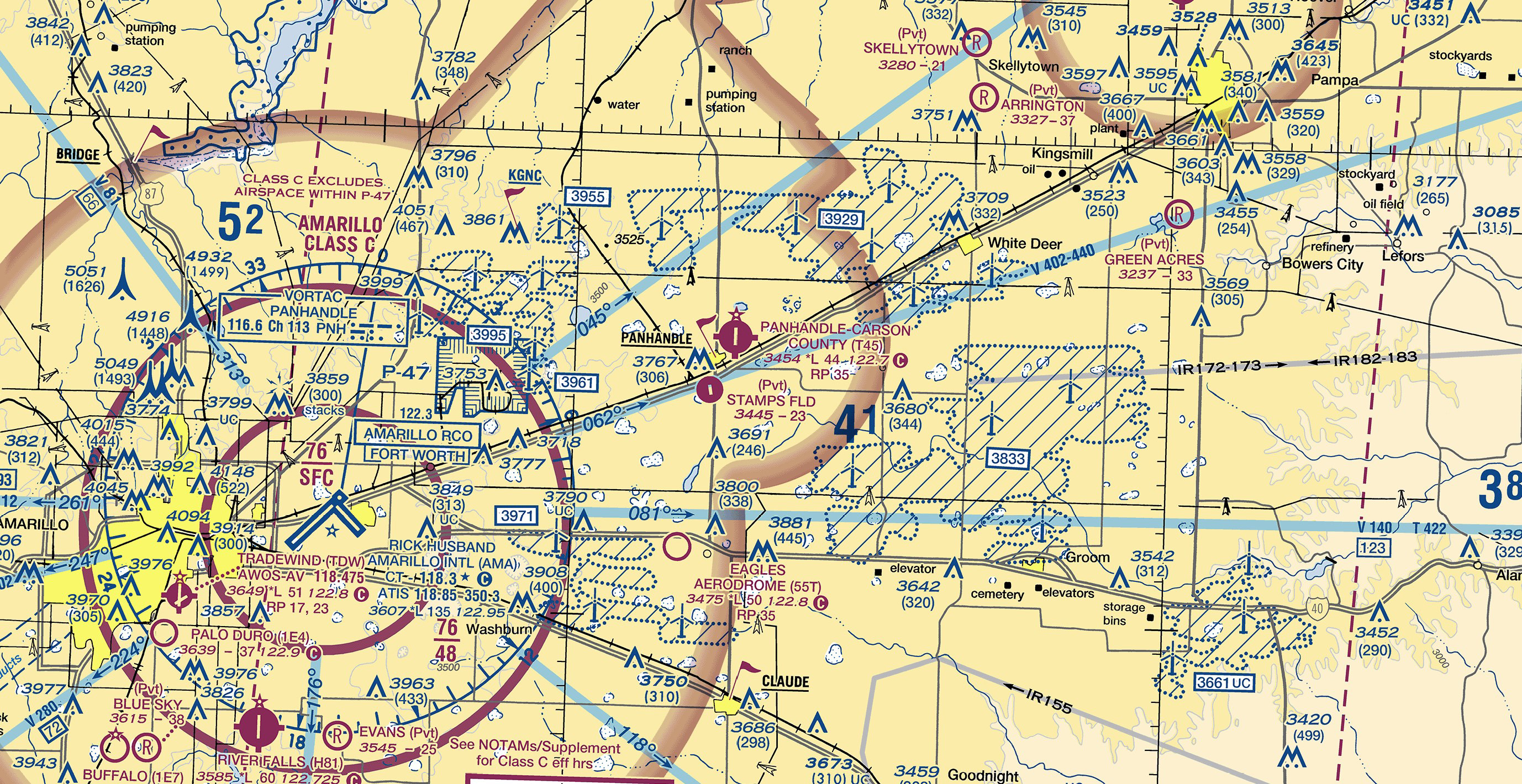
VFR charting changes for wind turbines coming soon
The FAA is implementing changes to make wind turbine farms more visible on VFR sectionals, VFR terminal charts, and helicopter route charts—to go into effect on or around August 10.
In 2011, when wind turbines were first depicted on sectional charts, there were approximately 25,000 wind turbines in the United States, with an average height of 408 feet. Today, there are more than 75,000 of them, with an average height of more than 499 feet. These taller turbines increase hazards to VFR pilots operating in Class G and Class E airspace for a variety of reasons, including the fact that the wind turbine blade tips (the highest portion of the turbines) are not lit.
The FAA Flight Procedures and Airspace Group, which is responsible for evaluating the national airspace system, hopes these charting improvements will help to mitigate the safety risks of flight operations around wind turbines. AOPA was involved in discussions leading up to the changes and supports both the updates and the FAA’s efforts to increase safety around wind turbine farms.
To depict the boundary of wind turbine farms, the current dashed line border will be replaced with an aviation blue zipper border for easier identification. And for additional increased visibility, 45-degree diagonal cross-hatching lines will be added within all wind turbine farms.
The masked elevation box will be revised to include a white background and a mean sea level elevation figure of the highest obstruction within the wind turbine farm—the wind turbine rotating blade tip at the 12 o’clock position. Additionally, the “UC” in white altitude boxes will denote “under construction.” There will be an FAA charting notice denoting these changes in advance of the August charting effective date. In addition, the updated information will be added to the Aeronautical Information Manual, Aeronautical Information Publication, and Pilot’s Handbook of Aeronautical Knowledge in March 2024.


