Radar basics
Simple in principle
To many, airborne weather radar systems are considered the best way to avoid thunderstorms and areas of precipitation.

That’s because they’re mounted on the airplane and scan the sky ahead in real time. Radar imagery datalinked to the cockpit from ground-based weather radars involve a few minutes’ delay.
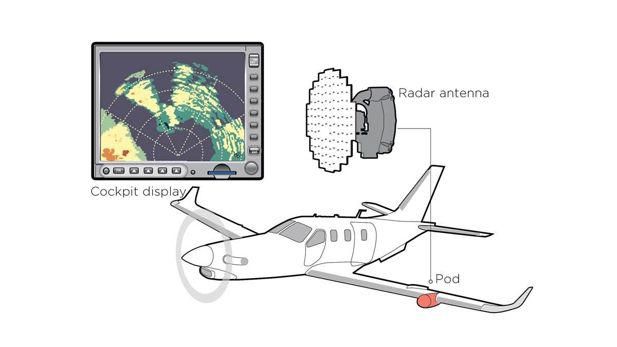
Airborne radar systems are simple in principle. A radar antenna, or “dish,” is installed in a pod on a wing, or in the nose of a multiengine airplane. The antenna broadcasts pulsed radio energy, then “listens” for it to return. The dish continuously sweeps from side to side, and the pilot can tilt the antenna up or down to look at the vertical extent of any radar returns, or “echoes.” These returns are converted into imagery and presented on a cockpit display screen
Like so many sophisticated technologies, radar has its limitations. Essentially, the radar pulse is a noise detector, bouncing its radio noise against whatever is ahead. It “sees” the largest water droplets in a precipitation field the best, and so plots them in shades of yellow, red, or magenta. Wet hail has the highest reflectivity, with rain and wet snow close seconds. Tiny water droplets in non-precipitating clouds don’t show up at all, nor do ice crystals or dry snow.
Another thing: Radar doesn’t know the difference between terra firma and rain. Both will send returns back to your radar. For this reason, it makes sense to tilt the antenna down until it “sees” ground, then tilt it up until ground returns disappear. Just don’t try this in mountainous regions, and always observe minimum altitude restrictions.
Also, a radar’s effective range is a function of its antenna size. Smaller antennas of the sort used in most general aviation airplanes produce less energy. So, anything displayed much beyond the 40-nautical-mile range is unreliable. But the three-foot-diameter antennas in airliners can accurately see 200 nm ahead.
Another limitation is attenuation of the radar signal. This happens when outgoing radar signals become so absorbed by heavy precipitation that they can’t make the return trip back to the antenna. This creates an apparently clear, precipitation-free zone behind an area of heavy precipitation. But it’s not clear at all. It’s a radar “shadow” that can contain the heaviest rain and most convective thunderstorm cells. A pilot trying to fly through a line of heavy rain may choose to cross a line of thin returns thinking it’s the quickest way through to clear weather, only to find that it masks the worst weather. Pilots should occasionally range their radar displays out to look for signs of attenuation, being mindful that smaller antennas may not see very far anyway.
Your best strategy would be to have a second source of radar information aboard: datalink weather. Datalink presentations come from powerful, ground-based Doppler weather radars with huge antennas and pencil-beam radar signals. That means no attenuation and much better strategic situational awareness. Add a Stormscope to detect lightning and you have another tool for avoiding the worst storms.


