Cub pilot confronts Alpine convection
A wary taste of forbidden fruit
On most days with a chance of isolated convective buildup in the mountains, one could only hope for rain. A flight around glaciers at 13,500 feet in a Piper PA–11 resulted in a stronger-than-expected thunderstorm, with an interesting opportunity to observe its interaction with terrain as it blocked the path home.


It is to state the obvious to point out conventional wisdom against flying in thunderstorms as well as to advise extreme caution in mountain flying environments. To fly in a thunderstorm in a mountainous environment in a Cub, well, I shall quote the reply I received when I asked for advice from locals in Leadville, Colorado, some years ago, when I had newly based the Cub there: “I don’t suggest it in that airplane.”
The mountains of Europe have vastly different meteorological characteristics in the summer and shoulder seasons than in the United States. While convective buildup in the Rockies and much of the United States often results in dangerous weather, the Alps and Pyrenees have a daily summer routine of immense towering cumulus, reaching menacing heights, which may or may not result in precipitation. Within an hour of sunset, the clouds virtually disappear with nary a peep. The season had just started for such behavior, so I was left with the desire to go flying yet a question of how to safely enjoy some mountain scenery.
 I decided upon a quick trip around the block, from Gstaad (3,330 feet field elevation) around the Jungfrau (13,642 feet). It is laterally 30 minutes away, with added time necessary to get to the altitude of the summit, which can be achieved by snaking around the Bernese Alps on the way. As I surfaced the cloud bases at 8,000 feet, the picture was what I expected: reasonable cloud buildup, though with what I understood to be no sign of impending doom. I did note a sudden drop in temperature at 9,000 feet, far more than the prior day when I flew, so I made a mental note to be cautious of hail if any thunderstorms brewed.
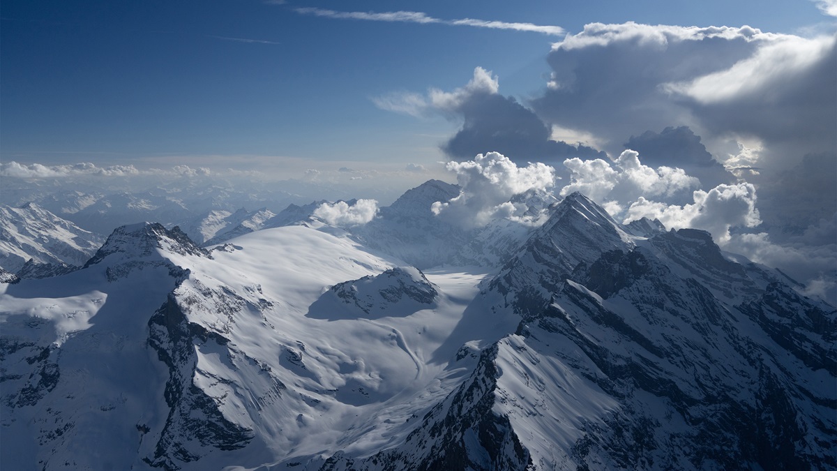
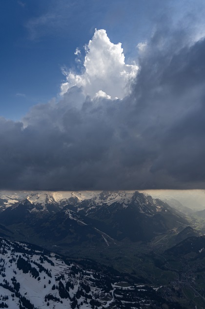
Towering cumulus was sufficiently spaced to allow for an exciting and beautiful flight east as terrain increased in elevation. I was pleased with the photographic form in front of me, exuberantly wondering why do I not do this more often. By the time I surfaced the massive ridge above the Rottalgletscher and circled around the Jungfrau at 13,000 feet, I was offered a glimpse of the answer. The innocent, routine daily buildup had turned into a small thunderstorm, appearing to be located right over my base airport. My wife appropriately texted me some minutes later to advise of raucous thunder and heavy rain.
 Wind energy was virtually nil on the day in question at all levels of the atmosphere, and cloud and storm coverage were small enough that there was no need to dive right under the storm to land back at base. I was within 20 minutes of five alternate airports, and I had plenty of fuel, so I decided to watch the storm progress as I continued my flight back westbound along the glacier ridgeline, above the largest glacier system in the Alps.
I saw an interesting meteorological story unfolding. The Rhône Valley, sandwiched between the Pennine Alps and Bernese Alps, is the driest section of Switzerland, with a steppe climate averaging 25 inches of rain per year. In inhabited towns to the north of the Bernese Alps, rainfall is over 50 inches, with glaciated mountains in between. Those averages were consistent with MeteoSwiss microcast and aviation forecasts for the day, which called for any precipitation not to make it over the ridge. I had a front row seat to that phenomenon from Flight Level 130, looking at clouds reaching almost 30,000 feet yet curiously not crossing the ridge to the south.
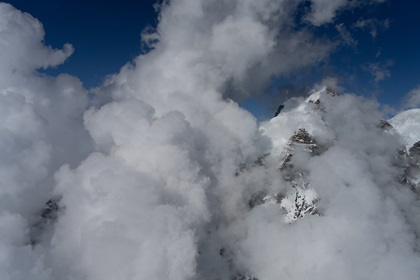
As I got under the shadow of the anvil, things seemed less innocent, as the storm appeared bigger, terrain more menacing, and options somewhat less abundant. I decided to get a better picture of what the storm was doing, admittedly tempted by the prospect of photographs, by crossing into the foothills to the northwest at FL130. Any higher would have put me in Class C military airspace. Things were fine for about 10 miles as I came around the side of the storm, enough to see terrain-induced training development along the ridge, from west to east. While it was clearly developing in a direction away from my base airport, a few static interferences on the radio signaled the presence of lightning. I also kept a wary eye for hail.
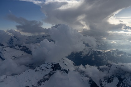 The cloud layer below went from scattered to broken on average, with overcast up ahead. I followed the Simmental Valley, which kept an orographic opening for a period, getting me within 10 miles of the airport. That resulted in a decision: Do I go up, entirely away and abort, or down? When facing limited openings below, particularly in convective weather in the mountains, I have come to learn that it is a critical decision-making point. To ascend would be pitting 100 horsepower at FL130 against the rate of cloud development, coupled with a harried request for Class C clearance. To exit laterally would take an extraordinary amount of time. I decided to head down in the hole before it closed, which largely meant that I had to accept what was going on below, which I could partially see from above.
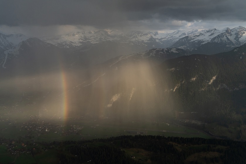
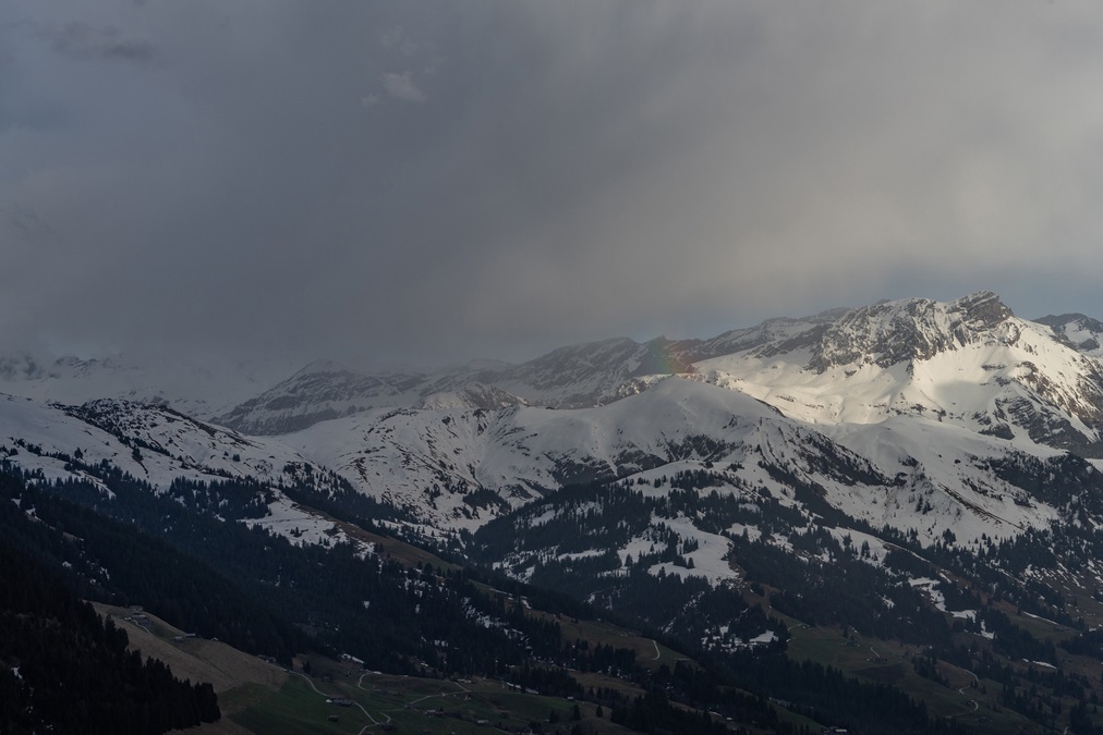
I cleared cloud bases at 9,000 feet over Zweisimmen Airport, accompanied by a rainbow and some light precipitation. Charter flights were making their last departures for the evening from Gstaad, so things seemed normal, except for what I understood to be a towering cumulus cloud southwest of the airport, over terrain. Its apparent growth coupled with an unusual easterly wind led to the conclusion, albeit incorrect, that convection was growing with an updraft and would likely turn to downdrafting precipitation before I could get down.
Nontowered airports in Switzerland do not have AWOS. Unicom is only allowed to relay the “runway in use” based on wind, though nothing more without an Information Service license. That left me somewhat ignorant of what was going on regarding wind speed. My decision was to let the cell move to the east, so winds would return to normal out of the west and not surprise me on short final. It is relevant to note that this airport is in a very deep hole, with ascending terrain on all radials except right over the Saane River; I have still never seen anything like it elsewhere. Wind shear from a thunderstorm is not something I would like to contemplate.
 The cell moved, except it started raining. After a bunch of flying around on the sunny side, I was getting to a point where fuel wouldn’t last forever, nor would alternates be open. I decided to join the circuit for Runway 26 and call it a night, until before turning base, I saw another rainbow. Like a curious cat, I took a five-minute detour to chase it. When I returned for a long base join, a sudden explosion of rain materialized over the field. I diverted again to the north to the western sunny side, waiting out a cell that now decided to commence training development…right over the airport.
Landing on Runway 26 was out of the question. Landing in a ferocious downpour into the setting sun is silly, so it was a question of winds. I eventually deduced, without the aid of being able to see a windsock, that it was a slight tailwind for Runway 08, marginal VFR at worst in the rain, with a caveat that a tropical downpour was awaiting on the go-around. There is no option for a left or right turn…just a straight climb and then within a mile of the end of the runway, one must turn up valley or hit terrain. Fortunately, the landing remained VFR and a go-around was not necessary.
I chose to toy with the small thunderstorm and series of later downpours as part of a theory of mine. While we warn against ever going near convection, and we warn heavily about risks of mountain flying, pilots end up in convection, untrained in mountains, or a combination of both, enough times that I am of the view that we should augment our warning regimes with training regarding dealing with a situation that we were warned never to find ourselves in. At all times, I could have easily escaped in almost any direction and landed in sunshine at an alternate. I wanted to see how a small thunderstorm would interact with massive terrain, to help formulate mental preparation if a worst-case scenario should ever befall a flight in such a locale.