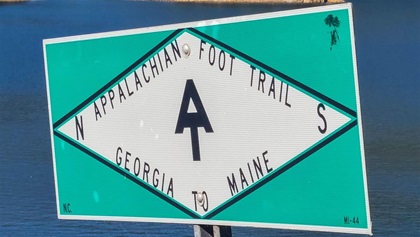
Flying the AT
The Appalachian Trail by air
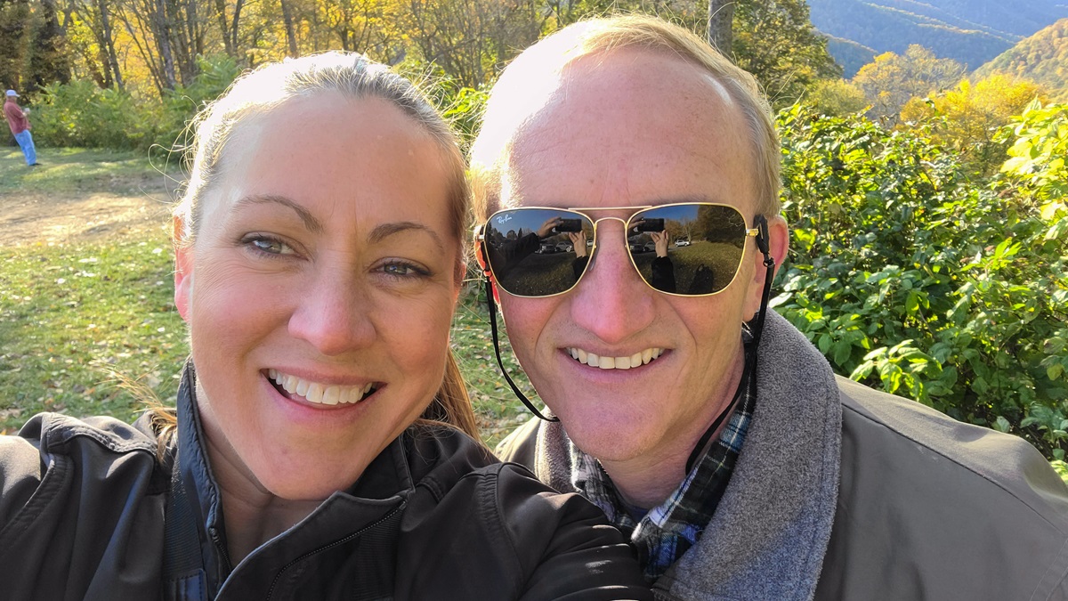
By Stacey Nilsen in collaboration with Keith West
From our front window, South Mountain looms in the distance. It’s the front range of the Appalachian Mountains, the Blue Ridge, and location of the Appalachian Trail in Maryland. It’s a constant reminder that a 10-minute drive will get us from home to a 2,200-mile-long hike, one of the most renowned treks in the world.

Say again?
 Perhaps the only disagreement on the trip was how to pronounce Appalachian. As a multigenerational North Carolinian with roots in Cherokee County, Keith stands on the correctness of the pronunciation used by the locals: “Appa-LATCH-an.” Stacey, however, continues to stick with the version she picked up in suburban Maryland: “Appa-LAY-shun.” Google “Appalachian” for some amusing and strongly held opinions on the subject.
What a glory it would be to hike that trail. But for a working-age couple with children, the six months it would take to tackle the Maine to Georgia hike would be, well...unaffordable.
In perhaps one of the only inspirations in which general aviation proved to be the cheaper option, Keith, my one-time CFI and now fiancé, looked over at me and said, “Why don’t we fly it?”
Planning begins
As a relatively new private pilot, I embraced the opportunity to not only enjoy the beauty of the scenery but also to embark on my longest and most adventurous flight to date. Among such new experiences would be the chance to climb to higher altitudes; traverse wild terrain; land at challenging airports; and navigate fickle weather, all far from home. And I would get to expand my flying comfort zone with Keith, a former U.S. Navy aviator, Civil Air Patrol mission pilot, and CFI.
A journey of a thousand miles may start with a single step, but a flight starts with a chart. Our first task was to figure out how to translate the many maps of the Appalachian Trail (known by hikers as the AT) into the world of aviation.
Tablets have improved many things in flying, charting not the least among them. Within an hour, we had figured out how to get a freely available depiction of the AT into ForeFlight, viewable as a layer on the sectional.
AT by Air


Airports on the AT
 There are many airports within 10 miles of the AT. These are some that are either directly adjacent to the trail or offer access to highlights and accommodations, listed north to south.
- Sugarloaf Regional Airport (B21), Maine
- Mount Washington Regional Airport (HIE), New Hampshire
- Lebanon Municipal Airport (LEB), New Hampshire
- Rutland-Southern Vermont Regional Airport (RUT), Vermont
- Harriman-and-West Airport (AQW), Massachusetts
- Pittsfield Municipal Airport (PSF), Massachusetts
- New York Stewart International Airport (SWF)
- Capital City Airport (CXY), Pennsylvania
- Frederick Municipal Airport (FDK), Maryland
- Luray Caverns Airport (LUA), Virginia
- Shenandoah Valley Regional Airport (SHD), Virginia
- Roanoke-Blacksburg Regional Airport (ROA), Virginia
- Mountain Empire Airport (MKJ), Virginia
- Elizabethton Municipal Airport (0A9), Tennessee
- Asheville Regional Airport (AVL), North Carolina
- Macon County Airport (1A5), North Carolina
- Blairsville Airport (DZJ), Georgia
History lessons
In the unlikely event that the scenery and geography fail to consume your attention, take some time to note the history you’re flying over. Long sections of the AT run along the ridges of the mountains forming the Great Appalachian Valley, the central feature of the Appalachian mountain system that runs from Quebec to Alabama. The valley has been a trade and war route since ages past and as you fly above it you will cross byways such as the Seneca Trail and Great Wagon Road. In Colonial times, British Gen. Edward Braddock—along with his aide, a young Col. George Washington of the Virginia militia—cut a path through Maryland and Pennsylvania on his way to death and defeat near Fort Duquesne, in modern day Pittsburgh. The route was later developed into the National Road, becoming a path for settlers moving west and the Underground Railroad. —KW
AT highlights
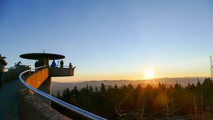
- Clingmans Dome: Highest point on the trail with great views of the Smoky Mountains (see image above).
- Rocky Top Trail: Classic day hike with views of the Blue Ridge Mountains.
- Biltmore Estate: America’s largest home.
- McAfee Knob: Iconic perch and view.
- Maryland Heights: Excellent hike and view of Harpers Ferry, West Virginia.
- Antietam National Battlefield: Well-presented monument to the bloodiest day of the Civil War.
- Appalachian Trail Museum: Pine Grove Furnace State Park, Pennsylvania.
- West Point: Beautiful Hudson River home of the U.S. Military Academy.
- Mount Mitchell: Tallest mountain on the East Coast at 6,684 feet.
- Angel Falls: 90-foot waterfall that resembles an angel.
Guidebooks
There are many guidebooks to the Appalachian Trail, most with particular audiences or purposes in mind. My favorite for our style of tourism centered around the trail was Drive and Hike Appalachian Trail, a Moon travel book that focuses on day hikes and attractions on and off the trail. For serious hikers there’s the official Appalachian Trail Thru-Hikers’ Companion, which is a data-driven book with mileages, elevations, shelter locations, and other information essential to thru-hikers. If you want to know how to plan and what to take on a six-month hike, or just are curious how hikers do it, How to Hike the Appalachian Trail by Chris Cage is a great place to start. —SN
Our charting revealed an agreeable surprise: Being free from zigzagging up and down the mountain sides meant we would travel half the distance of our earthbound counterparts. The AT by air can be accomplished in two long weekends of flying.
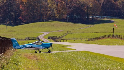
We decided to divide the trip in half, flying the southern journey in the fall and saving the northern half for another time. The first leg of our journey in a Van’s RV–12 would take us from AOPA’s home base at Frederick Municipal Airport in Maryland over the familiar V-shape landmark and ground reference point of Harpers Ferry, West Virginia. Harpers Ferry is the headquarters of the Appalachian Trail Conservancy and the traditional halfway point of the trail. The Potomac River slices through the Blue Ridge on its path to the Chesapeake Bay, providing a natural source of beauty and energy that Thomas Jefferson referred to as “perhaps one of the most stupendous scenes in Nature.” The energy was used to power the U.S. Arsenal and Armory at Harpers Ferry in the fledgling United States.
Weather or not
We would like to say that our aerial hike went off without a hitch, but how possible is that when covering long distances VFR? After a golden afternoon flight down the Shenandoah Valley, we spent our first night in the mountain-ringed city of Roanoke, Virginia. Roanoke-Blacksburg Regional Airport (ROA) is the only Class C airspace that the AT penetrates. Most of the trail is nearer to small towns and remote airports.
It’s always hard to imagine that a beautiful evening sunset can be followed a few hours later with an overcast dawn, but that’s what happened. Fortunately, the weather came slower than forecast and we were able to squeeze out of Roanoke and pick our way south along the edge of the low clouds. Our aircraft was equipped with a Garmin G3X with ADS-B weather, which was a big help in navigating the weather and terrain.
Knowing the weather observation from an airport in the next valley over and the height of the terrain in between takes much of the guesswork out when deciding how far to push in the pursuit of good weather. As it worked out, low ceilings kept us a few dozen miles east of the AT, but we were easily able to get to our destination of Asheville, North Carolina.
We rented a car to get to the nearest access to the trail, about 30 miles from Asheville. While the area is not touristy like a beach resort, the scenic roads and towns along the AT fill up through the summer and are especially busy on fall weekends when the trees are dressed in their dazzling fall foliage. We timed it perfectly and were treated to peak colors of red and gold.
We found a hotel in Franklin, North Carolina, that served as our base for exploring the part of the trail that winds though the Great Smoky Mountains National Park. Alternatives to hotels include a plethora of cozy mountain homes and lakeside vacation rentals available on sites such as VRBO and Airbnb. Book far in advance for fall weekends.
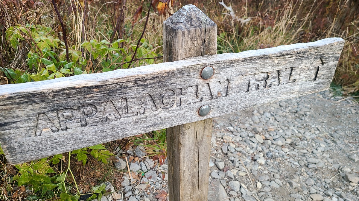
Taking a hike
An Appalachian Trail trip wouldn’t have been complete without treading the trail, so we rose early to see the sunrise from Clingmans Dome. At 6,643 feet, the peak is the highest point on the Appalachian Trail. We drove to within a half-mile of the summit and hiked the paved but steep path to the observation tower. The thin, 27-degree air chilled us unexpectedly, but the views did not disappoint. The 45-foot-high observation tower affords a 360-degree view of the Great Smoky Mountains.
After a couple of days exploring the Great Smokies, it was time to head north again. The weather was, thankfully, better with clear skies, smooth air, and a tailwind from the south.
After leaving Asheville, we flew back to Macon County Airport (1A5) in Franklin, a sweet little strip nestled in a tight valley. Keith took the stick as the nearby ridges forced a close pattern. The mountain air slipped calm over the ridges that morning, so Keith was able to fly low over the terrain, giving me the chance to take an abundance of photos.
Along the way, we stopped at Elizabethton Municipal Airport (0A9) in Tennessee. It was my first experience with the hallowed tradition of the airport crew car, which we took to nearby Blue Hole Falls, a serene waterfall that plunges to a water hole with remarkable color. A lovely place for a picnic and respite from travel.
Mountain Empire Airport (MKJ), one of a handful of airports directly adjacent to the AT, proved to be a convenient place to turn on our external GoPro cameras to record the trip into Burke’s Garden, Virginia.
From the air, Burke’s Garden appears to be the crater of a volcano, but it’s actually a depression caused by the collapse of underground limestone caverns. The visual effect is the same. Stand anywhere in the valley and you are surrounded by a ring of mountains, with the AT running along the eastern ridge.
We were fortunate to have received landing permission from the owner of the small private strip, which also serves as a driveway and farm road. The cows seemed rather content and a few Amish folk came out to watch us land. With the airplane shut down, we were as impressed with the quiet as we were the mountains. With no major road running through the valley, the sense of peace was palpable.
Air advantage
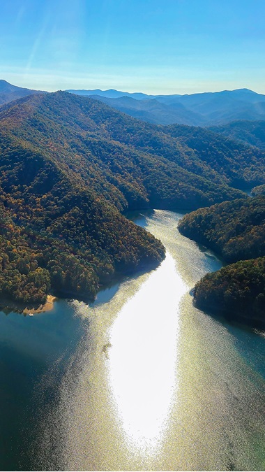
What does it mean to fly a trail? We quickly realized that literally flying over the trail for hundreds of miles would be undesirable and would perhaps not take true advantage of an aviator’s ability to see the forest, if not the individual trees. Flying along the valleys within sight of the ridges that the trail typically follows, we were able to gain a greater appreciation, not only for the rolling beauty but also for the geography of the Appalachian Mountains as the mountains served both as barriers and avenues to early settlement.
From the air, the geology of one of the world’s oldest mountain ranges is open to inspection. Once joined with the Little Atlas mountain range in North Africa before continental drift tore them apart, the Appalachians were formed from the uplift of an ancient sea floor. The marine sedimentary and volcanic rocks once reached as high as the Rockies until wind and water wore down the ridges to more small-airplane-friendly elevations.
Although not soaring to the oxygen-deprived altitudes of the Mountain West, the Eastern mountains do pose challenges to aviators. No one should venture in among them without study and preparation that, ideally, would include training from a CFI with mountain flying knowledge.
Of the challenges we faced through this journey, the foremost was the weather. Sierra airmets for mountain obscuration are a regular feature of Appalachian forecasts throughout the year for low ceilings, fog, and mist. Caught between the mountain ridges and the clouds without a visual way out is no place to be.
Turbulence is something else to watch out for. Winds greater than 25 knots can cause dangerous turbulence. Altitude is your best defense. If you must be near a ridgeline, stick to the upwind side of the ridge. Downdrafts on the lee side can exceed the climb capability of small aircraft.
Five states and 800 nautical miles of scenic Appalachia in the throes of autumn exuberance sounded like a great plan from the start and our journey didn’t disappoint. Rather than following the magenta line over anonymous terrain, we felt connected to the landscape. From the air, it is easy to see why this mountain range posed a challenging obstacle for early settlers wishing to go west. To this day, the small towns and isolated communities remain remote. The terrain, wild and free. We could have used more than three days and some warm gloves, but the view, the learning experience, and the great company proved more than enough reward.
Stacey Nilsen is an AOPA Aviation Finance account executive and private pilot. Keith West is a CFII and former senior director for flight school business support at AOPA.
Related Articles


