New AOPA Weather available online and via AOPA app
Latest in series of AOPA’s upgrades to flight planning tools
The new AOPA Weather, powered by SiriusXM Aviation, provides national and airport-specific data in a mobile-friendly format that makes it perfect for checking weather on the go—even via the AOPA app. The upgrade is the latest in a series of flight planning tool improvements we have made in 2020 to serve you better.
In April, we debuted iFlightPlanner for AOPA, replacing our legacy flight planner. In September, we upgraded our AOPA app to add the AOPA Airports and Destinations Directory, making the data downloadable for use offline. In November, we announced the consolidation of AOPA GO into the AOPA app.
“These upgrades make our powerful suite of flight planning tools—weather, flight planning, and airports database—available from your mobile device. We specifically tailored these upgrades to make it easier for you to plan your flights on the go,” said Jiri Marousek, AOPA senior vice president of marketing. “As pilots, we need to be flexible, and we wanted our flight planning tools to be just as flexible so that you can access them whether you are at home, at the airport, or enjoying an outing at a new destination.”
AOPA Weather 101
AOPA Weather pulls in your home and favorite airports from your settings in the AOPA Airports and Destinations Directory, but you can also set your home and favorites from AOPA Weather by clicking on the “Home” and “Heart” icons within the METAR and TAFs details for an airport. If you haven’t already selected a home or favorite, you can search by entering the airport identifier.
Get radar, satellite, wind stream, surface winds, and surface analysis charts in the “Current Weather Layers” and “Current Weather Charts” sections. Layer radar, satellite images, and the wind stream for a detailed big-picture view of what’s happening across the country. Turn off those layers to then check surface winds or the surface analysis.
In the “Forecasts” section, you can choose among a surface forecast, airmets, or sigmets. The three cannot be overlaid. However, within airmets, you can layer mountain obscuration/IFR areas, turbulence, and icing/freezing area.
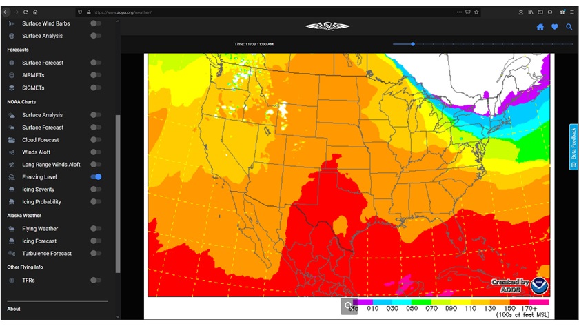
National Oceanic and Atmospheric Administration charts available from within AOPA Weather include prog charts, surface forecast, cloud forecast, winds aloft, long range winds aloft, freezing level, icing severity, and icing probability. NOAA charts for Alaska are called out in their own section.
Users can also check temporary flight restrictions within AOPA Weather.


