Destination Costa Rica: Into the wild
Flying in the land of pura vida
Flying Costa Rica
Flying in Costa Rica
 It’s possible, if not easy, for foreigners to fly here
If you want to undertake an epic adventure and fly south through Mexico and into Central America, Costa Rica is a great place to spend a few weeks. N-registered aircraft can be flown by FAA-certificated pilots anywhere in the country after obtaining a local permit, which usually takes only a day or two.
Flying a TI-registered aircraft involves a license validation that can be done before you leave home. Then it’s a matter of connecting with a flight school at Pavas or with the folks in Aranjuez.
Airport procedures across the country are largely the same as they are in the United States. Flying in and out of San Jose will require flying charted visual routes that air traffic control treats much more like IFR. Expect to maintain an exact altitude and course, in other words. But once out of the Central Valley, you will be almost completely unencumbered by airspace. A call to Coco Radio (like flight service) before the flight to file a flight plan, and a quick call afterward to close it, is all it takes.
However, the terrain and weather are unforgiving. Best to get some local instruction first. —IJT
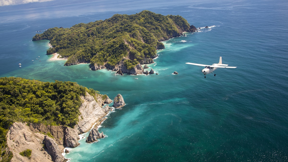
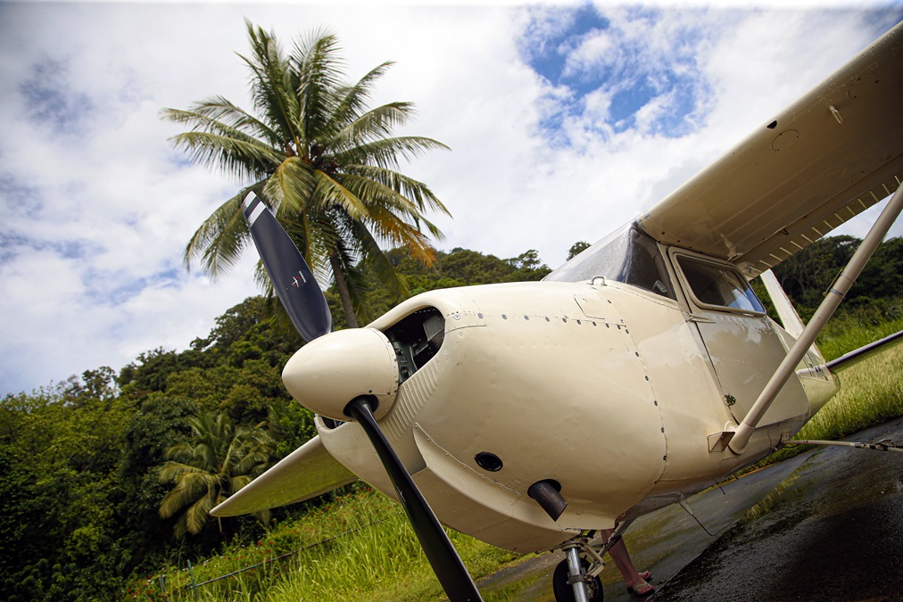
The plan is to depart Tobías Bolaños International Airport in San Jose, Costa Rica, bound for Carate on the wild Osa Peninsula in the southern part of the country. Costa Rica is known to millions of tourists a year as a premier destination for beautiful beaches, great surfing, diverse wildlife, and active volcanos. But what most tourists miss is that, especially for this part of the world, the country has a vibrant general aviation community, and nowhere are flying’s gifts more on display than the isolated Osa Peninsula.
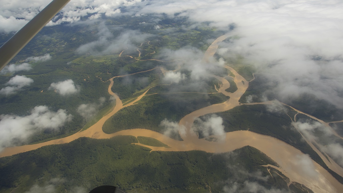
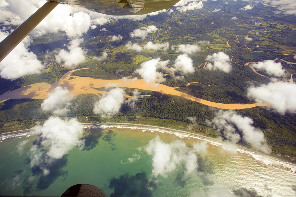
Set off Costa Rica’s southwest coast, Osa is about 8.5 degrees north of the equator. The area is going through immense challenges as it seeks to balance the protection of its natural beauty and diversity with the prosperity of tourism. Mostly covered by Corcovado National Park, Osa comprises just 700 square miles of land, but it accounts for 2.5 percent of the world’s biodiversity. Here you’ll find all six of the country’s wild cat species, all four of its native monkeys, more than 400 species of birds, and everything from tapirs to caimans. It’s one of the few places in the world where the rainforest comes down to meet the ocean, so getting there is challenging. Driving from San Jose to Carate would take an entire day and require fording rivers that are known to sweep away cars. Boat charters are possible, but lengthy and dangerous. The best way to get there is by general aviation, as six small airstrips dot the peninsula’s perimeter.
Tobías Bolaños—or Pavas, as the locals call it—contrasts starkly with Osa. In Costa Rica’s central valley it is surrounded closely to the south by mountains, and rising terrain to the east. The airport is busy, with national airlines flying Cessna Caravans and Piper Seminoles, lots of training in Piper Cherokees, many helicopter operations, and a smattering of international jet traffic. Despite being the country’s primary GA destination, there are no instrument approaches. But there are visual routes in and out of the valley, designed to keep you away from nearby Juan Santamaría International Airport (Coco for short) and, more important, to keep you from hitting a mountain.
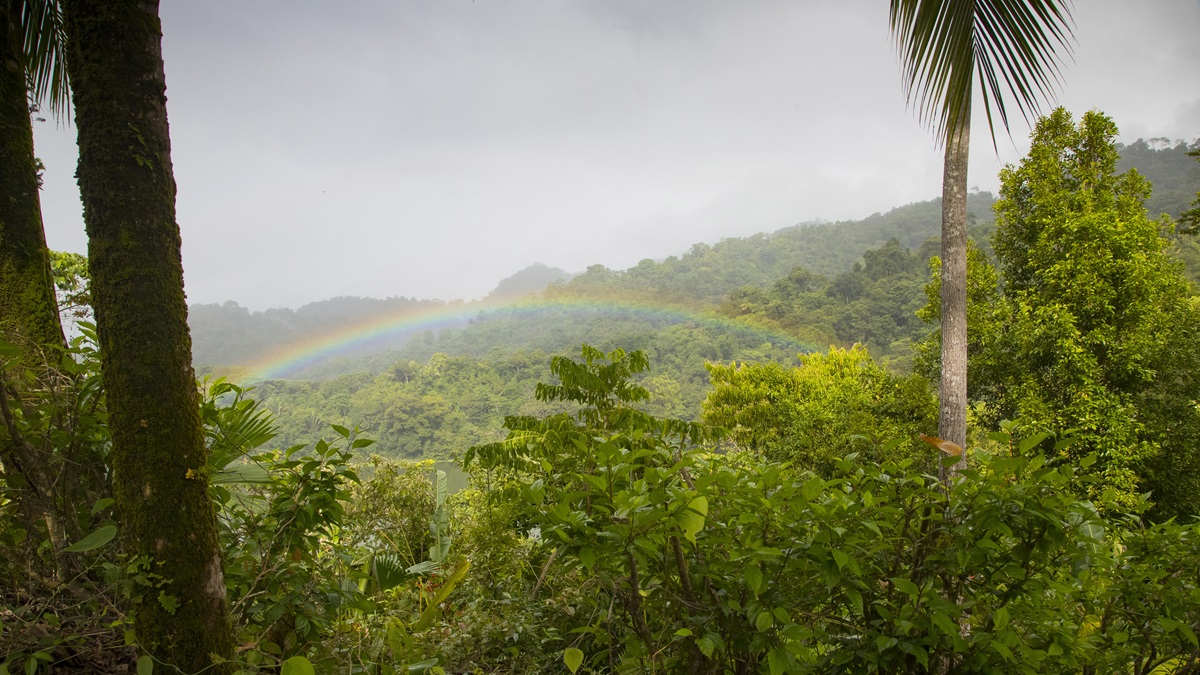
The takeoff from Runway 9 is over a deep ravine, and then dense housing with reddish-hewn roofs. I try not to think about engine trouble, because like most of the country, options are few. On the radio the calls come fast and mostly in Spanish. Although not an instrument procedure, the departure requires precise navigation and quick frequency changes. In a country the size of West Virginia, we are soon south of the city and soaring through Paso de Parrito, the route to the Pacific coast. Here we get our first glimpse of Costa Rica’s intense beauty, where jagged green mountains slide down to churning rivers.
CostA Rica Wildlife


Toasting history
Airplane bar has a past
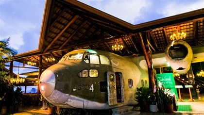 Although everyone who drives by sees it, few know its history. The El Avion bar and restaurant in Manuel Antonio is literally built around a Fairchild C–123. Its nose sticks out toward the road, and although only partially intact, the sight is impossible to miss. For history buffs, El Avion is a must-see because it is one of two C–123s used in the infamous Iran-Contra affair. A number of factors led to the scandal becoming public, but this C–123’s sister aircraft being shot down over Nicaragua was surely one of the most significant. Around the same time, the airstrip from which the operation in Costa Rica initiated was exposed. Soon the program was shut down, and the remaining C–123 languished in San Jose before El Avion purchased it for $3,000. Today you can get a beer in the fuselage, take photos in the cockpit, and crawl all over the Cold War relic. —IJT
It’s November, which means it’s coming to the end of rainy season. Relatively clear and calm mornings give way to afternoon thunderstorms. Thankfully the pattern is predictable because other than San Jose, Liberia in the northwest corner of the country, and Limon on the Caribbean coast, there is no aviation weather reporting. With dozens of microclimates, flying here requires skills most of us no longer have. Without weather radar, the satellite picture and a few ground stations that report recent rain, temperature, and dew point are the only outside help. Otherwise the eyes must find gaps, evaluate convection, and estimate ceiling heights.
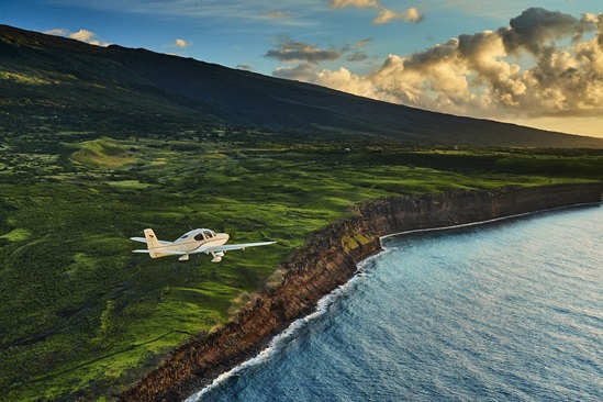
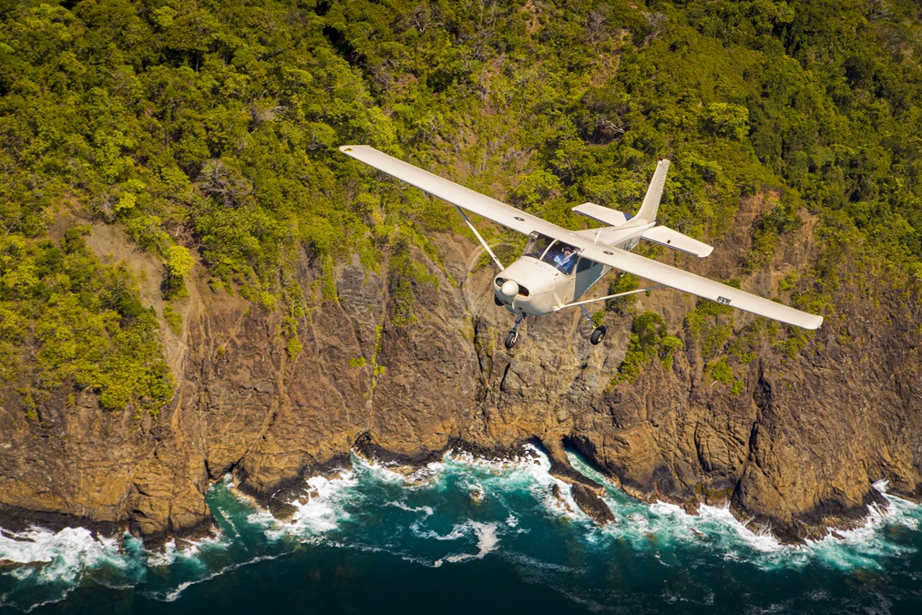
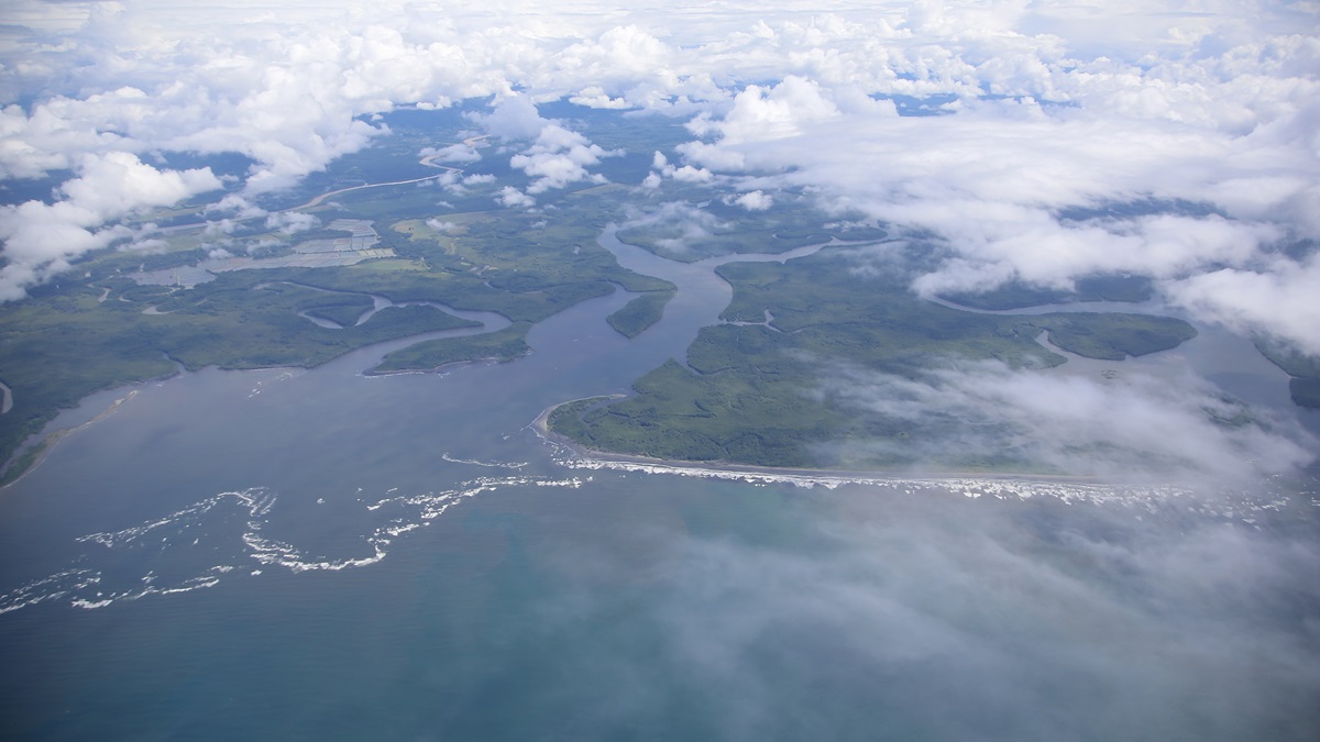
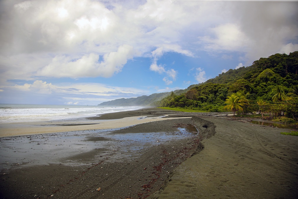
After Paso de Parrita we intersect the beautiful Pacific coast and slide down the shoreline with a rainbow of ocean colors mixing with rivers on one side and a wall of imposing mountains and dense clouds on the other. Thankfully it is mostly clear over the beach, which gradually transitions to estuary as the peninsula strikes out from the mainland. As it happens, Carate isn’t in the panel-mounted Garmin 696, but knowing it is on the southwest coast I figure we can fly low along the ocean looking for it.
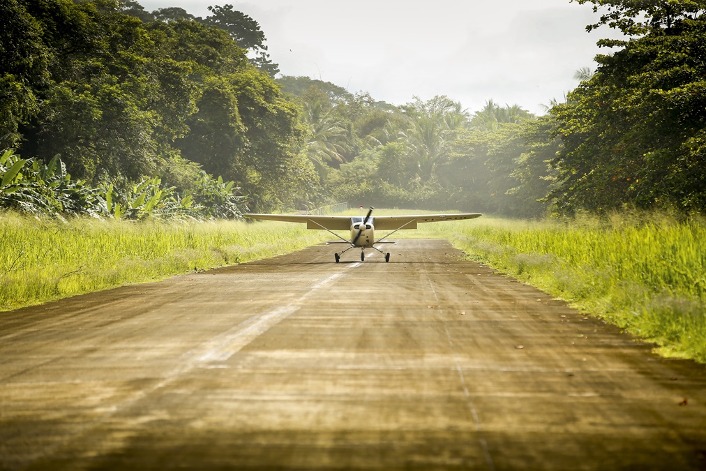
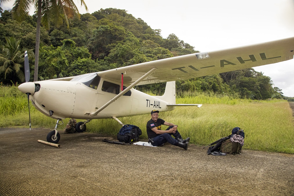
This turns out to be more difficult than anticipated. The airport is nothing more than a thin strip of concrete with tall trees on three sides. And being slightly offshore to avoid terrain, it is almost entirely hidden from our searching eyes. Only after seeing our hotel, high on a bluff overlooking a lagoon, am I able to piece together that the airport is to the north. With the windscreen increasingly obscured by spitting rain, we turn left base directly at the hotel and spot the hidden Carate airport.
With higher terrain inland the final approach is far from straight in. Instead you must work your way visually to the runway while hugging the terrain, flying level with the few houses that make Carate a town by only the loosest definition. The 2,362 feet of pavement is a worn gray, similar to the beach it abuts, save the tall palm trees in between. At this point I am happy to have 40 degrees of flaps in the 1957 Cessna 182A. It’s only in the last tenth of a mile that I am finally able to line up straight with the pavement, and pulling in that last notch of flaps with the large manual bar between the seats yields an impressively short arrival. We taxi to the end, find a small ramp big enough to double as a turnaround spot, and shut down. Along the side of the runway runs a primitive dirt road, and we have literally reached its end.
As we step out, the immense change a simple hour and a half of flying has brought is quickly apparent. The air is thick with humidity, rain sprinkles down, and the ocean crashes only feet away. Just off the airport the jungle becomes intensely thick. A few cars are parked around but no people. A few minutes later a man with frizzled gray hair pulled into a ponytail comes up. In English he asks what year our 182 is. We learn Glen is from Canada and has owned 182s, 180s, a Citabria, and more. Now he owns a few hundred acres of land along the beach, including some land upon which the airport was built. He was the one who convinced the construction company to put in the small parking apron, and for this we are thankful.
As we wait for a car from the hotel to fetch us, he describes life on Osa, losing cars on river crossings, flying adventures in Canada, and his current town’s role in the drug trade. It turns out being remote is an advantage for drug runners and ecotourists alike. Bundles of cocaine have washed up on the beach, and narcos have been known to make transfers at the airport, adding to the unfortunate stigma among the government and citizens that all private pilots in Costa Rica use aviation for nefarious purposes. As our ride pulls up we ask for Glen’s contact info. No phone, no email, and incredibly sporadic mail. He doesn’t care to give his last name, either. It’s a good place to live if you don’t want to be found.
costa rica on the ground
Just like home
Aero club is a fun GA destination
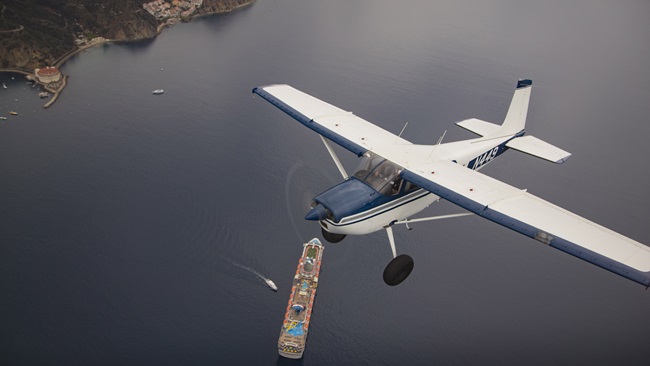
 Near the Pacific coast and the port city of Puntarenas is the Aranjuez Aero Club, a vibrant GA community with two nice grass runways. The airport is home to ultralights, gyrocopters, airplanes, a maintenance facility, a commercial operator, and a skydiving business. David Major and Sky Dive Pura Vida provided the platform for the aerial photos in this story. Aranjuez was started by Rafa Oreamuno as a private airport in 1981, Aranjuez is now mostly run by his son, also named Rafa, and it became public in 2013. There are dogs running around, pilots sitting on porches, and a lot of flying activity.
The elder Rafa was an early bush pilot in the country, flying tourists onto deserted beaches and in the jungle. The younger Rafa helped turn the private strip into the aero club with a vision to make it a central location for GA enthusiasm in Costa Rica. He has bigger plans to maybe build houses and make a place for pilots from the United States and Canada to have vacation homes and maybe leave an airplane. If he can preserve the same laid-back community feel, it will be a great success. —IJT
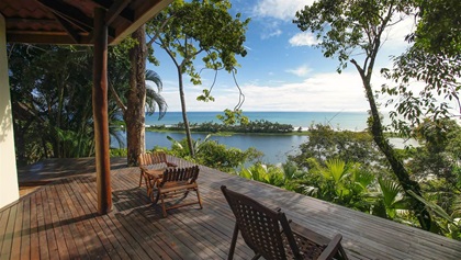
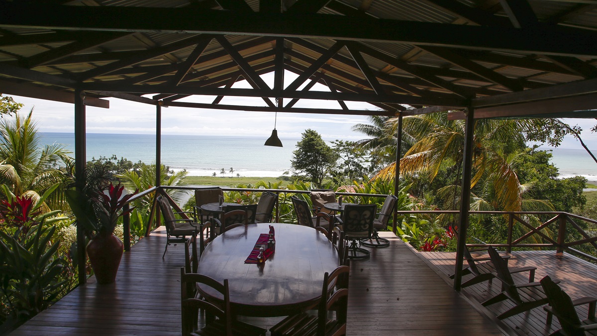
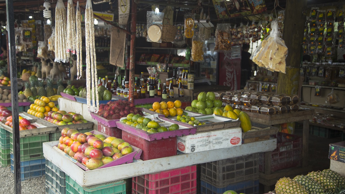
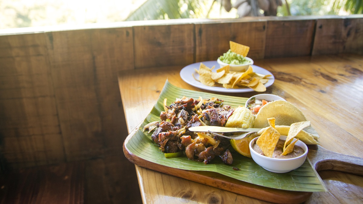
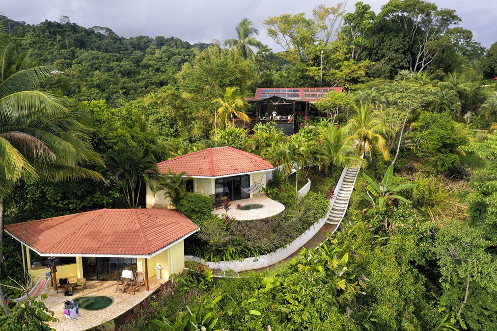
The LagunaVista Villas turns out to be the perfect antidote to the stress of flying down to Osa. High on a bluff overlooking the ocean and its namesake lagoon, the place typifies relaxation. There are no TVs, and phones work sporadically, as does the Wi-Fi. Power comes from solar panels, and hot water from a propane tank. The rooms are spacious and sparsely furnished, which seems to fit the setting perfectly. As is common in Costa Rica, the shower is what some may consider to be outside. Oh, and there’s no air conditioning. This may seem crazy, and we were prepared for the worst, but a steady breeze comes through the property and keeps things surprisingly comfortable. The large deck that makes up the common eating space has both an exceptional view and a fabulous cooling breeze. Here, cooks whip up impressive meals, especially given the challenging surroundings. We’re treated to a traditional casado at lunch with chicken, rice and beans, salad, and plantains. Dinner is a flavorful steak, vegetables, and a fresh salad. There’s rumor of a pie but no one partakes.
Although guests enjoy photography, guided hikes into nearby Corcovado, kayaking in the lagoon, night walks, and swimming in the pool, we opt for the superior choice of doing nothing. Sitting on a comfortable Adirondack chair, and looking out from our perch on the deck over the lagoon and ocean below, is a fulfilling way to pass the time. Scarlet macaws screech around us everywhere. Vultures circle next to us; toucans visit nearby branches; and all manner of interesting bugs, lizards, and birds are frequent guests.
The next morning howler monkeys replace roosters as an early alarm clock. Their call—something that sounds like it came from the gates of hell—is alarming the first time you hear it. For breakfast we’re given a choice of options, and the smart money says to always opt for a tipico of eggs, gallo pinto, tortillas, and natilla.
Because we know weather changes rapidly here and thunderstorms are sure to arrive in the afternoon, we’re eager to depart in the morning. We’ve been promised a ride back to the airplane, and once again we wait. Like many places south, the pace of life is more civilized.
It turns out that overnight the Land Rover Defender used to shuttle folks around drove itself out of the “garage” enclosure and down the hill. As we wait for a neighbor to help we watch fog creep in over the land, shrouding the hills above us with a quieting and eerie blanket. Rain comes at us from the ocean, and soon I’m wondering if we’ll be able to depart. I’m filled with an uncomfortable mix of anxiety at the flying conditions and awe at the mystic beauty of the place.
It’s raining when we get to the airport, but some blue to the north signals our need for a hasty exit. Police officers from a station down the beach are relaxing under the wing, their automatic rifles resting at their sides. But despite the fact that we are in a hot drug area and flying a very capable airplane, they are pleasant and chat with our driver as we prepare to leave.
It’s said that the United States has the world’s best freedom to fly, and that’s clearly true when you look across the landscape of regulations and cost. But it doesn’t mean that other places don’t enjoy certain freedoms. That was evident as we departed Osa. With no weather service to call and only a METAR at Pavas and a satellite picture to consult, the predeparture preparations are light. Self-sufficiency and pilot authority mean something different when you’re in such a remote place. Immediately after takeoff we stay low to avoid a pair of scarlet macaws and soon bank quickly away from the terrain and follow the beach north. There’s virtually no airspace to contend with, and radar exists only in limited spots. That leaves vast areas where you can fly wherever and whenever you want. Above 3,000 feet we call Coco Radio, the flight service equivalent. It gives basic nonradar advisories and the eventual handoff to Coco Control, San Jose’s radar facility. But otherwise, it’s a remarkably open place to fly.
It’s a good thing there isn’t much to do, because the view is completely encompassing. The coast varies between steep cliffs covered with virgin rainforest plunging to the ocean, and short beaches with crashing waves. There’s no sign of life for miles, only an enticing mix of vibrant green forest, deep blue water, and rolling hills in the interior. The area is so beautiful that there’s nothing to say in the airplane. We just stare and take in the ever-changing landscape.
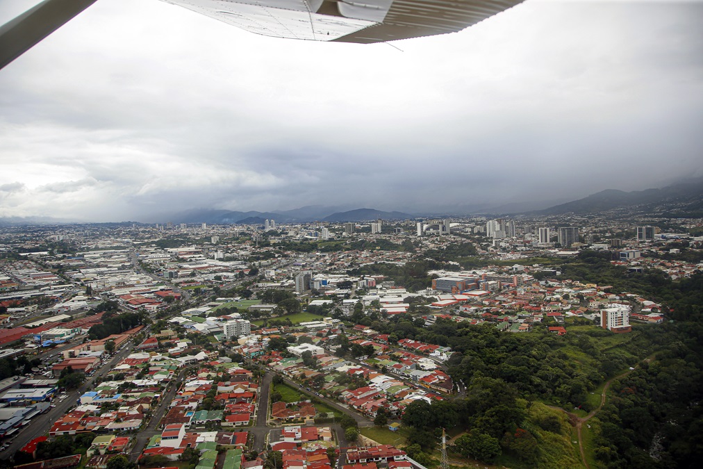
We zoom up the coast and into the mountain pass, and soon Pavas is in sight. We overfly downtown San Jose with its modern condos, proud new national soccer stadium, and tightly packed houses. After landing we step out into cool air and a stiff breeze. It’s hard to imagine, but at more than 3,000 feet above sea level you can get cold in the tropics. Among the many people we meet at Pavas is Carlo Sosto, owner of Aerotica, a respected flight school and aircraft management company. His hangar has a Bell LongRanger, a few Piper Cherokees, and an N-registered Cessna Citation. In fact, there are many N-registered aircraft at Pavas, a sign of the close link between the two countries. For lunch we head to nearby Escazu and eat grilled octopus in a swanky restaurant plaza that could have been plucked out of Southern California.
It’s an astonishing transition from the heat, rain, and remote wilderness we left that morning. And it shows how diverse the culture, landscape, and weather can be in such a small country, made even smaller with airplanes.
Email [email protected]

Related Articles