Weather: The Big 10
Clouds come in all shapes and sizes

Before you answer, ask yourself a few more questions: What do the clouds look like? Where are they? How much of the sky do they cover? VFR pilots can’t fly in the clouds, but they may be able to fly above, below, or around them. And the appearance of clouds can tell us a lot about what to expect after takeoff.
Stratiform clouds, for instance, cover large swaths of the sky and indicate stable air. IFR pilots can expect relatively smooth rides, but you may want to pack up the car instead because these clouds tend to stick around. Billowy cumuliform clouds indicate unstable air but not necessarily bad weather, especially if they are widely spaced. Expect turbulence below the clouds but smoother air above. Wispy cirrus clouds live above the cruising altitudes of a VFR pilot. And the greater the cloud’s vertical development, the more instability—so even instrument-rated pilots avoid menacing cumulonimbus clouds.
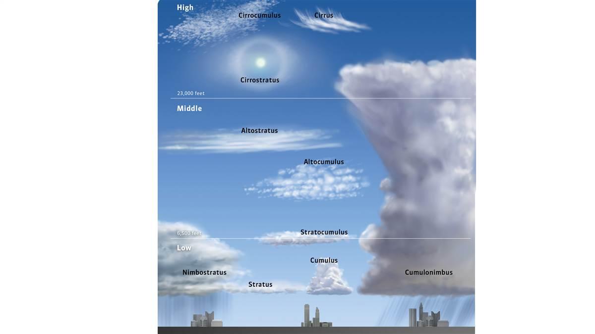
The World Meteorological Organization’s International Cloud Atlas groups clouds into 10 basic genera, based on their general appearance and where they form.
Name game
Back to roots
Wisps of hair, cotton balls, blankets, and rain
We owe our system of naming clouds to Luke Howard, an amateur meteorologist who published the Essay on the Modification of Clouds in 1803. Howard divided clouds into three categories based on their form: cirrus, cumulus, and stratus. Mashups of these three Latin roots, plus Howard’s terms for rain-bearing and middle-altitude clouds, comprise the 10 genera we know today.
Cirro/cirrus. These high, wispy, white clouds get their name from the Latin word for “curl of hair.”
Cumulo/cumulus. These fluffy, dense clouds with sharp outlines and a flat base look like cotton balls.
Strato/stratus. These broad, low, featureless clouds can cover the whole sky like a blanket.
Nimbo/nimbus. Rain-bearing clouds are darker and tend to have the greatest vertical height.
Alto. It may come from the Latin for “high,” but this means a cloud in the middle altitudes (typically between 6,500 and 23,000 feet).
Did you know?
If an aircraft condensation trail (contrail) persists for at least 10 minutes, it’s known as cirrus homogenitus.


