Weather: The lowdown on jet streams
Some jet streams are down where you fly

Regular viewers of television weather forecasts are used to hearing about the jet stream and its effects. A jet stream that dips to the south brings cold air in winter, while warmer temperatures accompany a jet stream that bulges toward the north. These jet streams are wide rivers of wind—maybe 200 to 600 miles across—up where airliners fly, from around 20,000 feet to above 40,000 feet.
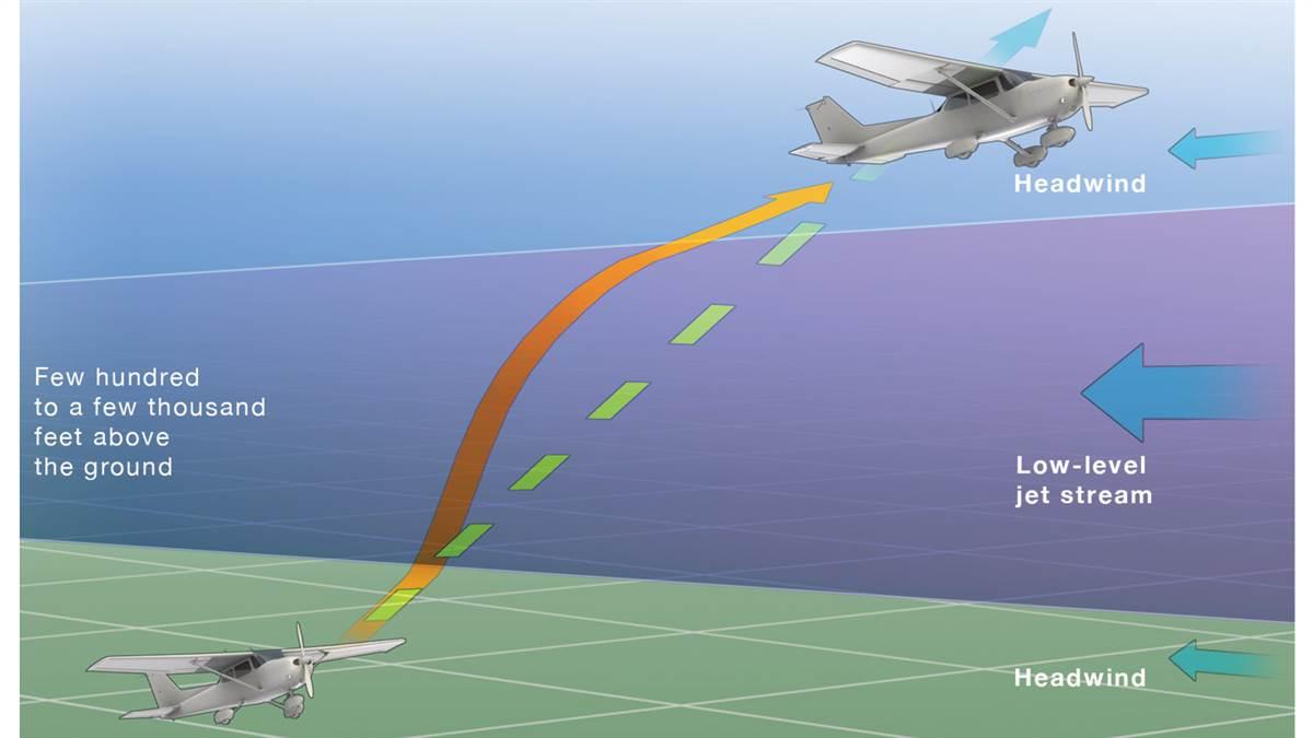
But not all jet streams are at jet airplane altitudes. As their name indicates, low-level jet streams can occur at altitudes as low as a few hundred feet above the surface. In the United States the most common location for low-level jets is blowing from south to north across the Great Plains—from the Mississippi Valley to the Rocky Mountains—in the spring and summer. Low-level jets have been discovered in almost all parts of the United States and in other parts of the world. Low-level jet wind speeds typically range from 20 to 50 knots, but at times are faster than 80 knots. They can be several hundred miles long and tens of miles across.
Low-level jets form on clear nights when the atmosphere is stable. As heat from the ground radiates into the sky, the air near the ground grows colder than the air a few hundred feet above. Such a layer of relatively warm air between cooler air above and below is called an inversion, which suppresses rising and sinking air motions.
The layer of stable air acts like a nearly solid object and allows the air above it to flow rapidly over the inversion without picking up bubbles of warm, rising air moving forward at slower speeds. Atmospheric scientists say the winds aloft are “decoupled” from the winds close to the ground.
After sunrise, warmed air near the ground begins to rise and some cold air aloft begins to sink, causing the low-level jet to fade away.
The National Weather Service tracks and reports on low-level jets because they affect an area’s weather. Since your local broadcast meteorologist isn’t likely to mention a low-level jet, you should obtain an aviation weather briefing before any flight—even one that won’t take you far from the airport.
If you’re taking off at night when the air near the ground is cooling off and is calm or nearly calm, think about the possibility of encountering a sudden shift in wind speed and maybe some turbulence as you climb. If you took off in the afternoon and are flying into the night with reports of nearly calm air from weather stations along your route, be prepared for wind shifts as you descend to land—even if you don’t hear anything about low-level wind shear or a low-level jet when you ask flight service (122.2 MHz) about weather at your destination.
Finally, if you do run into signs of a low-level jet on climbout or while descending to land, call the tower or flight service as soon as things calm down with a pilot report of the wind shift or turbulence. Your report could help other pilots avoid trouble and help forecasters improve their reports of current weather and predictions of what the rest of the night could bring.


