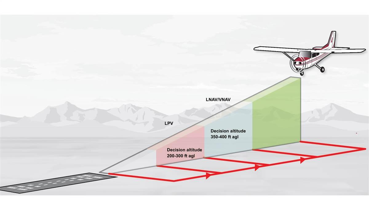
The higher accuracy and integrity of WAAS guidance allows aircraft to descend farther by reference to instruments on WAAS-based approaches. LPV approaches typically have decision altitudes between 200 and 300 feet above the threshold, and LNAV/VNAV approaches have decision altitudes from about 350 to 400 feet above threshold height. Compare that to regular GPS approaches (green), whose minimum descent altitudes range from 400 to 600 feet above the threshold.
Illustration by Steve Karp
To pilots, the beauty of WAAS approaches is that they look and feel just like traditional precision approaches—even though technically they’re not.
When flying Wide Area Augmentation System approaches, we intercept and track the “localizer,” configure the airplane for landing, then follow the “glideslope” down to the runway. WAAS brings lots of new acronyms, but the process of actually flying these approaches is comfortingly familiar, and they’re incredibly accurate.
GPS-based WAAS approaches are attractive to the FAA because they’re much less costly to establish and maintain than the instrument approaches they replace. There’s virtually no ground infrastructure to install or maintain. And WAAS approaches are safer than legacy nonprecision approaches because they contain vertical guidance, which enhances pilot situational awareness, gives us a powerful tool to avoid terrain, and promotes stabilized approaches at constant airspeeds and rates of descent.
The gold standard for WAAS approaches is the LPV, which stands for localizer performance with vertical guidance. Flying an LPV approach is virtually identical to an ILS (instrument landing system)—and LPV approaches allow descents as low as 200 to 250 feet above the runway, just like an old-school ILS.
LNAV, or lateral navigation, is a less sensitive type of GPS approach that typically allows descents to about 400 feet above the runway with the right equipment—and you don’t need WAAS to legally fly an LNAV approach. Any IFR-approved GPS receiver will do. But WAAS simplifies LNAV approaches by providing vertical guidance (LNAV/VNAV). And vertical guidance simplifies the process of flying the approach because it eliminates the old “dive-and-drive” practice of rushing down to the decision altitude, then plodding along in level flight searching for the runway. LNAV/VNAV lets you descend at a normal rate in landing configuration to the decision altitude, then execute the missed approach if you don’t see the runway.
The final flavor of WAAS approach is the LP—and it’s the rarest. LP (localizer performance) approaches have a highly accurate localizer to aid with runway lineup, but no vertical guidance. LPs are typically located at runways where obstacles on the final approach course require unusually steep descents, and they’re meant to be flown like old-fashioned localizers.


