How It Works: Sensing Winds Aloft
Where do winds aloft forecasts come from?
 You may not give much thought to how winds aloft forecasts come about. It’s easy to just call up your favorite flight planning website and have it show the winds for your route automatically. But there’s a whole network of meteorologists—and computers—hard at work gathering data and making forecasts.
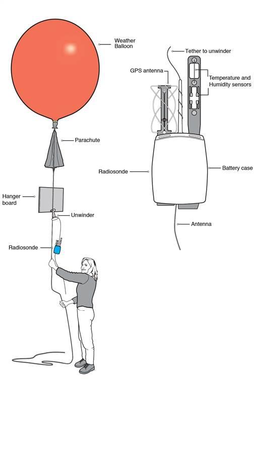
One tried-and-true method of gathering winds aloft data relies on instruments carried by surface-launched weather balloons, or radiosondes. Balloons are launched twice a day at some 92 sites across the continental United States, and another 1,400 or so around the world. They carry small instrument packages that transmit altitude, temperature, humidity, pressure, and GPS-derived wind information as they ascend.
Satellite observations can also yield wind speed and direction based on the movements of clouds. Other remote sensing methods include lidar (light detection and ranging), which sends laser pulses into the sky. The delay in the energy reflected back from clouds or particulates can be used to measure wind speed and direction. Lidar and other wind profilers are not in widespread use, but they have served the Midwest states plagued by severe thunderstorms.
Increasingly, airliners provide winds aloft information through the GPS-derived winds as determined by their flight management systems. This information is near-real time, as it is sent via datalink to ground stations. Airliners also provide winds aloft over the oceans, which aren’t covered by balloons or profilers.
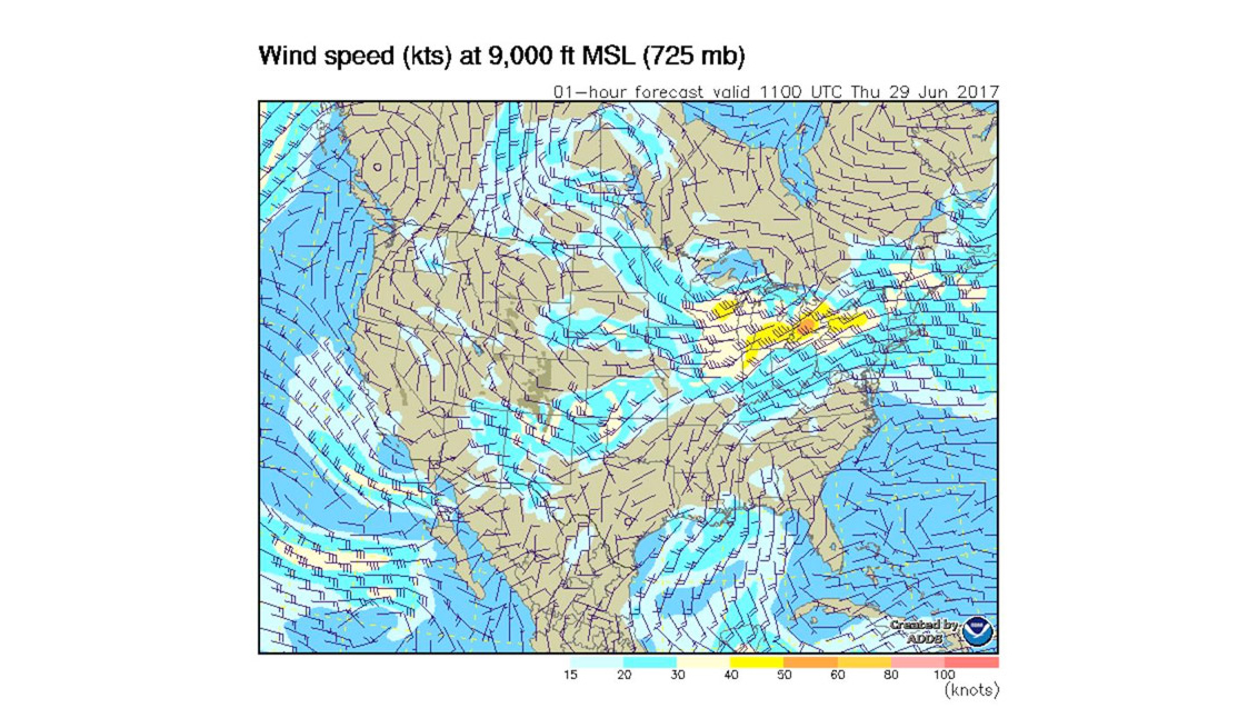
 But the standout heroes are the supercomputers used by the National Weather Service. They constantly crunch the wind observations and put out models of wind patterns. Some models do this every three hours, based on data assembled hourly.
Supercomputers factor in many important variables, including thermodynamic relationships within layers of the atmosphere; the wind patterns’ behaviors over the past few days; comparisons with past weather events having the same wind patterns; and the nature, movement, and extent of the very influential global upper-air winds.
Weather balloons are very old-school, but they can make more vertical samplings than any computer model. And many a meteorologist’s career began with a stint launching balloons. Also, many nations can’t afford high-tech wind sensing technology. So without balloons our knowledge of wind movements would be incomplete at best.


