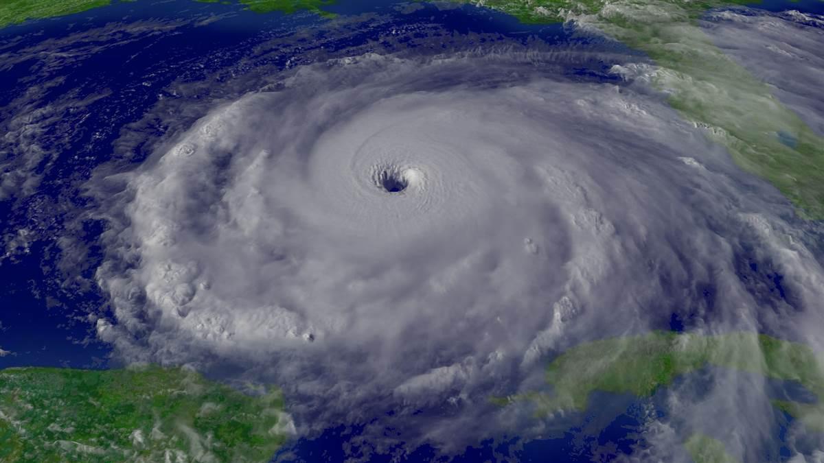
Weather: Eye of the storm
Hurricane hunters track valuable storm data

Hurricanes are tropical cyclones: storms that form over oceans with surface temperatures of 80 degrees Fahrenheit or higher, and which draw their energy from the warm water. A tropical cyclone consists of winds and bands of thunderstorms circling around and into an “eye,” an area of calm winds at the storm’s center. A tropical cyclone’s strongest winds are found in the eye wall, the band of thunderstorms surrounding an eye.
The air above a warm ocean is extremely humid. As it rises into a storm and cools, the humidity condenses, releasing heat. This added heat causes the air to rise faster. A tropical cyclone’s wind is air from around the storm flowing into it to replace the rising air. When a hurricane moves over cooler water or over land, it loses its supply of humid air and begins to weaken and die.
The word hurricane is used for tropical cyclones with sustained winds of 74 mph or faster that form over the Atlantic Ocean, Caribbean Sea, Gulf of Mexico, and the Pacific Ocean east of the international date line. Tropical cyclones west of the date line and north of the equator are called typhoons. South of the equator in the Pacific and in the northern and southern Indian oceans, they are called cyclones.
All of these storms begin as winds circling around a center with sustained winds slower than 39 mph. At this stage they are called tropical depressions. If the winds increase to 39 mph, the system becomes a tropical storm. If the sustained winds reach 74 mph, a tropical storm becomes a hurricane, typhoon, or cyclone. U.S. forecasters categorize hurricanes depending on wind speeds, with the strongest being Category 5—with winds of 155 mph or faster.
Hurricanes are large storms; even a small one will have winds of at least 39 mph covering an area with a diameter of 100 miles. When Hurricane Hugo hit South Carolina in 1989, it brought 74 mph or stronger winds to a 90-mile stretch of the coast. In addition to creating winds, hurricanes push ashore a dome of water called the storm surge that can be as much as 20 feet high.
While hurricanes directly threaten the U.S. Gulf of Mexico and Atlantic Ocean coasts, they can create windy, instrument-flight-rules weather far inland. Sometimes, such as with Hurricane Sandy in October 2012, a hurricane merges with an extratropical storm to create a “super storm,” with strong winds and extremely heavy rain over a very wide area.
Even if it does not merge with an extratropical storm after moving ashore, a hurricane or even a weaker tropical storm can bring widespread low clouds, gusty winds, tornadoes, heavy rain, and floods a few hundred miles from where the storm made landfall. If you’re planning to fly across Iowa and a hurricane has hit the Gulf of Mexico coast in the last two or three days, you should make sure its remnants aren’t headed your way. Fortunately, an ordinary preflight weather briefing will alert you to these dangers.

Flying low
WC–130s and WP–3s collect data on wind speeds and directions, air pressure, temperature, humidity, and more in all quadrants of a hurricane. Such data is especially useful in forecasting the speeds of winds in different parts of a storm when it hits land.

Flying high
NOAA's Gulfstream jet collects data on high-level winds and patterns of atmospheric pressure to help forecast windssteering a hurricane.
The AMS Weather Book, used by permission of the American Meteorological Society


