Experimental cross section weather product has new features
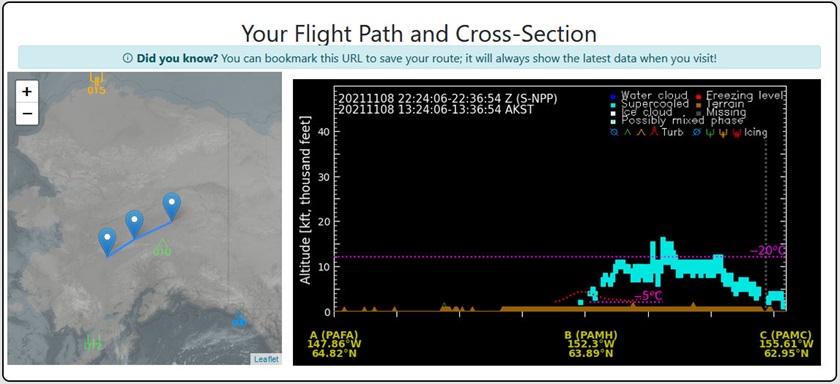
It is exciting to see new tools developed to help pilots predict the weather we plan to fly through. For the past couple of years, a team of atmospheric scientists at Colorado State University has been developing an online product that combines satellite cloud products with other data sources to create a cross-section along one’s route of flight to anticipate the presence of clouds—and more importantly, whether those clouds are expected to contain ice. Recently, the Cloud Vertical Cross-Section (CVC) got a new look and an important new feature—the ability to create a custom route.
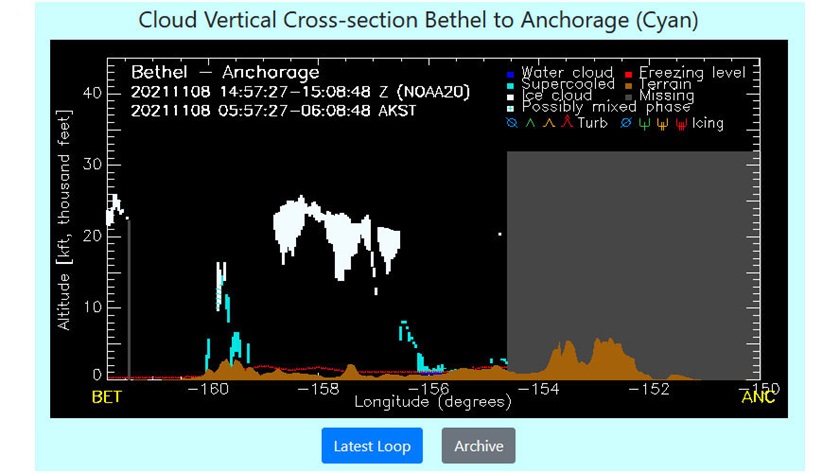
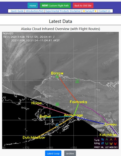 Image sensors on National Oceanic and Atmospheric Administration polar-orbiting Joint Polar Satellite System (JPSS) satellites are making it possible to create higher resolution products, especially in high-latitude places like Alaska. A NOAA-funded project at CSU’s Cooperative Institute for Research in the Atmosphere has integrated data from the JPSS satellites to create a very different kind of experimental aviation weather product. Instead of a 2D map showing the areal extent of weather (areas of VFR, MVFR, IFR for example), this product depicts a vertical cross-section along a flight route.
New feature
The first generation of the product was limited to fixed routes, such as Juneau to Anchorage. After receiving feedback from users, the development team has given the product a new look, and more importantly, has added the ability for users to create custom routes, defined either by typing in a list of airport codes, or by using a drag and drop method, if where you plan to fly doesn’t have an airport. It also allows the user to define a multi-leg route. If you haven’t yet tried this product, please give it a look.
I find it helpful, before looking at a cross-section, to click the “latest loop” button on the home page and step through the satellite passes that cover Alaska. This shows what areas have recent satellite coverage and is useful for watching cloud patterns to see which way weather systems are moving.
Limitations
Unlike geostationary satellites, which image an entire hemisphere at a time but don’t cover the high latitudes very well, the JPSS satellites orbit from pole to pole, imaging an 1,800-mile-wide swath of the Earth’s surface as they fly by about 500 miles overhead. Consequently, depending on the exact route you plan to fly, there may not be complete coverage during a specific orbit. Users may examine cross sections during several satellite passes, looping between them to look for trends. At times, you will find a portion of your prescribed route is not covered. In this case, light gray shading indicates that data is missing for that portion of the route. Clicking through the image slider will display past cross-sections, allowing users to watch how conditions are changing. The CVC is derived from complex satellite products. To understand the sources of information that go into making it, check out the reference documents, available from links at the top of the homepage.
User feedback needed
The development team has been very responsive to feedback and has adapted the product by adding graphic pilot reports, freezing levels, and other features along the route segments. After using the product for a while, please take the user survey (link at the top of the homepage) to describe how you use the product, what you like, and what you might like to see changed. This helps the science team understand what is needed to make this product more useful for flight planning proposes. Your feedback is a vital part of making this an operational product in the future.