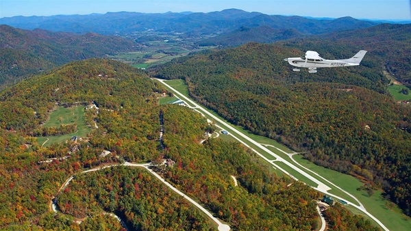
Pilots preparing for solar eclipse
Aviators from Portland, Oregon, to Charleston, South Carolina, are making plans to fly to airfields within the arc of a total solar eclipse Aug. 21 for a prime vantage point. The phenomenon sweeps across the United States for the first time in 100 years, and general aviation pilots are in a position to make maximum use of their mobility. Pilots can quickly fly to a more favorable location if the forecast calls for less than a perfect view.
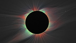
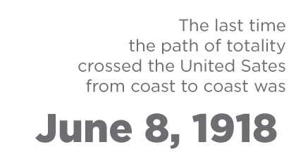
Astral aficionados in the Lower 48 will have about two and a half hours to view the spectacle occurring on such a large scale for the first time since World War I. The last such occurrence was June 18, 1918, when aviation was still in its infancy.
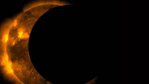
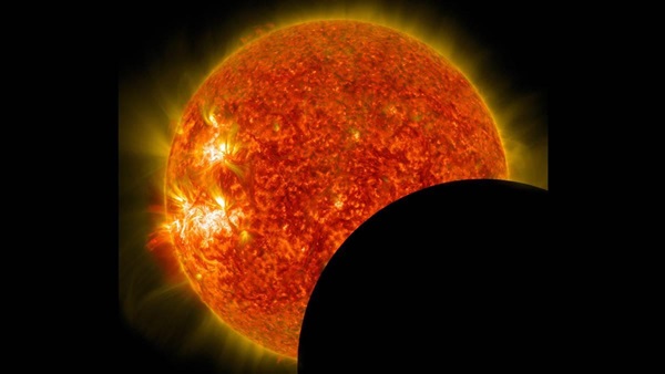
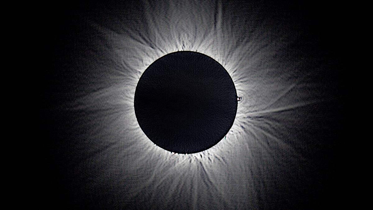
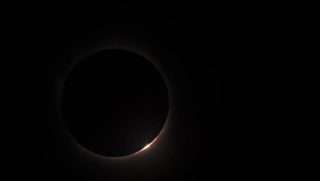
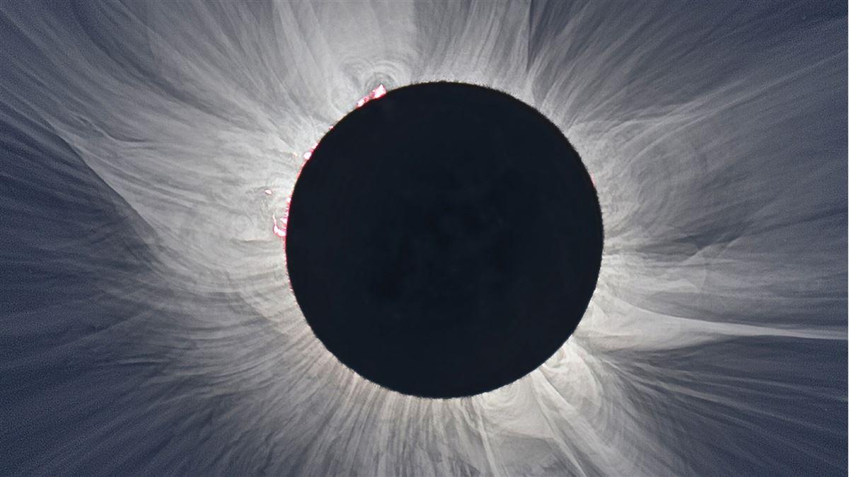
A NASA fact sheet explains that during a total solar eclipse the moon completely hides the sun in its umbral shadow because the moon is “close enough to Earth to completely cover the sun” and the sun's “faint corona is then safely revealed to the naked eye.”
AOPA has pointed out a few of the total solar eclipse’s hot spots—centers of viewing activity or areas where nature provides the perfect photographic backdrop—for the once-in-a-lifetime event.
Oregon’s Independence State Airport in Salem takes the honors as the first airport to witness the eclipse’s longest duration. Pacific Northwest aviation enthusiasts have several viewing options including an Eclipse Weekend at the Oregon State Capitol, an Eclipse Festival at Coria Estates, and the Oregon Museum of Science and Industry’s viewing party at the Oregon State Fairgrounds. At the other end of the country, the inviting turf field at South Carolina’s Triple Tree Airport in Woodruff has excellent camping facilities and is a likely gathering area for pilots based in the Southeast.
Other hot spots include Idaho Falls, Idaho, near the Sawtooths; Jackson, Wyoming, near the heart of the Teton Range; North Platte, Nebraska’s Sand Hills; St. Joseph, Missouri, which will experience some of the eclipse’s longest durations; Carbondale, Illinois, with five viewing party options; Nashville, Tennessee’s Music City Solar Eclipse; and the Eastern Seaboard just north of Charleston, South Carolina, where the solar event exits the mainland.
Airports along the path
The public and private airports listed below are intended to give pilots an idea of airfields along the route of the total solar eclipse. Pilots should perform due diligence beforehand to determine if their destination has adequate facilities or requires prior permission.
A single asterisk (*) indicates that a special activity is scheduled or the airport is in the longest-duration area or both.
Two asterisks (**) indicate airports that are within the longest duration of the eclipse.
Oregon (10:18 a.m PDT)
Salem/Independence State Airport*
First airport in U. S. near longest eclipse duration path. Eclipse Weekend at Oregon State Capitol, Solar Eclipse at Willamette Valley Vineyards, Solar Eclipse Festival at Coria Estates, OMSI Solar Eclipse Viewing Party
Salem/McNary Field Airport*
Second airport in U. S. near longest eclipse duration path [by only a couple of miles]. Eclipse Weekend at Oregon State Capitol, Solar Eclipse at Willamette Valley Vineyards, Solar Eclipse Festival at Coria Estates, OMSI Solar Eclipse Viewing Party
Madras/Madras Municipal Airport**
Oregon SolarFest, Solar Celebration 2017, possibly an excellent photo vantage point looking due west at Mt. Jefferson. In direct path of longest duration
Idaho (11:30 a.m. MDT)
Weiser/Weiser Municipal Airport*
Border with Oregon, first airport in Idaho for eclipse. Snake River adjacent to airfield. Dead Indian Ridge and Indian Head Mountain to west.
Lowman/Warm Springs Creek Airport
Unpaved. South Fork of the Payette River. Boise Mountains. 8,722’ Eightmile Mountain, Jackson Peak, Big Buck Mountain, base of the Sawtooth Range. [mountain country]
Stanley/Stanley Airport
Unpaved. Near Redfish Lake in Sawtooth Range
Smiley Creek/Smiley Creek Airport
Along the Salmon River, close to Sun Valley Ski Resort, near Redfish Lake
Mackay/Mackay Airport
Unattended, near Mackay Reservoir, White Knob Mountains, Blaze Canyon, Crows Nest Canyon
Arco/Arco-Butte County Airport*
Close to Craters of the Moon National Monument and Reserve, Pioneer Mountains
Howe/Howe Airport
Near Lost River Range, Taylor Canyon, Jump Off Canyon
Mud Lake/Mud Lake/West Jefferson County Airport
Near Mud Lake
Idaho Falls/Idaho Falls Regional Airport*
Museum of Idaho Eclipse Viewing Party, expecting 55,000 to 500,000 extra viewers in this area according to pilot Thomas "Tom" Hoff of Aero Mark Inc. Near Kettle Butte, Butterfly Butte
Rigby/Rigby Airport
Near Idaho Falls Reservoir
Rexburg/Rexburg-Madison County Airport
BYU Solar Eclipse 2017, White Owl Butte, Menan Buttes
Driggs/Driggs-Reed Memorial Airport
Last airport in Idaho, near Table Mountain, Grand Teton National Park
Wyoming (11:34 a.m. MDT)
Alpine/Alpine Airpark*
First airport eclipse touches in Wyoming. Scenic airstrip surrounded by mountains, Palisades Reservoir, Snake River, Teton Mountain National Park to the north.
Jackson/Jackson Hole Airport*
Teton Mountain National Park to the north just north. Great American Eclipse viewing point on Snake River, Wyoming Stargazing event in Jackson. Near Ansel Adams turnout along Snake River, w/notable view to Tetons.
Dubois/Dubois Municipal Airport*
Wind River Range to west, Wildlife Wonders Solar Eclipse Weekend
Riverton/Riverton Regional Airport*
Wind River eclipse viewing point. Several balloon pilots are organizing a Riverton flight during the eclipse.
Casper/Casper/Natrona County International Airport
Wyoming Eclipse Fest 2017
Casper/Harford Field Airport
Wyoming Eclipse Fest 2017
Glendo/Thomas Memorial Airport**
In direct path of longest duration and Solar Eclipse viewing point, along North Platte River, Glendo Reservoir adjacent, unpaved runway 4,600 feet
Nebraska (11:47 a.m. MDT)
Alliance/Alliance Municipal Airport*
Just north of longest duration, no mountain obstructions, glider port, Solar Eclipse Carhenge, Alliance Viewing Site
North Platte/North Platte Regional Airport Lee Bird Field*
Stapleton Total Eclipse event, Total Eclipse in the Sandhills event
Kearney/Kearney Regional Airport*
Kearney/Ravenna Eclipse 2017 events in two locations, one north in Ravenna, one south in Kearney
Grand Island/Central Nebraska Regional Airport
Gem over the Prairie event
Aurora/Aurora Municipal - Al Potter Field Airport
Gem over the Prairie event, Aurora Eclipse 2017 event
Fairmont/Fairmont State Airfield Airport**
In direct path of longest duration
Beatrice/Beatrice Municipal Airport
Beatrice Eclipse 2017 events, 3 locations
Pawnee City/Pawnee City Municipal Airport
Unpaved, Pawnee County Eclipse 2017 event
Falls City/Brenner Field Airport
Sac and Fox Indian Reservation, Iowa Indian Reservation
Kansas (1:04 p.m. CDT)
Hiawatha/Hiawatha Municipal Airport*
First airport in Kansas in eclipse path
Charles B Wheeler Downtown Airport
Barely catches southern edge of eclipse
Missouri (1:06 p.m. CDT)
St. Joseph/Rosecrans Memorial Airport*
First airport in Missouri in eclipse path, three Total Solar Eclipse events nearby, bend in the Missouri River at French Bottom. This area in Missouri along the Kansas border has some of the longest eclipse durations and the large field near the airport is a good viewing spot.
Event information is available online.
Mosby/Midwest National Air Center Airport*
Total Solar Eclipse 150 Years Festival
Excelsior Springs/Excelsior Springs Memorial Airport*
Total Solar Eclipse 150 Years Festival
Grain Valley/East Kansas City Airport
Carrollton/Carrollton Memorial Airport
Marshall/Marshall Memorial Municipal Airport
Boonville/Jesse Viertel Memorial Airport*
almost directly in path of longest duration
Columbia/Columbia Regional Airport*
Columbia Eclipse 2017 event
Jefferson City/Jefferson City Memorial Airport*
Missouri State Museum Eclipse event
Linn/State Technical College of Missouri Airport
College
St. Clair/St. Clair Regional Airport*
Two events nearby, Total Eclipse St. Clair, Union Total Solar Eclipse 2017 event, near Missouri River. Close to St. Louis.
Washington/Washington Regional Airport*
Along the Missouri River, two events, Great American Solar Eclipse, Total Eclipse in the Park at Labadie Bottom along river. Close to St. Louis
Festus, Herculaneum/Festus Memorial Airport*
Herculaneum Eclipse event, Festus Eclipse event. South of St. Louis, along the Mississippi River
Perryville, Missouri/Perryville Regional Airport**
In direct path of solar eclipse longest duration. Perryville SolarFest event, Mississippi River nearby, Illinois across river. Eclipse Festival in Makanda, Illinois, four public viewing events.
Illinois (1:18 p.m. CDT)
Columbia/Sackman Field Airport
One of the first Illinois spots along the eclipse path. See the Great American Total Solar Eclipse event.
Cahokia, St. Louis/St. Louis Downtown Airport*
One of the first Illinois spots along the eclipse path. See the Great American Total Solar Eclipse event.
Carbondale/Murphysboro/Southern Illinois Airport*
Southern Illinois University public event, Eclipse Music Festival “Moonstock” event, Eclipse Festival in Makanda, eclipse event in Panther Den National Forest, Alto Pass public event, Crab Orchard National Wildlife Refuge event
Marion/Williamson County Regional Airport
Eclipse Music Festival “Moonstock” event
Metropolis/Metropolis Municipal Airport
Along the Ohio River
Kentucky (1:22 p.m. CDT)
Gilbertsville/Kentucky Dam State Park Airport*
First airport in Kentucky to experience solar eclipse. On Cumberland River, state park. Kentucky Lake, Lake Barkley
PrincetonPrinceton-Caldwell County Airport
SolQuest 2017 event
Hopkinsville/Hopkinsville Christian County Airport*
Almost dead center on longest duration, four Solar Eclipse Hopkinsville events nearby
Elkton/Standard Field Airport
Tennessee (1:25 p.m. CDT)
Clarksville/Outlaw Field Airport*
First airport in Tennessee to be touched by eclipse, two Solar Eclipse Experience viewing parties
Nashville/John C. Tune Airport*
Cumberland River, J. Percy Priest Reservoir, Music City Solar Eclipse
Gallatin/Sumner County Regional Airport*
Almost dead center on longest duration and north of Nashville, Music City Solar Eclipse, The Eclipse Experience solar eclipse event, Gallatin, TN, Eclipse Encounter near the Cumberland River
Lebanon/Lebanon Municipal Airport
Smithville/Smithville Municipal Airport*
Adjacent to Center Hill Lake, Tennessee’s Appalachian Mountains
Sparta/Upper Cumberland Regional Airport*
Adjacent to Center Hill Lake, Tennessee’s Appalachian Mountains
Sweetwater/West Wind Airpark Airport**
Unpaved, center of area of longest duration
Madisonville/Monroe County Airport
Athens/McMinn County Airport*
Home of the Swift Museum
North Carolina (2:34p.m. EDT)
Andrews/Western Carolina Regional Airport*
Public Eclipse Festival, very close to center of longest duration, Appalachian Mountains, Nantahala Mountains
Georgia (2:34 p.m. EDT)
Blairsville/Blairsville Airport
High mountain airport, close to Brasstown Bald. Georgia only gets a tiny piece of the eclipse.
Clayton/Heaven’s Landing Airport
One of the highest airfields in Georgia, adjacent to the Tallulah River, nestled among the southern Appalachian Mountains
South Carolina (2:36p.m. EDT)
Eclipse touches this South Carolina airfield first
Anderson/Anderson Regional Airport
Scenic airfield along Lake Hartwell divides South Carolina and Georgia
Greenville/Greenville Downtown Airport
Solar Eclipse Central 2017 Upstate SC event
Greenwood/Greenwood County Airport
Near Lake Greenwood
Woodruff/Triple Tree Airport*
Private airfield with a turf strip and camping facilities that hosts an annual radio controlled aircraft event and several local fly-ins.
Visit the website for information about the Eclipse Fly-In event at Triple Tree Aerodrome.
Columbia/White Plains Airport*
Private, close to the Grape Experience
Columbia/Columbia Metropolitan Airport*
Sunblock Total Eclipse Viewing Party, Farm to Table event. Close to the Grape Experience, Lake Murray
Columbia/Jim Hamilton L B Owens Airport*
Sunblock Total Eclipse Viewing Party, Farm to Table event. Close to Columbia Metropolitan Airport CAE. Shadows and Science in the Wilderness of Congaree National Park.
Pelion/Lexington County at Pelion Airport
Orangeburg/Orangeburg Municipal Airport
Manning/Santee Cooper Regional Airport
Lake Marion
Moncks Corner/Berkeley County Airport
Mt. Pleasant/Mt. Pleasant Regional-Faison Field Airport*
Last airport on Eastern seaboard, at 2:46 p.m. EDT
Destinations

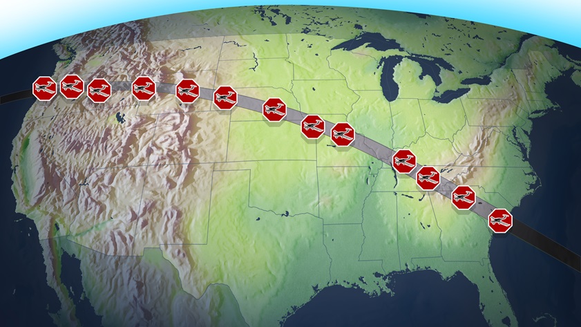
Weather watchers are combing meteorological charts to determine the best locations to view the event. Several general aviation airports along the 70-mile-wide cross-country swath of totality have established arrival procedures to help combat the expected crowds; motels have been booked for months; and transportation department officials are predicting an “onslaught” of motorists seeking vantage points.
FAA Deputy Regional Administrator for the Central Region John Speckin is reminding pilots to maintain vigilance for increased air traffic, check notams before departure, and carry the current U.S. chart supplements. He said some airports might already be at capacity while others plan to park aircraft on secondary runways. Speckin also suggests pilots call the destination airport ahead of time for specifics; use air traffic services when available; file VFR flight plans; use IFR operations when appropriate; and in general, “let air traffic control assist you.”
Depending on sky conditions, pilots should be in the best position to move around the country because most of the United States will experience at least a partial solar eclipse. Pilots worried about violating any of the federal aviation regulations when the sun’s illumination briefly disappears should not fear. Flying in the daytime darkness does not qualify as night flying, according to AOPA Pilot Information Center specialist Paul Feldmeyer.
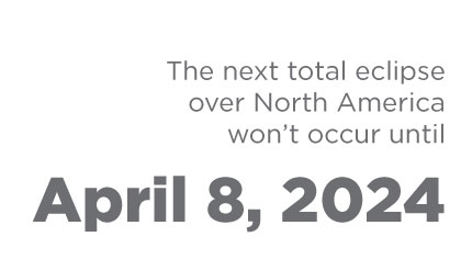
The event begins when the moon slides in front of the sun at 10:16 a.m. Pacific Daylight Time near Oregon’s Siletz Bay State Airport. Three time zones later, the Great American Eclipse exits the country at 2:48 p.m. Eastern Daylight Time near South Carolina’s Mt. Pleasant Regional-Faison Field Airport, throwing parts of 14 states into total daytime darkness along the way. Approximately 12 million people live along the band of totality, and some 25 million reside within a day’s drive. The entire event lasts one hour, 33 minutes.
Pilots ready for solar eclipse
Pilots planning to view the Aug. 21 total solar eclipse as it tracks across the country from Oregon to South Carolina are in the final stages of gearing up for the celestial phenomenon. For aviators without a plan—or an airplane—there is still hope. Read article.
The Great American Eclipse
On Aug. 21, a total solar eclipse will sweep across the continental United States for the first time since 1918. Astronomers are calling it the Great American Eclipse. Beginning at 10:15 a.m. Pacific Daylight Time on the Oregon coast and heading east like an accelerated sunset-in-reverse, what’s known as the path of totality will cut a 60-mile-wide arc across Idaho, Wyoming, Nebraska, Missouri, and Tennessee before crossing the South Carolina coast an hour and a half later. Read article.

After the checkride: take in the solar eclipse
On August 21, the United States will be treated to a total solar eclipse, and pilots are uniquely positioned to get the best views of this event—because we can fly to where there’s no cloud cover. Read article.
Solar eclipse on FAA's ATC calendar
Countless celebrations, observations, and education-based activities are planned for the total solar eclipse that will sweep northwest to southeast across North America on Aug. 21. Read article.
Wyoming balloonists going up for solar eclipse
Aviation enthusiasts in the Mountain West who are up for a unique solar eclipse experience might consider viewing the Aug. 21 spectacle from Riverton, Wyoming. Balloonist Patricia Newlin is helping organize a weekend of hot air balloon rides among the scenic Wind River Range in the days leading up to the once-in-a-lifetime event. Read Article.