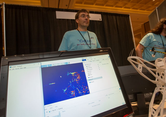
A blue square dotted with clusters of red and orange pixels doesn’t look very impressive as video images go, but it could prove to be a key to integrating unmanned and manned aircraft at close quarters and low altitudes.
The system, now being developed by Qelzal (with help from a grant from the Defense Advanced Projects Research Agency), may give even small unmanned aircraft of the not-too-distant future the capability to detect other moving objects in the environment, and avoid those objects without human intervention.
“That’s the goal,” said Qelzal CEO Olivier Coenen, who brought a background in physics and neuroscience to the task of detect-and-avoid, considered by many (AOPA included) to be among the prerequisites to the safe integration of drones in the National Airspace System.
Coenen envisions Quelsafe as a “last resort technology,” part of a multisystem approach that would keep all aircraft separated in much the same way they are today, with a layers of air traffic control, radar, and satellite-based surveillance, airspace classification, and regulations.
If those fail and a drone is converging with disaster, the on-board cameras and related systems will take over and take action.
“It’s basically like having the pilot’s eyes on board a drone,” Coenen said. “This technology is really close to how our eyes see.”
Coenen explained that human vision is well-suited to detecting movement, and the brain processes those cues before a detailed image is built and interpreted. By stripping away thousands of bits of visual information and rendering objects only in the roughest outlines, the “novel visual sensors” as the Qelzal detection devices are called (they look an awful lot like cameras) can capture enough data to detect a moving aircraft yet remain compact and lightweight enough for a small drone to carry along with other payload. Along with the reduced power demand, and a fast response rate, this overcomes the problems posed by on-board radar and similar systems that are heavy, bulky, and impractical for unmanned aircraft that weigh just a few pounds.
A hand waved slowly in front of the sensors produced a very grainy image indeed, a few hundred pixels, perhaps, though Coenen said that’s plenty to get the job done. What’s more, this new approach performs well when transitioning rapidly between areas of light and dark, and is not susceptible to the temporary blinding effect of emerging from a dark tunnel into bright sunlight, for example, as traditional cameras (and human eyes) are.
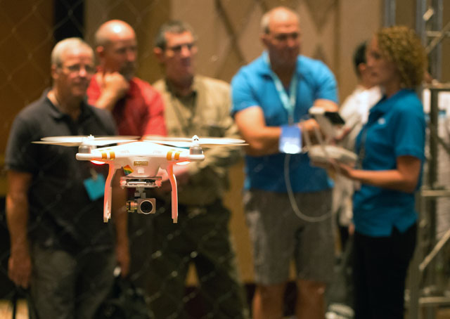
Coenen was not alone exhibiting safety systems at the International Drone Conference and Exposition in Las Vegas, a three-day event which launched Sept. 9 with 3D Robotics CEO Chris Anderson predicting a dramatic expansion in the capabilities and numbers of drones in future years, comparing the dawn of drones to the dawn of the Internet in terms of how these technologies will reshape the world and our perception of it.
Realizing this vision will require effective traffic separation. Qelzal’s approach is distinct from other early efforts in unmanned traffic management and collision avoidance on display at the Las Vegas convention, in that it uses on-board systems. For now, the more readily available approach is to leverage the communication capabilities of cell phone networks and the Internet, giving drone operators access to existing air traffic control systems in real time or near it. In some future cases, a drone invading restricted airspace may be flown out of harm’s way by ATC personnel before the drone operator reacts.
Situational awareness tools
Retired U.S. Air Force pilot and Botlink CEO Shawn Muehler said his company’s software for mobile devices links through cellular networks to air traffic control systems, displaying for drone pilots a detailed map of their surroundings with air traffic displayed on the map, along with the drone’s position. The drone operator is warned of potential conflicts, and other potential hazards including weather. Botlink draws position data from radar and Automatic Dependent Surveillance-Broadcast returns to create a map on the operator’s mobile device that also delineates airspace restrictions. It is in essence a more robust version of the FAA-developed B4UFLY app that is now in beta testing, which does not display air traffic.
It will most likely take at least a few more years before technology allows drones to fulfill Amazon’s fantasy of operating beyond the operator’s sight, as package delivery on a mass scale would require. Operating beyond visual line of sight is also a long-term goal of a collaboration of federal agencies including NASA, which is among the research leaders and details online the expected progression of the Unmanned Aerial System Traffic Management (UTM) program. Drones allowed to fly out of sight may well be controlled through cellular networks, given the limits on the range of radio frequencies used for primary control and the widespread coverage achieved by network providers to date.
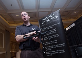
Poised for that future, and helping to define it, Nevada Dynamics was launched by University of Nevada students who shared with others a vision of future drones all connecting to the Internet on the fly, vastly extending the range at which they can be controlled and allowing operators and onboard systems to access the same air traffic information sources tapped by Botlink. Operators can respond to changing conditions and move the drone out of harm’s way from a distant ground station, controlling the drone through through a cell phone attached to the drone running what amounts to a drone control app. CEO MacCallister Higgins said his company is developing a lightweight cellular network connection device that can handle the same task with less weight and power demand, and be built into future drones; the software written to date is compatible with nearly all of the major drone brands. Nevada Dynamics is collaborating with NASA and others in the effort to reduce “the level of human interaction required” to fly safely, Higgins said. Algorithms written into the code respond automatically to the introduction of flight restrictions, for example. Drones with that kind of equipment would eliminate the problem now faced by firefighters in California, where an explosion in drone use has directly interfered with efforts to fight wildfires during the worst fire season on record.
Uncertain timeline
While NASA, university labs, the FAA, and other federal agencies collaborate on the development of technological solutions, none of them apply to the nearly 700,000 drones that have been or will be sold in the United States alone during 2015, according to Consumer Electronics Association estimates. The drone market is estimated to generate $105 million in revenue for 2015, CEA reported in July, a 52-percent increase over 2014 revenue; unit sales are expected to increase 63 percent at the same time. InterDrone, as the conference organizers referred to the Las Vegas event in shorthand, drew more than 3,000 participants, and 100 exhibitors offering a range of products and seminars. In one of those, Dallas Brooks, director of UAS research and development at New Mexico State University, and among the leaders of a national, multi-agency collaboration to solve the problems associated with drone integration, said a variety of strategies and approaches have been, are being, or will be tested, and there remain several crucial questions to answer about the acceptable levels of risk involved with particular drones and particular missions.
As for how long that will all take to sort out and pave the way for integrated airspace, “It really depends on how you define what truly integrated means,” Brooks said, explaining that standards will be higher for aircraft operating above 400 feet than below, and a great deal more research and investment will be required to create solutions to the many problems posed by mixing manned and unmanned aircraft.
Along with proven and certifiable technology, the FAA will also need to make changes to Part 91, allowing an alternate method of complying with the see-and-avoid requirement under visual flight rules. Once the scientists and engineers are far enough along, the regulators and advocates will still have work to do.
“That kind of language being adopted," Brooks said, "I’m going to say that’s between two-and-a-half and three-and-a-half years away.”
Based on the latest estimates, nearly four or more drones have been sold in the United States to date (in the under-55-pound weight class) for every single (active) general aviation aircraft, and those drone sales continue to ramp up. The FAA has issued more than 1,500 exemptions allowing commercial use of drones beyond the limits currently set for model aircraft flown by hobbyists. Many of those commercial operators have come from the manned aviation world, and many share a sense of urgency to ramp up safety education and training before disaster strikes.
Jeremy Barber, who founded Aerius Flight LLC, a firm specializing in drone photography and videography, is also an airline transport pilot with airline experience, and gave one of several safety-related presentations at the conference, focused on adapting checklists, manuals, and safety management systems from the manned aviation world for drone use. Barber said there is an urgent need to promote an industrywide safety culture.
“The minute that there is a serious accident, a collision with an airplane, then everything changes,” Barber told the audience. “Then it will take a long time to get back to where we are.”