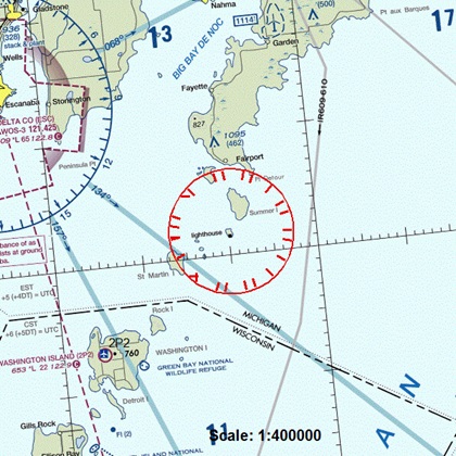
Training Tip: Tracking down TFRs
 Part of the process of keeping that aerial operation safe was for the FAA to order a temporary flight restriction—a TFR— from the surface to 3,000 feet mean sea level, effective over a period of 23 days, as the notam about the operation recently appeared on the FAA’s online list of TFRs.
That list, which a pilot can sort by a range of parameters including state, facility, TFR type, notam number, or TFR description, is a must-see item for pilots planning local and cross-country flights, and a must for updates on a TFR’s dimensions or effective times before a flight gets under way.
From firefighting operations and airshows to flight hazards and areas of security concern on the ground, TFRs are put into effect for a wide variety of reasons, and in places as diversely distributed as remote islands and the largest of major metropolitan areas.
One unfamiliar item for many student pilots inspecting TFR listings is the three-letter facility identifier that appears after the date and notam number of the TFRs on the FAA’s list. For example, the notam for the firefighting TFR on Lake Michigan refers to “FDC 6/6857 ZMP MI.”
The identifier ZMP refers to the Minneapolis Air Route Traffic Control Center (ARTCC), which is the FAA’s coordination facility for the operation, as explained in the notam text.
Do you know the identifier for the ARTCC in the area where you fly? You can locate it in flight information publications, request it from flight service during your next preflight briefing, or find it using this search tool and a search term such as “artcc.”

