The right tool for the job...
... is not always a drone
Drones are capable, fun, and can fly many places where manned aircraft can’t. The reverse is also true, so here’s a case for manned and unmanned aviators working together.

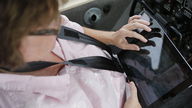
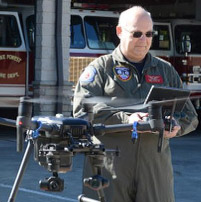
As a fire department drone pilot, I have access to some pretty capable equipment, drones in a range of sizes and sensor capabilities. Recently, I was working with a law enforcement agency and a K-9 team to locate a person of interest using the drone. The low-flying UAS with the thermal and zoom cameras onboard allowed me to follow the trackers, work with the ground team, and send pictures back of the located target.
I fly drones for the Wake Forest Fire Department here in North Carolina, and I also volunteer to fly manned missions for a conservation-focused nonprofit called SouthWings, which gathers aerial image data to monitor pollution including illegal discharges into rivers, and educate the public and policymakers by giving them a perspective on the world as it is, viewed from above.
Emily Sutton is a riverkeeper who is responsible for keeping an eye on particular waterways. I’ve flown with her a couple of times, giving her a chance to observe farms with a particular eye on animal waste and other agricultural waste discharges that can threaten water quality. Coal ash repositories are another potential pollution source on our target list.
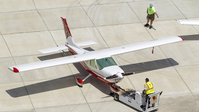
I've learned a lot by being her volunteer pilot and seeing responsible farming operations from an entirely new point of view. Most farms we fly over operate responsibly. During my most recent flight, I pondered the utility of unmanned aircraft for this kind of mission, covering a broad area in a short period of time. A Cessna is not known for being a speedy airplane, but we covered 14 widely scattered areas of interest spread over hundreds of square miles in less than two hours.
Try doing that with a drone.
Even if you enjoy spending days in the car, crisscrossing the countryside in search of pollution sources and environmental offenders, consider this: I have found, over the course of five years of flying unmanned aircraft, that people can get a bit tense when you fly a drone over their property. This tension can lead to an unpleasant confrontation.
When I first started flying drones in 2014, I was doing real estate photography. Tense neighbors have threatened to shoot me, sue me, or have me arrested if I continued my flight. It made for some exciting moments. I can't imagine a farmer who is not following the waste management rules today would react kindly to a drone flying over the farm.
Let's put the legal issues of flight over private property aside for the moment. Imagine you have a massive farm operation to film, but you have not been invited by the property owner. How would you establish a safe and legal landing zone, reduce potential confrontation, and maintain line-of-sight of the aircraft flying an operations area that might span hundreds of acres?
During our flight, I asked Sutton how gathering her data with a drone would change things. She made a great observation: "The drone would not give me the context of the area that I get from looking out the airplane window."
She is correct. From the airplane, a couple of thousand feet up it is like looking through a wide-angle lens that you can zoom in with. The view from a drone at 400 feet also tends to be on the wide side, but you may not realize how much of the “big picture” you’re missing at that altitude. The sudden influx of newly minted remote pilots, many with zero aviation experience before drones, has created an entire class of aviators that have not had the opportunity to view the world from an airplane flying low and slow.
That's something I would love to see change. It would be great for local airplane pilots to take drone pilots up on a short orientation flight. Drone pilots can repay the favor by introducing the airplane pilot to the potential and utility of drones. In my experience, manned aircraft owners are willing, even eager, to take people up for a good cause. Just look at all the public benefit flying that airplane pilots do flying sick people for medical care, animal rescue flights, or flying for groups like SouthWings.
Aerial photography has been around for decades. As drones came on the scene, some of the traditional operators got as tense as a rule-breaking farmer with a giant pool of animal waste leaking into the river next to his property, while others embraced the technology and incorporated this new tool into their kit. (The same goes for helicopter operators hired by utility companies to inspect power lines, in some cases.)
We all have the tendency to see nails everywhere when there’s a hammer handy. There are plenty of photo missions that a drone excels at. Just recently, I read about a group of volunteer drone pilots who are working with a nonprofit group to create videos for hospice patients. That's not a mission I can accomplish from the airplane.
By learning what the best platform for the mission is and working together, we can do great things in the air.
Steve Rhode
Related Articles