Super Cub Sweepstakes: High and Low
Fundamentals of mountain canyon flying
Flying the Idaho wilderness
Don’t mistake efficiency for ease. The rugged mountains create their own weather, which can change quickly. Wilderness strips vary in size and elevation. Some have one way in and one way out; some can only be accessed by aircraft with short takeoff and landing (STOL) capabilities, while others can accommodate many types of general aviation aircraft. Then there are the nonstandard traffic patterns in deep canyons, winding approaches, warm temperatures, high density altitudes, sloping runways, and changing winds, to name a few variables.
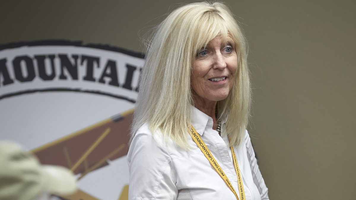
A love of fishing lured Lori MacNichol to the Idaho wilderness nearly 40 years ago. The California native talked her private pilot flight instructor into doing their cross-country training on a flight from Redding, California, to the small town of McCall, Idaho, in the early 1980s. After returning from that flight, MacNichol packed up and moved to McCall, completed her private pilot certificate there, and made a career out of flying in the mountains. The 12,500-hour airline transport pilot has spent 80 percent of her flight time in off-pavement operations in Idaho. She co-founded McCall Mountain Canyon Flying Seminars in 1996 with the late I.E. “Lyn” Clark to train pilots how to operate in the challenging environment so they too can live out their wildest adventures safely.
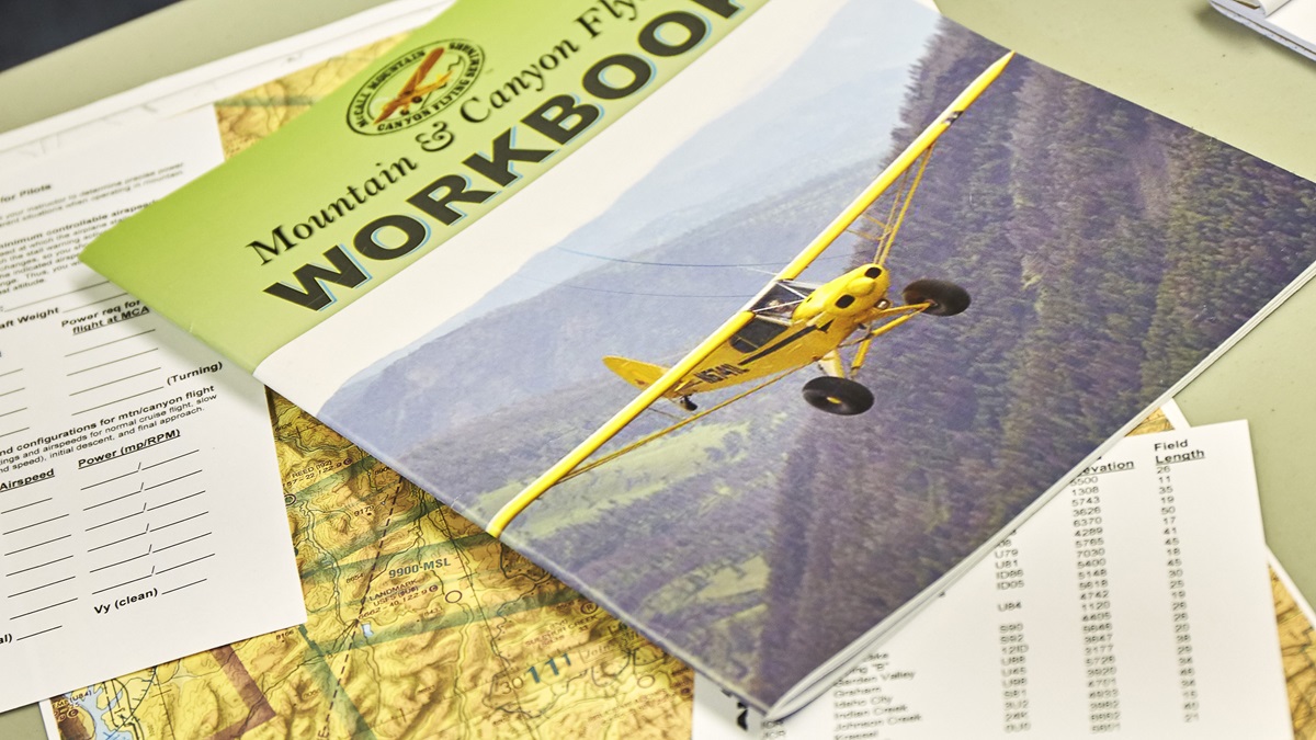
MacNichol’s mountain canyon training follows a structured, building-block approach. Through two- and four-day courses, pilots receive four to 12 hours of flight training, in addition to extensive ground school. MacNichol prefers to conduct training in the pilot’s own aircraft, and she recommends participants have at least 50 hours of flight time in their aircraft. Much of the early training for takeoffs and landings is completed at backcountry strips outside the wilderness, but the course includes training at public-use wilderness strips inside the protected areas. The two-day course equips pilots with the fundamental tools for flying in the mountain canyon environment—and a confidence boost, as I discovered during a modified version of the class in the AOPA Sweepstakes Super Cub.

Emergency canyon turn
The emergency canyon turn is “a good platform to help the pilot operate below the rim,” explains Lori MacNichol, who learned the turn from a mentor and has worked with the FAA to document the maneuver. It’s not a chandelle—a tight, full-power climbing turn that instructors teach to escape box canyons during the commercial pilot training curriculum. The maneuver is quick but graceful, imposes low G loads, and results in little loss of altitude.
To begin the turn, add just enough power to accelerate the aircraft from canyon speed yet stay within the white arc. Immediately roll into a steep turn between 30 and 60 degrees of bank toward the middle of the canyon, add full flaps, and lower the nose slightly to prevent stalling the airplane. Halfway around the turn, retract to half flaps, or the best lift-over-drag setting. Then begin the rollout, reduce power, and return to cruising altitude. The maneuver pulls about 1.2 Gs, according to MacNichol. It seems as if it’s completed in about as many seconds, even though it takes a few more.—AJC
Resources for flying in Idaho
Lori MacNichol encourages pilots who come to McCall Mountain Canyon Flying Seminars or who plan to fly in Idaho to get three resources:
- Fly Idaho! book
- Idaho Airports free app or the Idaho Airport Facility Directory
- Idaho Aeronautical Chart provided by the Idaho Aviation Association
Illustration by Steve Karp
Canyon speed/configuration
Stalls and slow flight—yes, there’s a practical purpose for these maneuvers beyond preparing for a checkride. Even though pilots don’t operate in canyons just above stall speed, flying in slow flight with the stall horn on (or near the buffet if the aircraft doesn’t have a stall indicator) and stalling the airplane in different configurations allows pilots to become intimately familiar with how their aircraft performs before flying in this challenging environment. Developing the feel for the aircraft is essential because more attention is focused on the terrain and flight conditions that can change quickly.
The power and flap settings that provide the greatest spread between stall warning activation and the stall are particularly important to note because those performance figures will be used to help determine what is called canyon speed and configuration. When flying in canyons, it’s important to slow down and operate in canyon speed/configuration. This decreases the turn radius. It also allows pilots to make shallower banks to prevent overstressing or stalling the airplane, and combats the disorientation that could result from not being able to see the horizon.
The school takes a methodical approach to determining the figures, using a “speed card” to note the speeds and altitude at which various maneuvers were performed along with the aircraft’s weight. (MacNichol recommends doing a new performance card each time the aircraft’s weight and center of gravity change to get a range of its indicated stall speeds in different loading configurations.) All of these variables factor in when trying to operate at short strips at high elevations in the mountains on hot days.
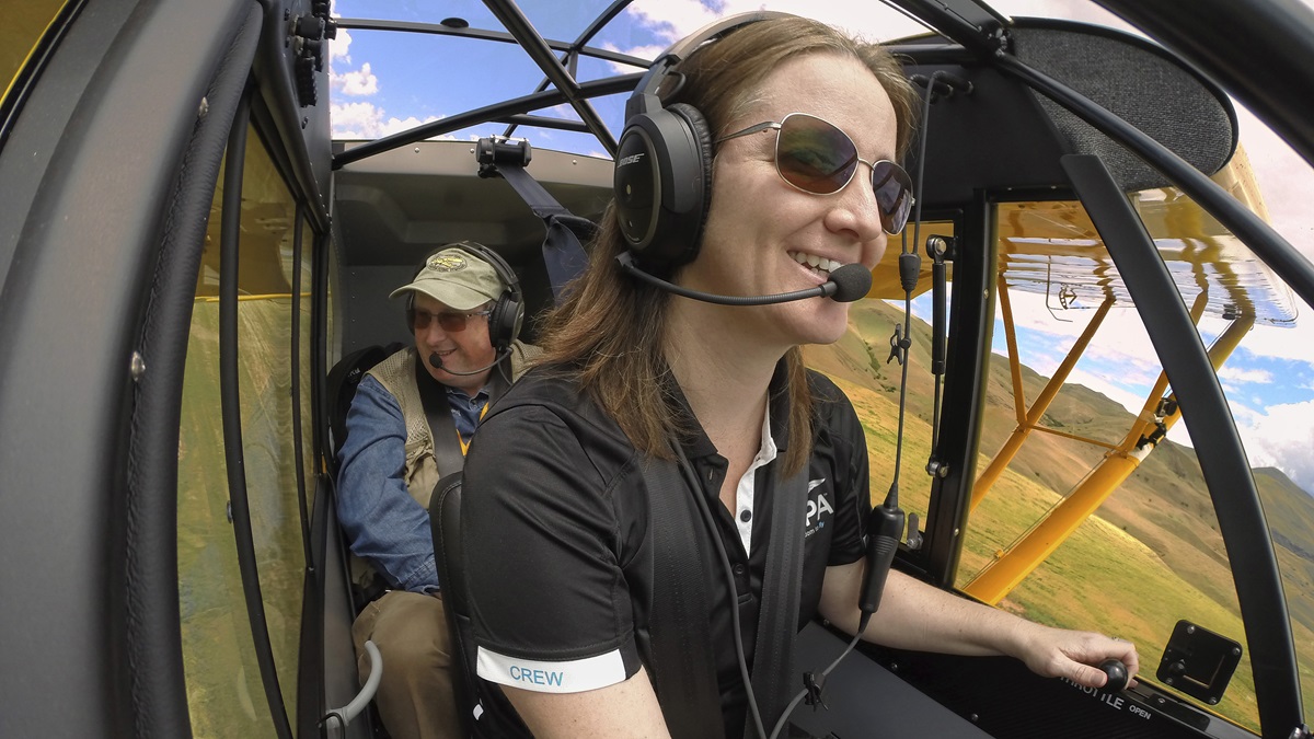
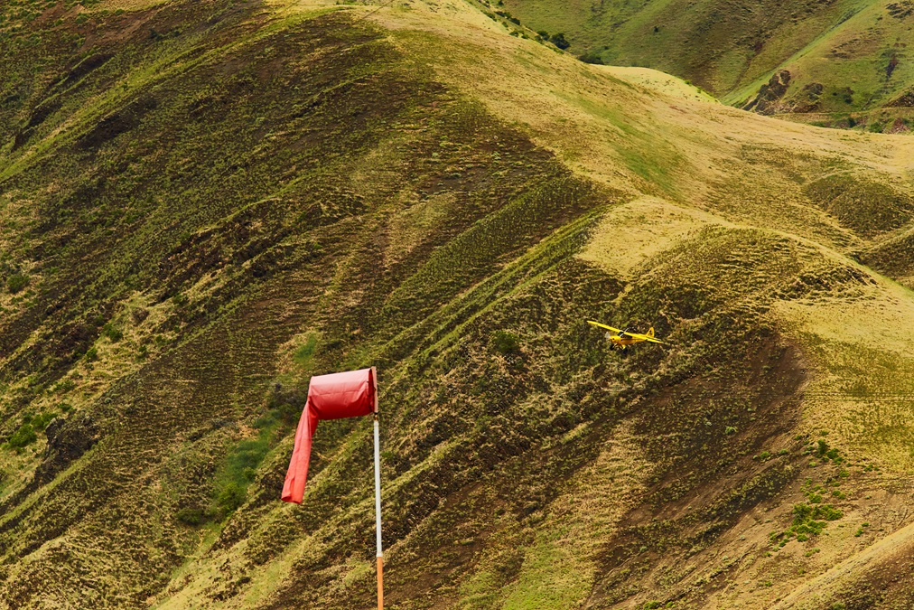
McCall Mountain Canyon Flying Seminars instructor Gary Glodowski records the airspeed and power settings I read off to him as I run the 1954 Super Cub through a series of straight-ahead and turning stalls at 5,700 feet msl over a valley. The checklist approach makes me feel like a test pilot analyzing a new airplane’s performance envelope. The greatest speed spread between the first indication of a stall and stall is 5 mph at 1,780 rpm with 10 degrees of flaps. Twenty degrees of flaps produces a 4-mph difference, so we can safely use either flap setting to fly in canyon configuration. Canyon configuration is the safe, slow speed used when operating below the rim in confined areas so you can turn around to escape terrain if needed. It’s also used to observe airstrips from overhead, noting gradient, egress and ingress options, abort point, runway condition (mud, grass, gravel), windsock indications, and wildlife. The downwind leg of the pattern to a strip should be flown in canyon configuration as well.
The National Wilderness Preservation System contains “over 109 million acres” and “more than 760 wilderness areas administered for the American people by the federal government,” according to the U.S. Forest Service.We check cruise performance and descents at various power settings, noting the flap configuration, vertical speed, airspeed, and power setting for each combination. This enables us to determine canyon operating speed and the initial descent, base, and final approach speeds—all of which help the pilot operate below the rim and at short strips without destabilizing or overstressing the airplane. Flying straight and level at 65 mph with 10 degrees of flaps and 58 mph with 20 degrees (both at 2,100 rpm) provides a healthy margin above stall, allows the Super Cub to be trimmed out and maneuvered easily while attention is divided, and provides a small turn radius to reverse course in a canyon. That’s my canyon operating speed and configuration for the way the Super Cub is loaded on this day.
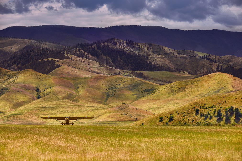
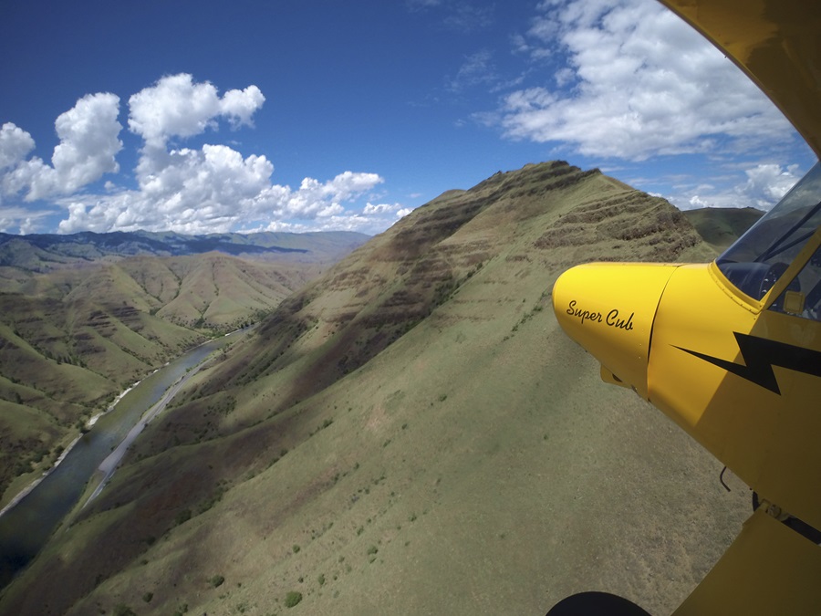
Knowing the numbers is the first step. Now it’s time to put them to use. Idaho’s mountains have steep, narrow V- and U-shaped canyons, MacNichol explains to her ground school class. Hells Canyon, which runs along the Oregon-Idaho border just north of McCall, is the deepest river gorge in North America, according to the U.S. Forest Service, and it drops 8,000 feet below Idaho’s He Devil Peak. When flying in the canyons, it is critical to be able to reverse course in case you inadvertently fly up a box canyon, can’t outclimb terrain, or decide to turn around for any reason. Because of this, flying on the far right side of the canyon, near the mountain, in canyon configuration is important to give you the most space available to turn around.
The Super Cub has a remarkably small turn radius at cruise, but it really shines as we slow to canyon speed/configuration and turn, setting us up nicely to practice the emergency canyon turn.
Ridge crossing
Glodowski coaxes me closer and closer to the side of the mountain, following its contours. It feels as if I’m just a couple of wingspans away as I near the ridge I’ll cross. On our first pass, we approach the ridge at a 45-degree angle and note terrain on the other side. We are close enough to get a sense of wind differences, but today winds are calm. We also note any lone trees protruding from the ridge that could grab the tires of the Super Cub. After an initial pass, I turn away from the ridge wall with enough space to execute a normal turn, and circle back to approach again. This time, we cross the ridge, again at a 45-degree angle so that we always have a safe option to abort the crossing. Mountain canyon flying is all about having a safe out.
After crossing a few ridges of pine-covered mountains at 5,500 and 6,000 feet msl, we set off in search of higher-elevation, jagged, snow-covered peaks. The Garmin aera 660’s aural alert “Caution: Terrain, pull up!” has been manually silenced—with this kind of flying, the friendly alert would become a constant nag. Crossing ridges around the highest peaks in the 7,000-foot range, my confidence builds and the overwhelming sense of vulnerability fades; what had seemed to be angry monoliths ready to pounce on the Super Cub transform into magnificent creations.
Approach, aim point, and airspeed
The lengths of backcountry and wilderness strips vary, but many of the public-use strips managed by the state, U.S. Forest Service, and Bureau of Land Management have markings to break the runway into thirds, and fourths when they are really short. The goal is to always land in the first segment, MacNichol says.
She advocates steep, stabilized approaches using a 4- to 4.5-degree glidepath because obstructions (Idaho’s 100-foot tree instead of the FAA’s 50-foot obstacle) might obscure the approach. It also provides better visibility, increases pilots’ chances of making the airfield in the event of an engine out, and provides more power to counter downdrafts on approach. There’s little to no margin for error on these remote, unimproved strips, so hitting the aiming point every time is important. Landings at these strips should always be made with full flaps, no exceptions: MacNichol says if the weather is so windy or turbulent that you want to land with partial flaps, “then don’t go there to start with.”
Airspeed control is critically important. Glodowski asks me for a speed check to make sure I’m on target on the approach. With the airspeed nailed, I control the steepness of my approach with power based on how the aim point looks outside the windscreen. To steepen the approach, reduce power; to shallow it, add power.
Pulling it all together
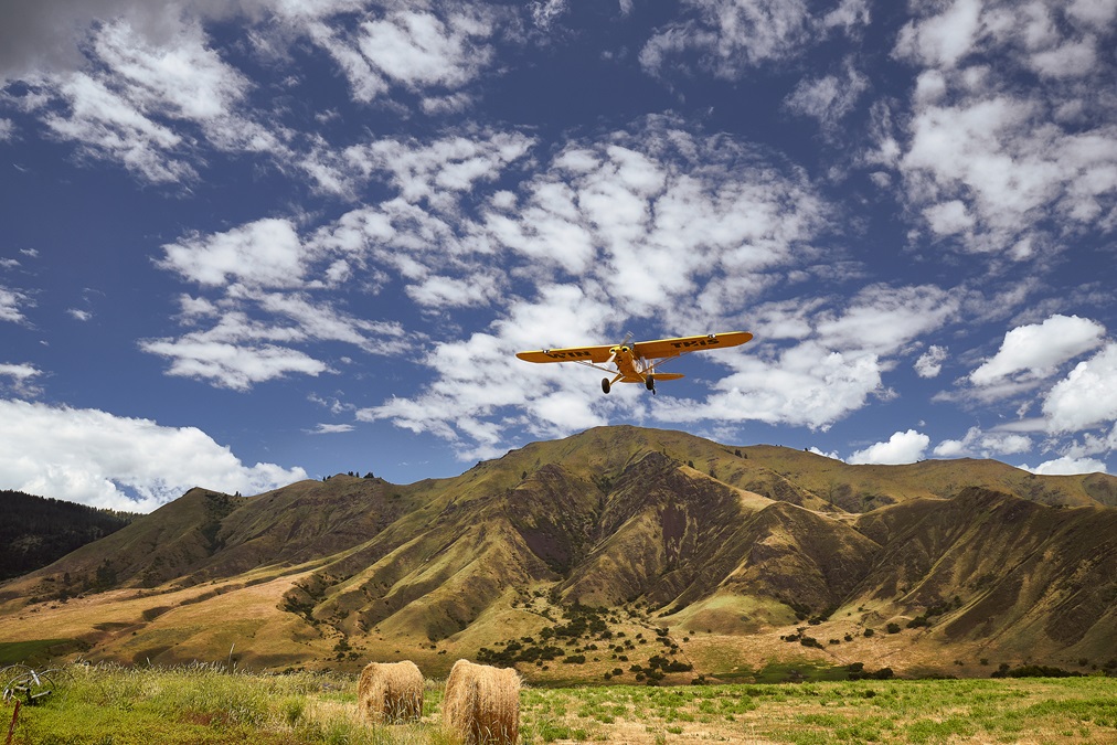
Just four miles east of the Hells Canyon Wilderness area, Slate Creek Airport sits at 1,660 feet in the bowl of a canyon along U.S. 95 and the Salmon River. Nearby peaks top 6,000 feet, so we are operating well below the rim; however, the valley widens as the Salmon River snakes around the 2,600-foot grass runway, allowing for left or right traffic patterns and open approaches. Ingress and egress options run north and south of the runway in valleys before the rising terrain starts.
The windsock is limp, and the surface has tall grass (hay, actually—it gets baled) and a small knoll in the middle of the strip so the takeoff from either end is slightly uphill. After overflying the field in canyon configuration to observe the landing area, I set up to pass over the runway to get a closer look for holes, wildlife, or other obstructions I might have missed. “I never let my guard down on these runways,” Glodowski had counseled me earlier in the day. “They’ve got teeth, but where are they?” Following the speed card notes for the initial descent, base, and final approach, I line up and aim (at the desired 55 mph) for the first third that is marked by white rocks on the side. After landing, the airplane slows quickly in the hay.
Climbing out of the airplane to walk the strip a bit, I gaze skyward at the mountaintops almost a mile above. The grass strip isn’t one I would have attempted before the training because of its location in the bottom of the bowl. With the fundamentals of mountain canyon flying under my belt, Slate Creek presents a manageable challenge—one that leaves me wanting more.
Email [email protected]
Get the latest news and photos of AOPA’s Sweepstakes Super Cub: www.aopa.org/sweeps
Alyssa J. Cobb
Related Articles