CAP provides Hurricane Lane damage reports in Hawaii
Civil Air Patrol members in Hawaii were pressed into service during Hurricane Lane and directed to collect data with their cell phones to help provide more accurate damage reports to the Federal Emergency Management Agency (FEMA).

The National Weather Service reported more than 52 inches of rain pelted the islands in the days immediately preceding landfall, just eight inches shy of the 60 inches of precipitation that devastated Houston from Hurricane Harvey in 2017. “Heavy pounding and hazardous conditions” were reported throughout the islands, the Kauai Emergency Management Agency said.
“FEMA is looking at the situation as a flooding event, but the information we’re getting from current monitoring systems is incomplete because those monitoring systems do not accurately reflect flash-flood data, and there are some areas where monitoring systems are not installed,” said FEMA Geospatial Information Officer Christopher Vaughan.
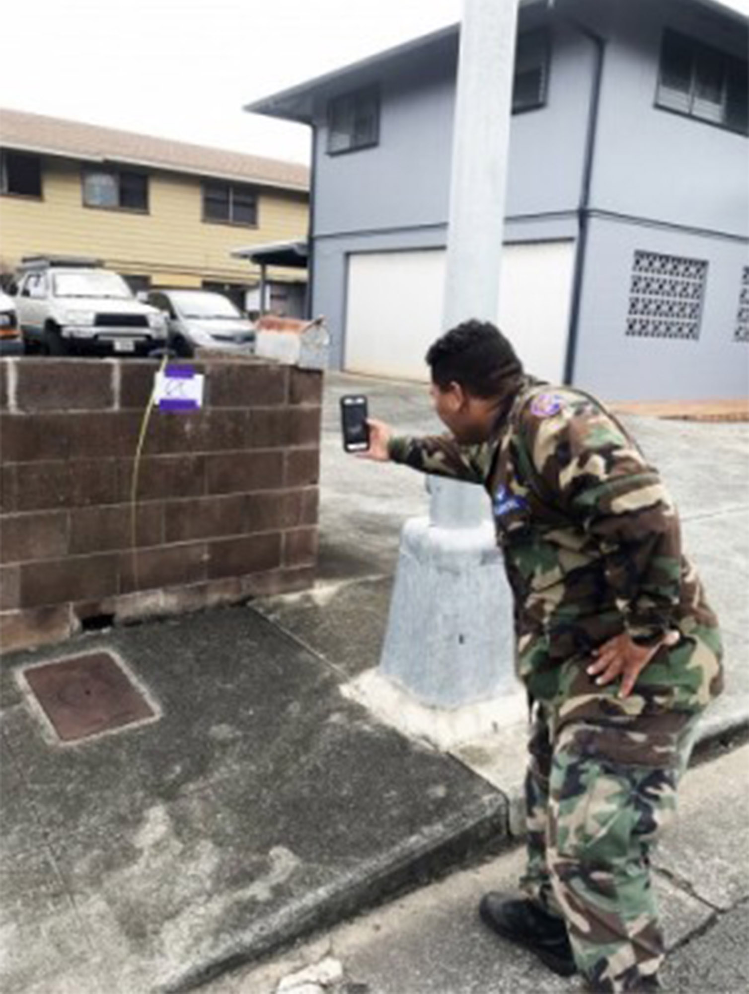
Hawaii Wing cadets were dispatched in teams for ground-based photography missions and directed to use their GPS-enabled smart phones in concert with the FEMA app to document high-water marks left as floodwaters receded. The agency planned to analyze the photos to determine the high-water marks and water wreck lines on structures that would lead to better understanding of the overall impact of the floods. The lines are visual clues that result from dirt or discoloration and remain behind as evidence after floodwaters recede.
The public was also asked to help provide photos via the FEMA app so the agency could complete its evaluation of the storm’s damage. “As people return to school and work ... they can snap photos of high-water marks on homes, workplaces, trees and light poles as they encounter them and just upload them to the app,” said Col. Tim Hahn, CAP Pacific Region commander.
The organization provided aerial warning announcements to the public, surveyed the coastline for potential hazards, and performed other duties during the hurricane’s approach. During 2017’s hurricanes Harvey, Irma, and Maria, the group performed communications functions, photography documentation, and aerial reconnaissance in Texas, Florida, and Puerto Rico.
In other news, the group recently welcomed aviation education expert Martha King of King Schools Inc. to its board of governors. A news release noted that King considered it “an honor” to be associated with the aviation-based leadership organization. In July, the CAP’s cell phone forensics team worked its 1,500th mission during a search for a missing Utah hiker.