Get extra lift from AOPA. Start your free membership trial today! Click here

Hike, climb remote Robber's Roost

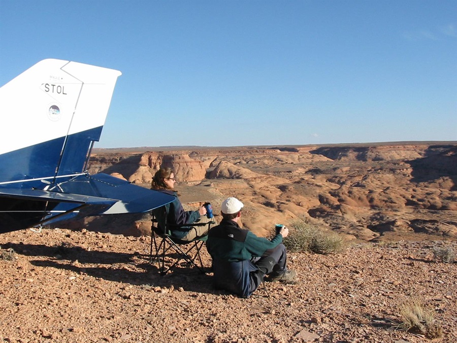
Explore the canyons of Angel Point, Utah

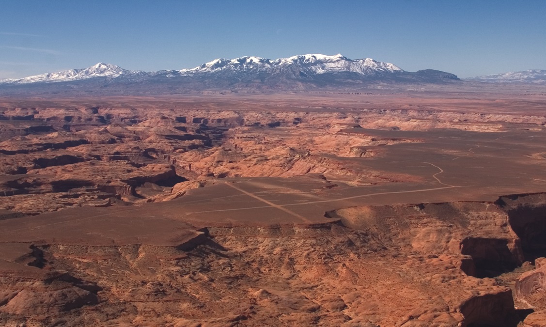
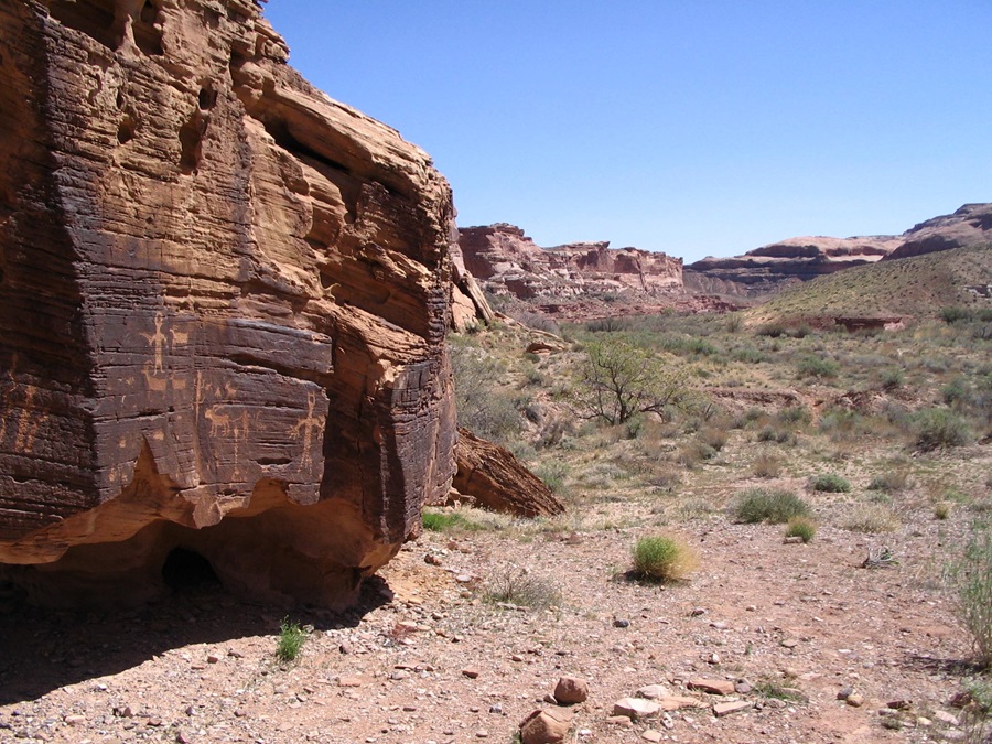
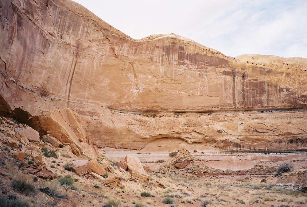
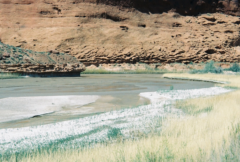
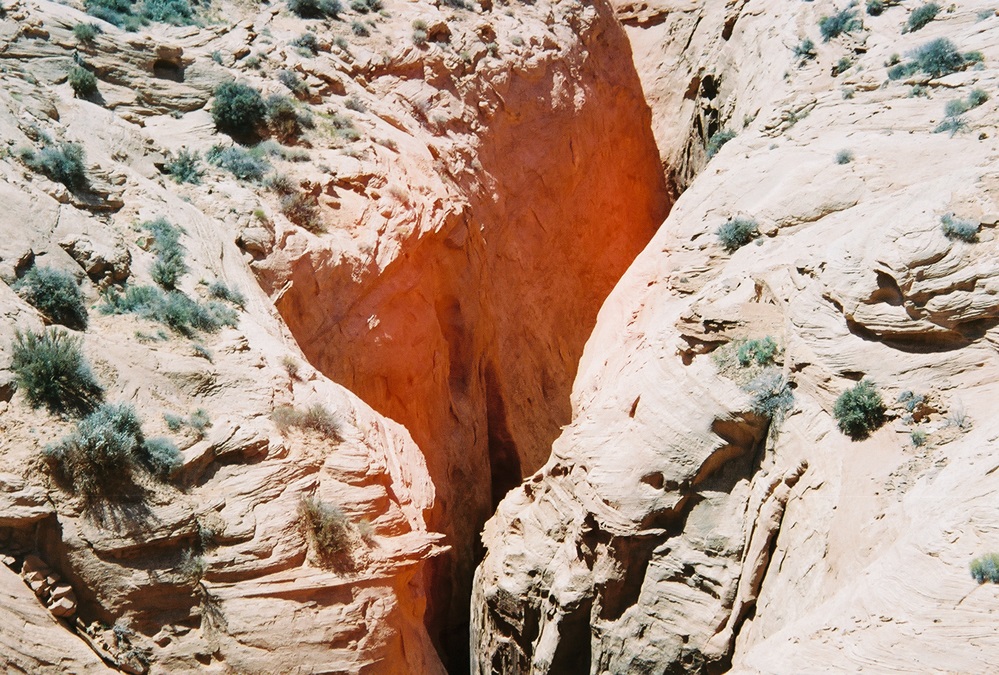
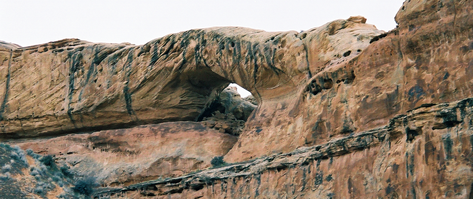
Thinking about flying to one of Utah’s outstanding backcountry airstrips? Angel Point makes an excellent choice. The scenery is very representative of Utah’s red rock, with plenty of hiking in all directions. Deserted as the area is now, it’s loaded with history. Meander down to the Dirty Devil River, named by John Wesley Powell, to find ancient petroglyphs. The airstrip is on the Outlaw Trail used by Butch Cassidy and his Wild Bunch, as well as other outlaws. Rumor has it there’s buried treasure in the surrounding canyons. You can backpack to Robber’s Roost Canyon and look for Butch’s signature in the rocks, or just marvel at the fascinating way water has carved the sandstone in the narrow slot canyons.

  • Rob Hunter of the Utah Back Country Pilots Association camps at Angel Point with his wife June Steeley and their Maule. Camping with great views can be had around the south end of Runway 20. Photo courtesy Karl Spielman.
  • Angel Point, looking southwest. The runways lie on a large, open plateau, rather than at the bottom of a canyon. If you’re just beginning to explore Utah’s backcountry, Angel Point is a good place to start, with a strip that’s challenging, but less so than some others. But first, arm yourself with the vital information contained in the book “Fly Utah!” Photo copyright Galen Hanselman, QEI Publishing. Used with permission.
  • No doubt about it, the desert is as harsh as it is beautiful. The three quickest ways to die here are from thirst, flash floods, or rattlesnakes—well, let’s make that four, you can always crash your airplane—but visiting during cooler months greatly reduces the chances of the first three, and perhaps even the fourth. Photo by Tom Unger.
  • Ride your mountain bike to the Angel Trail trailhead for a dayhike. The road runs down Runway 28 and continues southwest for 4.16 miles. Park at the overlook and descend the steep Angel Trail 1.5 miles to the Dirty Devil River. Across the river is Angel Cove, with its spring, where you should find fresh water and a great place to camp. The river is usually less than knee-deep, so crossing should be easy. Back on the east side of the river, if you turn downstream and walk about a quarter mile, you will find a large boulder with numerous petroglyphs. Photo by Drew Willerton.
  • You can backpack to Robber’s Roost Canyon, a trip to which you can devote between one and six days, depending on how far you wish to explore. It’s about a mile upstream from Angel Cove. Some pictographs are opposite the canyon’s mouth on the west side of the river, with petroglyphs on the east side. Robber’s Roost soon diverges into north and south forks. Take the north, or main fork and after about 4 miles, a trail leading up to the right will bring you to Angel Arch. Continuing farther, you will find more forks with interesting side trips. It’s about 14 miles to the end of the north fork, which becomes very narrow toward the end, where it’s called The Crack. Photo by John Styrnol.
  • Experienced hikers/climbers can challenge themselves with a hike/climb from the airstrip to the Little Middle Fork of Robber’s Roost Canyon, called Mindbender Canyon. Photo by Jason Halladay.
  • First rappel down Mindbender Canyon. This canyon requires complete technical gear and is rated 3A III using the Canyon Rating System. Photo by Jason Halladay.
  • As you proceed down Mindbender, you’ll occasionally have to bridge with your body, to avoid water at the bottom of the slot. Photo by Jason Halladay.
  • Continuing down Mindbender Canyon. Photo by Jason Halladay.
  • On the way out, looking back down the water-carved slot of the Little Middle Fork of Robber’s Roost Canyon (Mindbender). Photo by Jason Halladay.
  • Exiting the Little Middle Fork of Robber’s Roost Canyon and climbing back to the top. Photo by Jason Halladay.
  • Another option for experienced hikers/climbers is a loop hike/climb from the airstrip to the end of the South Fork of Robber’s Roost Canyon, where there is a spring, about four miles. Then you can let down into the canyon. There are five dropoffs from 12 to 40 feet, so you’ll need rappelling gear. In the South Fork, it’s perhaps 13 miles down to the Dirty Devil, with plenty of narrow slots and the Navajo Sandstone walls rising high above. After reaching the river, turn downstream and either take the Angel Trail back up to your airplane, or continue downstream, past No Man’s Canyon, near where this photo was taken. Photo by John Styrnol.
  • Once you reach the river, it’s 4 miles downsteam, passing No Man’s Canyon on the way, to Larry’s Canyon. This is the Dirty Devil River at the mouth of Larry’s Canyon. Photo by John Styrnol.
  • Turn up Larry’s Canyon, which becomes deep, with exposed Wingate Sandstone, for more canyoneering. Photo by John Styrnol.
  • Climb out of Larry’s Canyon at the end and head back to your airplane. This is the view down into Alcatrazz Slot, near Larry’s Canyon. Altogether, the loop down the South Fork of Robber’s Roost and then up Larry’s could take a week. Photo by John Styrnol.

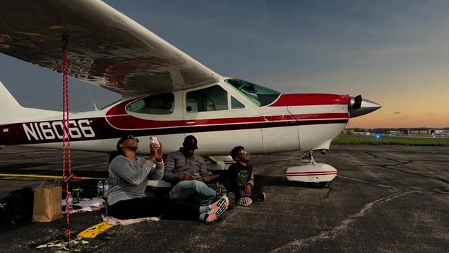
Before flying to any Utah backcountry airstrip, order a copy of Galen Hanselman’s Fly Utah! and his Utah Supplemental WAC Chart. The two-volume book covers just about every usable airstrip in the state and supplies vital information in the form of aerial photos, diagrams that depict runway dimensions and slope, plus surrounding terrain. The book also details what to do on the ground and provides area history. The laminated chart depicts the strips, including 57 that have never been shown on an aeronautical chart before.

Angel Point is 14 nautical miles southeast of Hanksville, in southeastern Utah. From Hanksville, follow the Dirty Devil River as it flows south-southeast through a 2,000-foot-deep canyon. Soon you will see a series of tributaries, all but one coming in from the east. The second major tributary to the east is Robber’s Roost Canyon, at 38°19’15” north, 110°32’15” west. Turn east and follow its south fork. Angel Point will be about halfway down this fork, on the plateau just to the south, and you should see the intersecting runways, with a road leading toward the river. Find it on Google Earth before you go.

Shut down on the runway and then push your plane off the runway for parking; don’t taxi into the brush. Bring your own tiedowns. Photo courtesy UBCP.

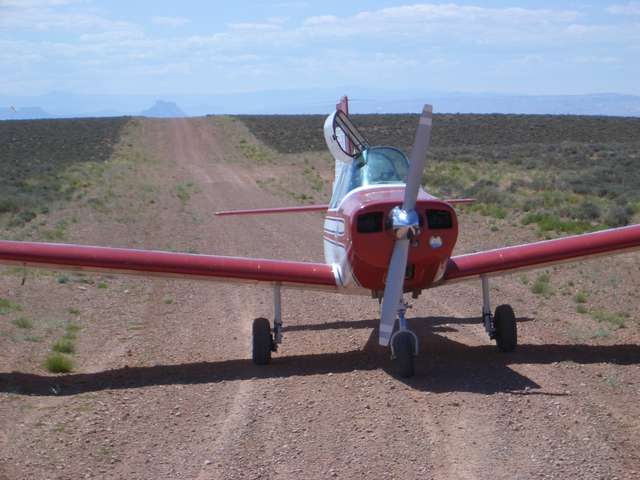
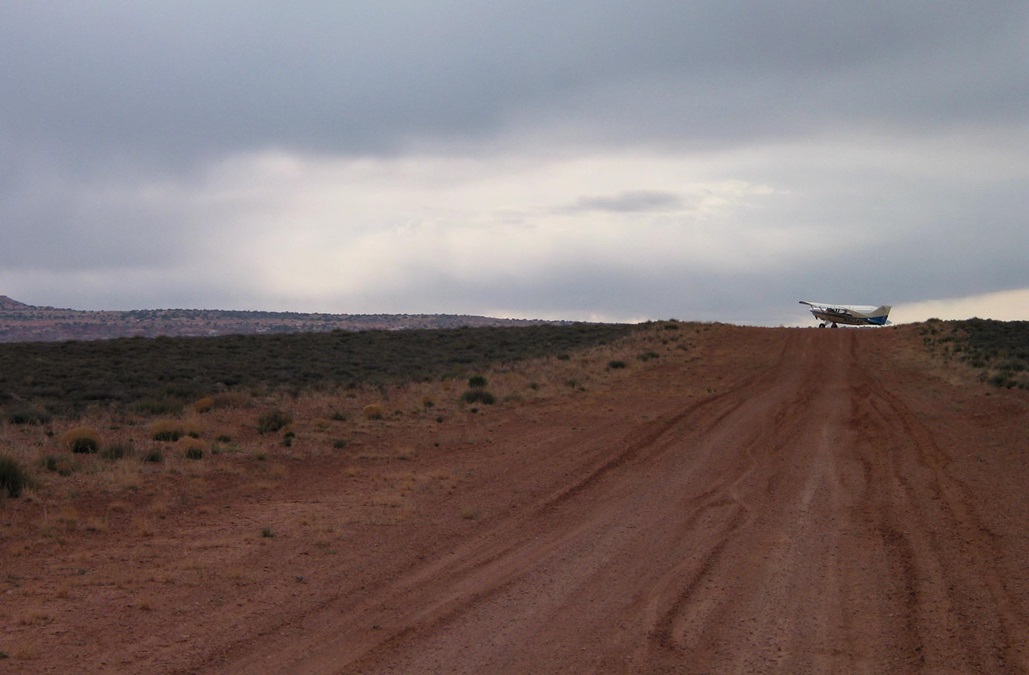
The surface is dirt and gravel, with some sand. You never know if the windsock will be up, blown over, or gone. Drag the strip first to make sure it isn’t obstructed or wet, and watch for ATVs, cyclists, or cattle. Runway 2/20 is only 1,847 feet long by 20 feet wide, with lips and steep dropoffs at both ends, so Runway 10/28, at 2,695 feet (excluding overruns) by 20 feet, is recommended if wind permits. Do not land on Runway 28 before the intersection; this 1,023-foot overrun is unusable, as is the first 55 feet of Runway 10, which also has a couple of humps near the approach end. The Richfield office of the Bureau of Land Management may have information on the condition of the strip, or you can contact the Utah Back Country Pilots Association.

A big rappel down the wall of Mindbender Canyon. Photo by Jason Halladay.

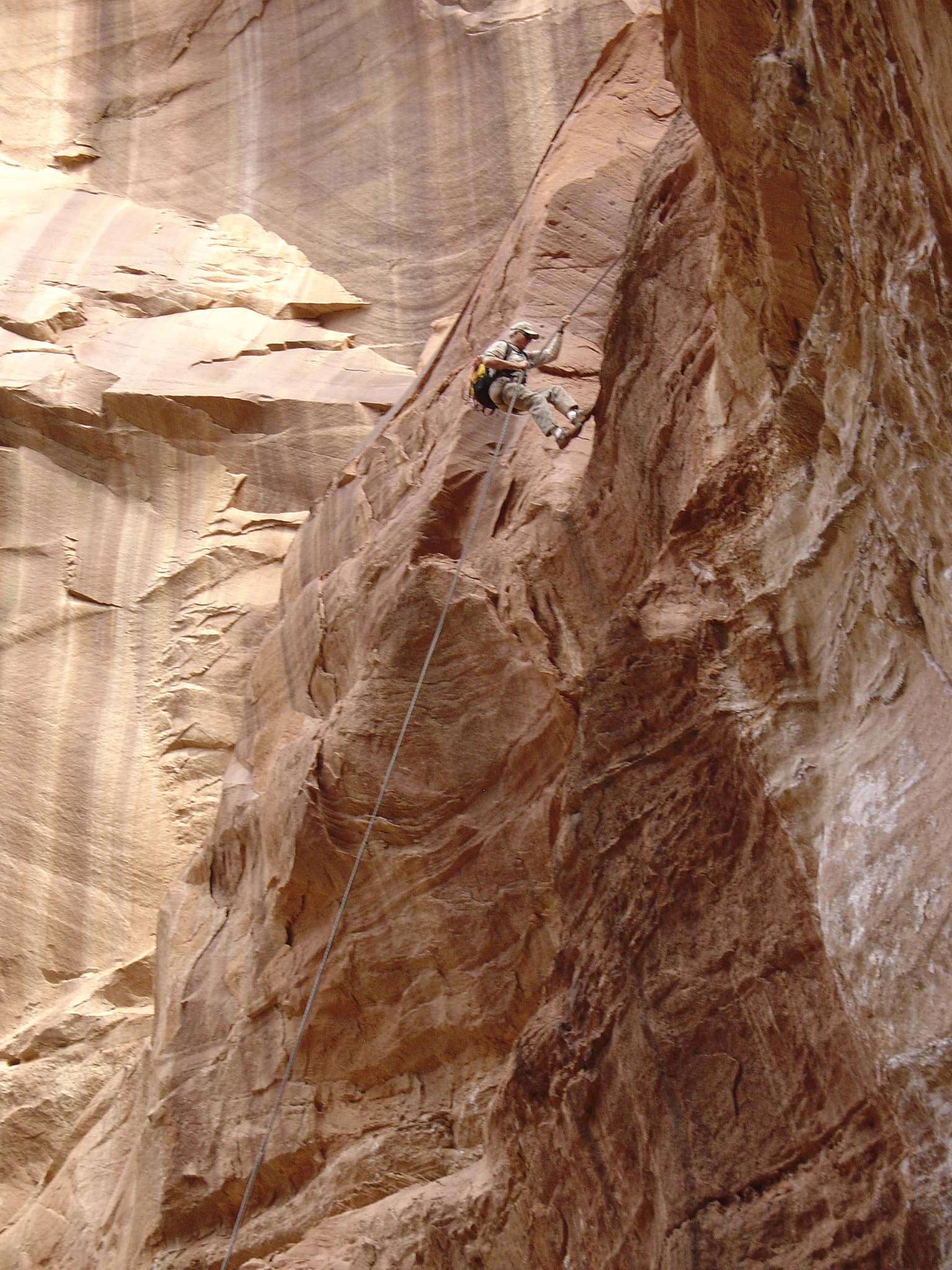
You can explore as much or as little as you like, but come prepared, because you probably won’t see any other people. Remember that poor lad whose arm got caught under a boulder in a slot canyon and he had to cut off his arm? That was in Bluejohn Canyon, not far from here. Lesson: Bring water, food, maps, and gear (a satellite tracker is great too), and tell people where you are going and when you plan to return, so a search can be instituted if you don’t.

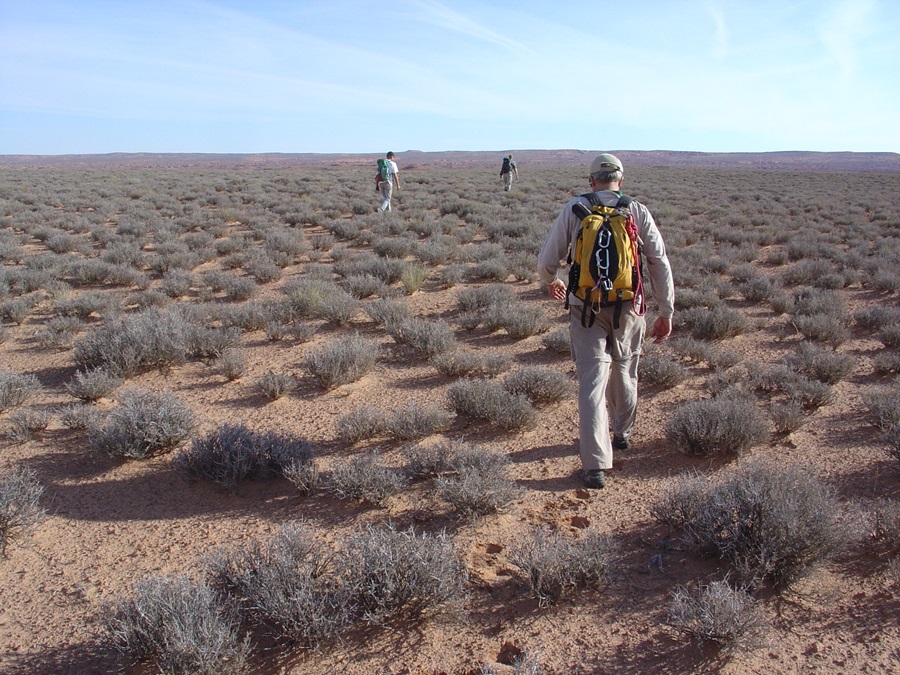
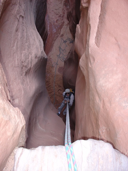
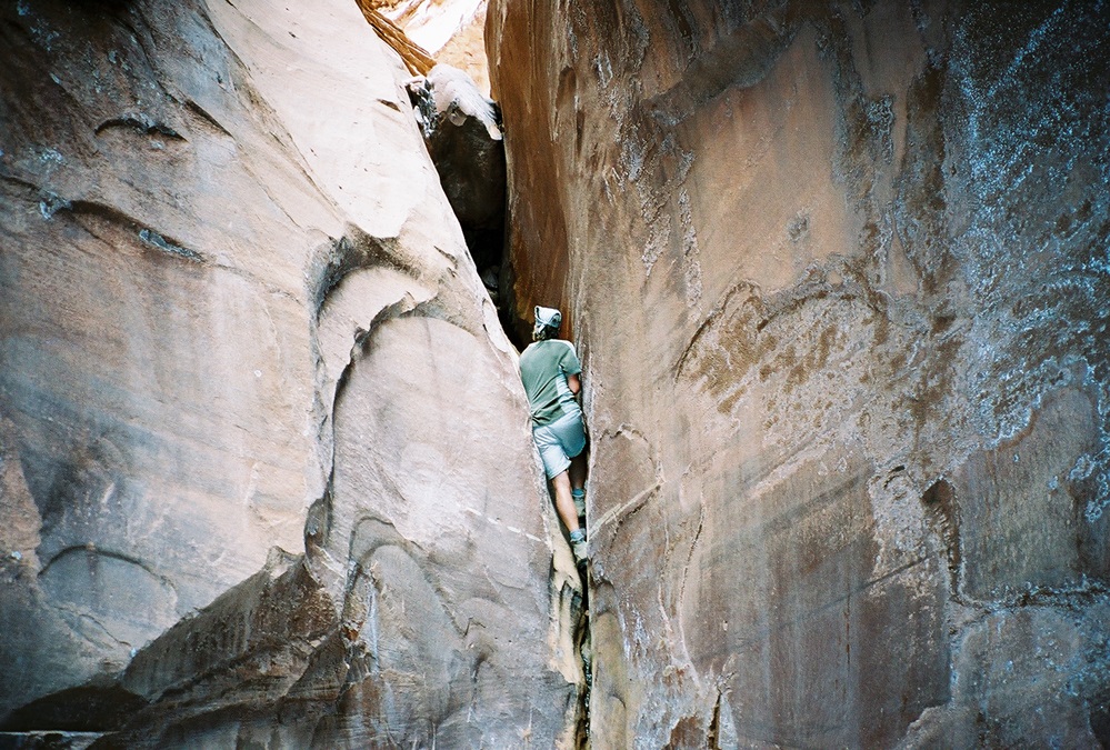
Numerous hikes can be taken from the airstrip, including to Angel Cove, up Robber’s Roost Canyon, down Mindbender Canyon in the Little Fork of Robber’s Roost Canyon, and a loop hike down the South Fork of Robber’s Roost Canyon to the river and then up Larry’s Canyon and back to your airplane. See photo captions for descriptions of all these hikes. Read Steve Allen’s Canyoneering 2: Technical Loop Hikes in Southern Utah, or Michael R. Kelsey’s Canyon Hiking Guide to the Colorado Plateau, Technical Slot Canyon Guide to the Colorado Plateau, or Hiking and Exploring Utah’s Henry Mountains and Robber’s Roost for more details.

Some people devote their entire lives to exploring the canyons, buttes, and mesas of Utah’s redrock country, returning again and again for a peace and perspective they can find nowhere else on Earth. Fly to Utah and experience it yourself!

Angel Arch, in Robber’s Roost Canyon. Photo by John Styrnol.

Share your favorite destination in the AOPA Hangar: Places to fly, things to do, where to eat!

Crista Worthy

Crista V. Worthy

Crista V. Worthy has been flying around the United States with her pilot-husband Fred and their children since 1995, and writing about fun places to fly since 2006. She has single-engine land and sea ratings. Her favorite places to explore are the backcountry strips of Idaho and Utah's red rock country. She currently lives in Idaho and serves as editor of The Flyline, the monthly publication of the Idaho Aviation Association.
Topics: U.S. Travel

Related Articles