Look Before You Land
Wrangle unfamiliar landing sites with Wind-LASSO
By James Rush Manley
A pilot’s initial solo landings rank as major achievements worthy of celebration—getting drenched with water or having your shirttail cut off. But the newly minted aviator quickly learns that finessing an aircraft through a maneuver is not the same thing as judging where, when, or even if he or she should employ the acquired skill.

Ahead of the curve
Pitch for speed in the region of reverse command
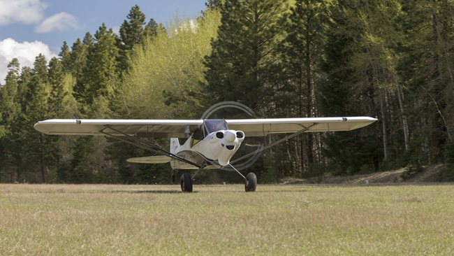
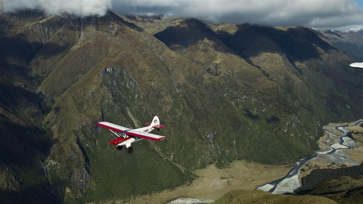
Backcountry pilots often make approaches to short-field landings on the back side of the power curve, to touch down at the slowest speed possible. It’s a useful technique for short, unimproved airstrips, but operating on the back side of the power curve can be dangerous for pilots who don’t understand the inputs needed in this unfamiliar flight regime.
In normal flight, a higher power setting produces a higher speed. But as the airplane slows beyond a certain speed, a lower airspeed will require a higher power setting to hold altitude. This is known as the back side of the power curve, or the region of reverse command. When you’re in the region of reverse command, adding power to speed up may not be enough; pitch is a more effective control of airspeed. That’s why your instructor may have told you to use pitch to maintain airspeed and power to control altitude on final approach. If you’re getting slow, you may need to pitch down to increase your speed.
But why? Two types of aerodynamic drag affect an aircraft in flight: parasite drag and induced drag. Parasite drag has the biggest effect on aircraft at higher speed, and it’s relatively intuitive: As speed increases, so does parasite drag. But induced drag is created by the production of lift. As angle of attack increases at slower airspeeds, lift increases—and with it, induced drag. In the region of reverse command, the increase in induced drag more than offsets the decrease in parasite drag as airspeed decreases. —Sarah Deener
Take, for example, confronting an unfamiliar landing site. Most airports in developed countries build in generous safety margins. Questions about the conditions on the ground are usually—but not always—answered in advance by a combination of charts, chart supplements, notices to airmen, and AWOS/ASOS broadcasts. But where information is not available easily—or at all—a mission flight service with more than 70 years’ experience operating in some of Earth’s remotest regions developed an airstrip evaluation procedure to ferret out information a pilot needs for a successful landing.
Mission Aviation Fellowship (www.maf.org) provides air transportation for church, nongovernmental organizations, and humanitarian organizations that serve remote and isolated people around the world. Started in 1945 by four military airman and one airwoman, MAF operates in jungle, mountain, and desert bush environments primarily using single-engine Cessnas from the 185 through the 208 Caravan, as well as the Quest Kodiak. Landing safely depends on evaluating potential hazards awaiting pilots.
Upon arrival, the pilot performs passes over the airstrip at different altitudes to answer questions asked by the mnemonic Wind-LASSO: Wind, Length, Altitude, Slope, Surface, Obstructions. Each pass yields more information until the pilot has a complete picture of the approach, landing, and go-around environment. This technique also may help pilots evaluate airstrips for recreational flying (see “Not Just for the Backcountry,” p. 39).
Three passes
The three types of evaluation passes—high, middle, and low altitude—may be repeated or omitted as necessary. Fly each as part of a normal pattern. Configure the airplane on downwind leg for landing. Choose an airspeed on the front side of the power curve (see “Ahead of the Curve,” on right) and add partial flaps (if equipped) for better stall margin and forward visibility. Full power should produce an immediate climb in this configuration. A Cessna 182 pilot, for example, would fly at 80 knots with 20 degrees of flaps. Adjust airspeed with pitch. Control altitude/glidepath with power. These are not landings; they are information-gathering maneuvers only.
High. Conduct the first pass entirely at pattern altitude (or greater if obstacles dictate). Don’t hurry. Use the configuration outlined previously and slow down. The goal is not to get somewhere quickly but learn everything possible about an unfamiliar environment.
Medium. Start this pass also at pattern altitude, but begin a descent as if landing. If the runway has significant slope, conduct this pass downhill. Level off and fly over the runway at 100 to 500 feet above ground level (agl), maintaining the chosen airspeed.
Low. Starting from pattern altitude again, configure the aircraft for landing, except maintain the chosen airspeed and flap setting throughout this maneuver. Commence the descent and pass over the runway at five to 10 feet agl. As with the medium pass, conduct this pass downhill to preserve the best go-around option.
Look for a windsock, flags, smoke, or bending trees to estimate wind direction and strength.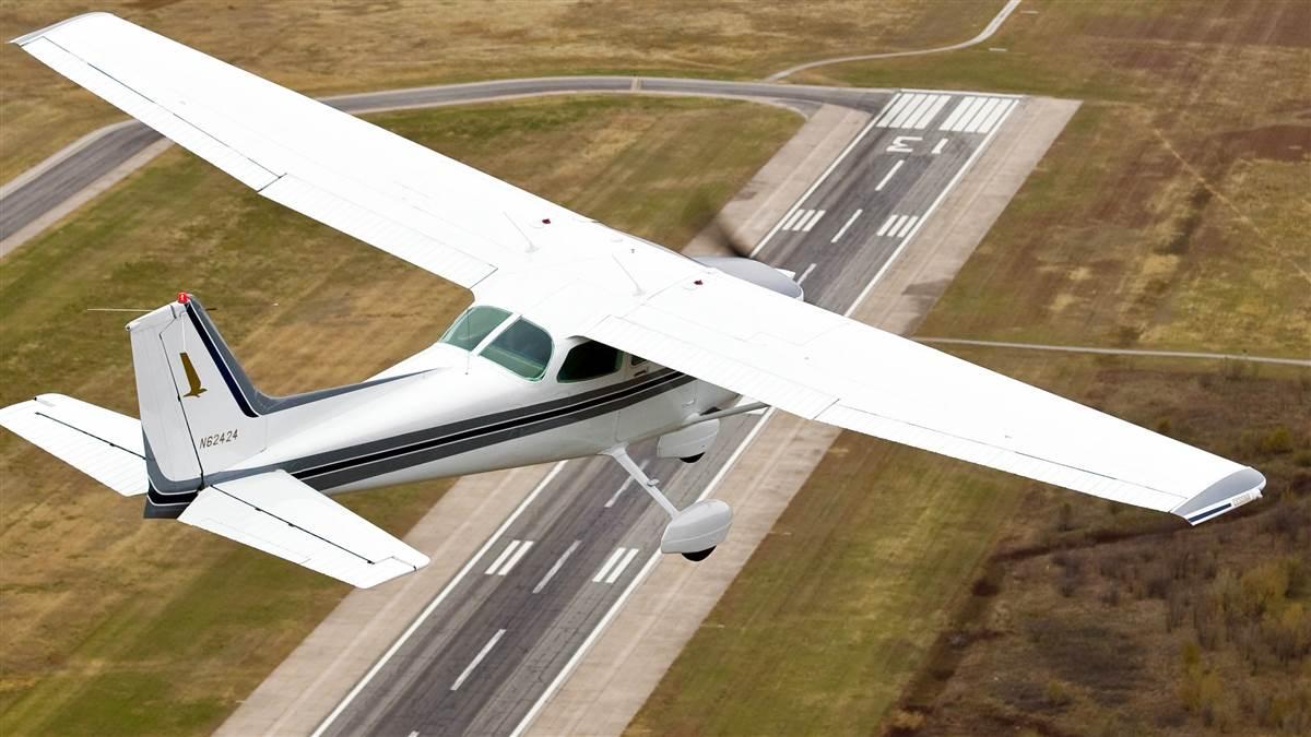
Not just for the backcountry
These tips can help in urban environments, as well
Close visual inspections of landing areas aren’t just for bush pilots in remote regions. They can be a good idea at many runways—even paved ones, in big cities.
At some suburban airports, for example, deer tend to congregate on the runway in the early mornings and late evenings, and pilots must make sure the landing area is clear before taking off or landing.
Paved runways can develop cracks, potholes, and loose gravel, particularly in early spring or after heavy rains, and knowing the hazards helps pilots avoid them.
Seldom-used runways, private, and backcountry strips require pilots to answer even more questions. Does the surrounding terrain dictate taking off or landing in one direction? Are peaks, valleys, or rivers likely to affect wind speed or direction? Are there powerlines or other obstructions nearby? What’s the last place that an approach can be safely aborted?
That covers the approach, but the actual landing area requires even closer inspection. Are there vehicles on or near the runway? Campers? Dogs? Is the surface covered with water, mud, or tall grass? How firm is it? Are there ruts, bumps, or fence posts?
It may take several overflights at various altitudes to answer all these questions to the pilot’s satisfaction. Notices to airmen and pilot reports can provide valuable information, but there’s no substitute for getting a close look at the landing area with your own eyes. —Dave Hirschman
Wind-LASSO
Use as many passes as necessary to answer the questions this mnemonic raises:
Wind. What’s the wind direction and strength? Is it steady, gusty, or from a variable direction? How does that compare with the runway orientation? The pilot can employ two tools to evaluate the wind: the environment and the aircraft itself. In the environment, look for a windsock or other indicator, flags, smoke, laundry on a line, bending trees, upturned leaves, or a calm water surface on the lee side of a hill or bank. To use the aircraft, conduct a medium pass in both directions over the runway centerline. Time both passes at the same airspeed. The pass taking longer is the upwind direction. If terrain and obstacles permit, do a medium pass with the wings perpendicular to the airstrip. The direction and distance the aircraft drifts will indicate the wind direction and strength.
Length. How long is the intended landing area? How much of it is available now? Big Metropolis International might have its 10,000-foot runway length marked on the chart, but the duster strip just outside Little Hamlet probably does not.
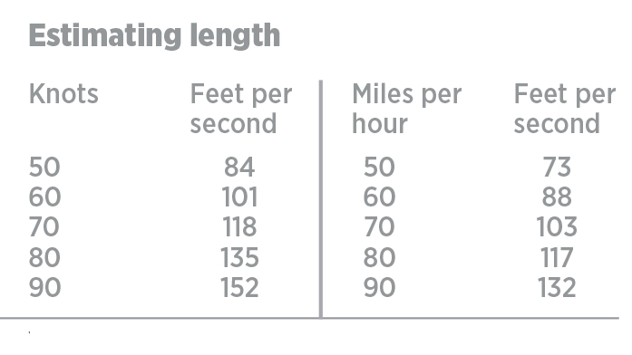
Use the medium pass to approximate length. Start a timer (or count “one thousand one, one thousand two,” et cetera) when crossing the approach threshold. Hold that attitude and speed while flying down the centerline. Stop the count when passing over the far threshold. Multiply the number of seconds required by the appropriate distance per second from the tables above (“Estimating Length”).
For example, a pilot sets up her Cessna 182 with 20 degrees of flaps and flies over the runway at 100 feet agl at 80 knots. She counts off 15 seconds, then multiplies that by 135 feet. That gives her an approximate airstrip length of 2,025 feet.
For airstrips potentially too short for a safe landing, fly two passes, one in each direction. Use the average of the two elapsed times to refine the length calculation.
Altitude. What is the strip elevation? Make the first guess using chart topographical information. Refine the estimate with the medium and low passes, comparing it with the cruise altitude (hopefully corrected by a recent altimeter setting). Conduct a medium pass downhill, to estimate the touchdown zone’s elevation. This is particularly important on a sloped strip.
Surface. What is the surface like? Consider its composition and condition. Is it paved? Dirt? Sand? Grass? Loose gravel? Packed gravel? Is the surface wet or dry? Hard or soft? Smooth or bumpy? Rutted? Broken? Covered with snow, water, or debris? Use the high pass to check overall strip color. Darker sections—particularly on an unpaved strip—may indicate wet or soft conditions. Investigate further with medium and low passes.
Use the medium pass to spot debris, ruts, and holes hidden in high grass. Use the low pass to check grass height, depth of water puddles, and contour size.What obstructions lie in your path? Always plot the full escape route back to a cruise altitude during the high pass.
Slope. Is the runway level, or sloped along its length and width? If the runway is particularly sloped along its length, plan an uphill landing unless strong wind or high obstacles dictate otherwise. But consider how that might affect a possible go-around. It may be necessary to choose an abort point well before touchdown. Past that point, the aircraft is committed to touching the ground—the only question is where.
 A normal 3-degree to 5-degree glidepath will not look “normal” when approaching a sloped strip. To overcome the optical illusion, determine the elevation of the intended touchdown point. Then, start the final leg one statute mile out, 300 to 500 feet above the touchdown elevation. Chose an altitude that corresponds to the desired glide slope angle: 300 feet agl yields a 3.3-degree glide slope, 400 feet a 4.3-degree glide slope, and 500 feet a 5.4-degree glide slope.
If the airstrip is sloped to one side, consider how that might affect the landing rollout in slippery or high-crosswind conditions. In some cases, the aircraft may slide downhill and off the edge of the strip, despite being pointed straight down the centerline.
Obstructions. What obstructions lie in the traffic pattern, final approach path, and the go-around path? Always plot the full escape route back to a cruise altitude during the high pass, before dropping down for a medium pass. Do the plot again before descending further down for the low pass.
Using Wind-LASSO to get the information while also flying the airplane takes practice. A willing passenger taking notes helps. On the ground, check the accuracy of the estimates. It will give you confidence for next time.
James Rush Manley is a freelance writer and pilot based in Meridian, Idaho, with more than 7,000 hours, including operating Cessna 185s and Cessna 206s in the Amazon jungle and Andes Mountains.
How the other side does it
Helicopter pilots learn off-airport landings from the beginning
Unless you’re flying a seaplane, chances are you won’t get instruction in off-airport landing techniques during private pilot airplane training. Even though landing off-airport is allowed, in most of the country it’s not practical.
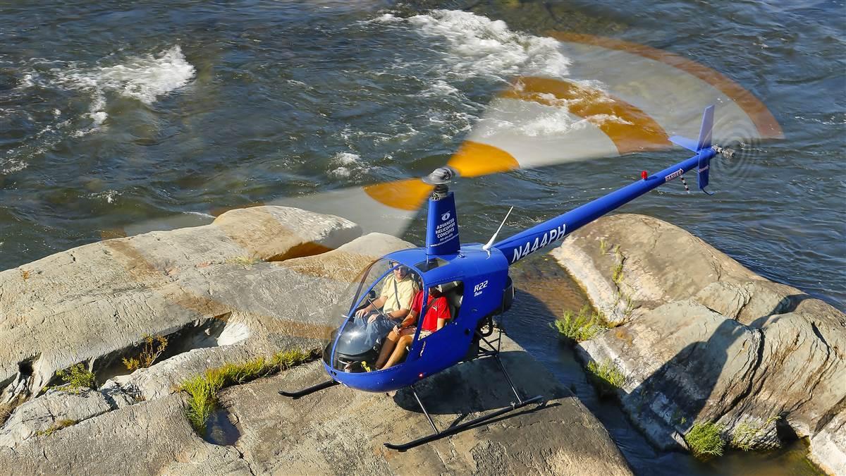
Conversely, helicopter pilots learn how to evaluate off-airport landing sites early in their training. Everyone goes about the process differently, but a common method uses the mnemonic WOTFEEL.
Wind. Determine direction and relative speed to factor into approach decision and landing safety.
Obstacles. Everything from mountains to power lines is scouted and accounted for, and combined with the wind, an approach path is selected.
Turbulence. More of an issue for emergency services or military pilots, mechanical or other turbulence is factored.
Forced landing. If the engine were to quit during the approach, where would you set down the ship? It’s not good enough to have one clear landing spot; emergency landing sites should be present as well.
Entry. Determine the approach path and ensure it’s clear of obstacles.
Exit. Determine the exit path and ensure the helicopter can clear obstacles.
Landing. Can the helicopter comfortably make the landing site? Is there slope? Are there obstructions or people?
These are just a few of the many things a helicopter pilot will determine during a recon circle of a landing site, whether it’s a parking lot, big grass field, or a rock in the middle of a river. —Ian J. Twombly