Southern wildfires affecting aviators
Low visibility, mountainous terrain
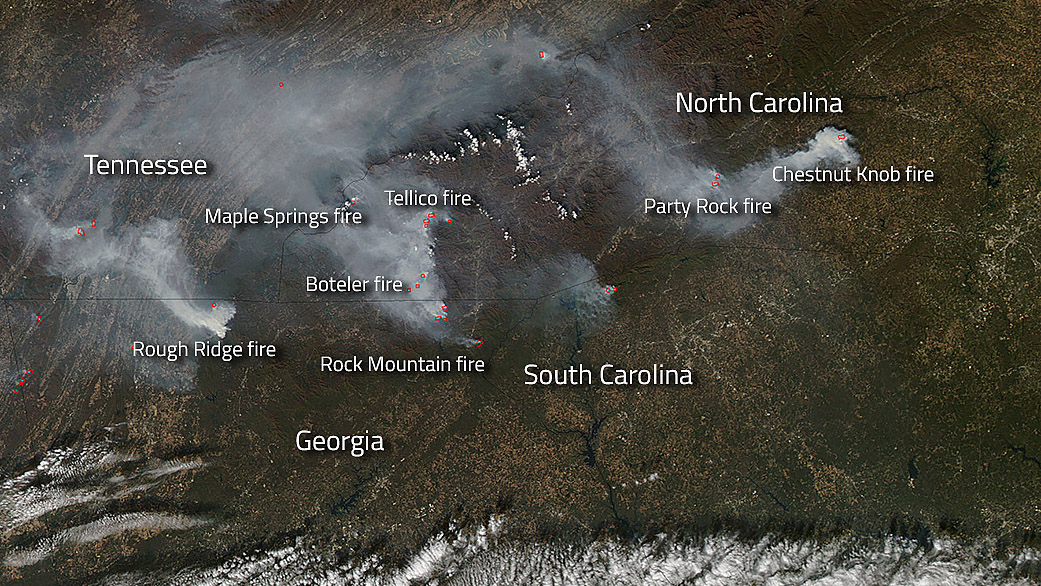
Wildfires are scorching the Appalachian Mountains, plaguing pilots with smoke and low visibility in Georgia, North Carolina, South Carolina, and Tennessee. Temporary flight restrictions have been activated for firefighting activity as winds continue to fan flames caused by lightning strikes and drought with no immediate end in sight.

Pilots unfamiliar with the weather description FU are becoming reacquainted with the smoke obscuration designation as it pops up on terminal area forecasts with more regularity, said AOPA Southern Region Manager Steve Hedges.
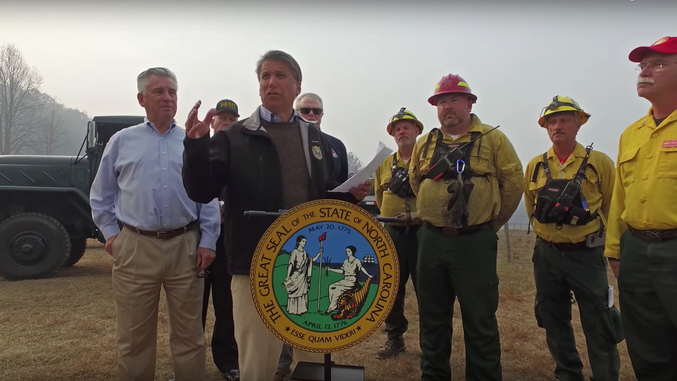
North Carolina Gov. Pat McCrory visited hard-hit Clay and Cherokee counties Nov. 14. The governor said in a video that parts of the state “have been in a drought since late spring and because of that drought we’ve got literally hundreds upon hundreds of acres on fire” that are “causing tremendous smoke.” According to Reuters, more than 36,800 acres of the state were burning with 15 major fires in various stages of control.
Gray haze surrounded the governor and firefighting crews as he spoke at an outdoor news conference near Lake Lure, a tourist attraction pressed into service as an incident command center.
Hickory Regional Airport, a favorite stop for pilots navigating across the spine of the Blue Ridge Mountains, has broadcast an ATIS report for smoke and low visibility for days, as has Charlotte/Douglas International Airport.
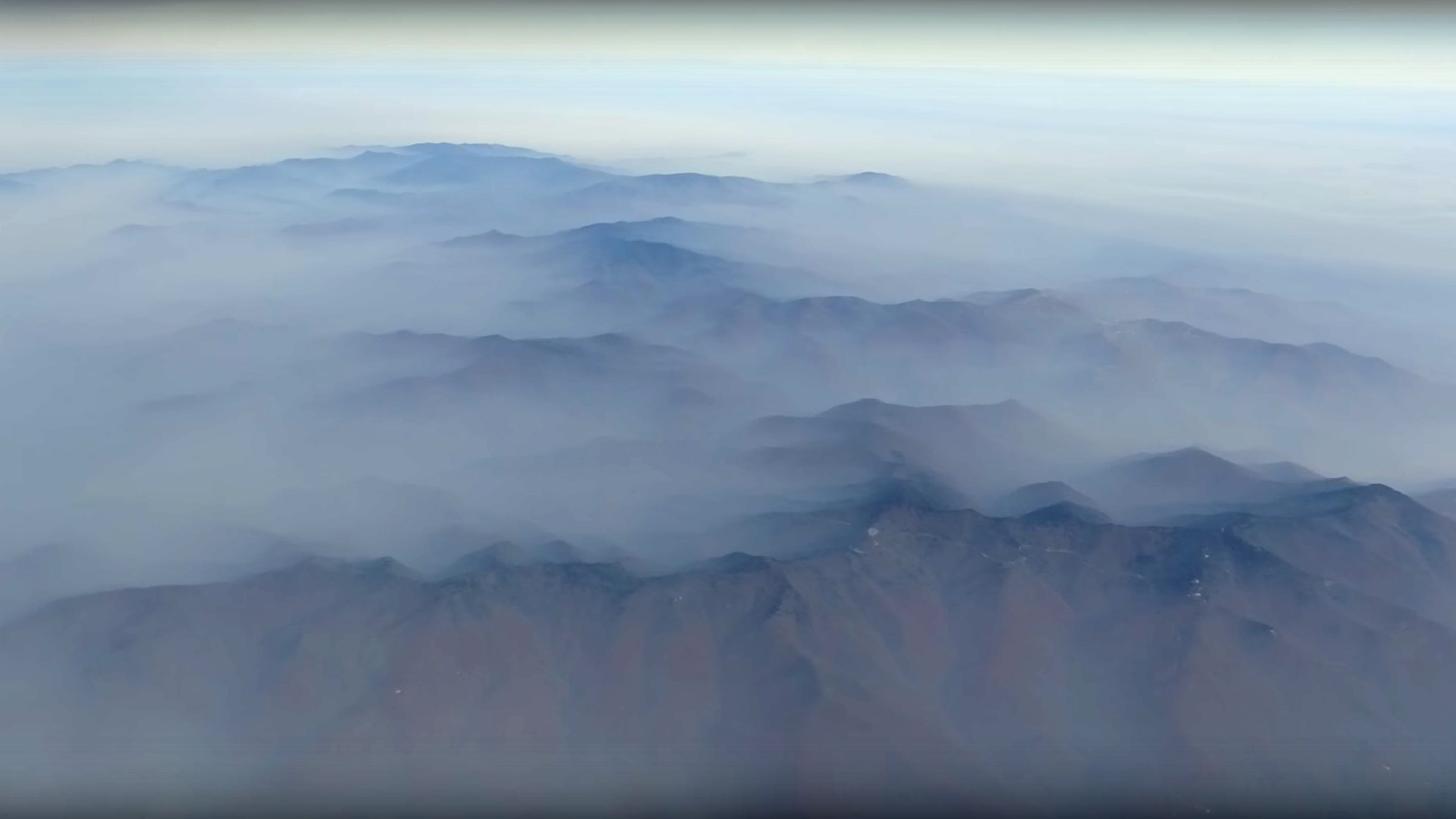
Asheville-based pilot Nancy Marstall said high terrain and low visibility from the smoke-filled haze is a threat to aviators’ safety. “I haven’t been able to fly because of the visibility,” said the Beechcraft Sundowner owner. “Our fires are really terrible now.”
The problem worsens when the sun slips toward the western horizon, she explained, because elevations in the Shining Rock Wilderness to the west top 6,000 feet. Meanwhile, 10 miles to the east, the blaze known as the Party Rock fire near Lake Lure is spewing smoke along those ridges and valleys.
Longtime western North Carolina resident Alan Marler who lives near Asheville Regional Airport said, “It’s as bad as I’ve ever seen.” He said the area hasn’t had significant rainfall since the second week of August. “You can taste the smoke when you go outside.”
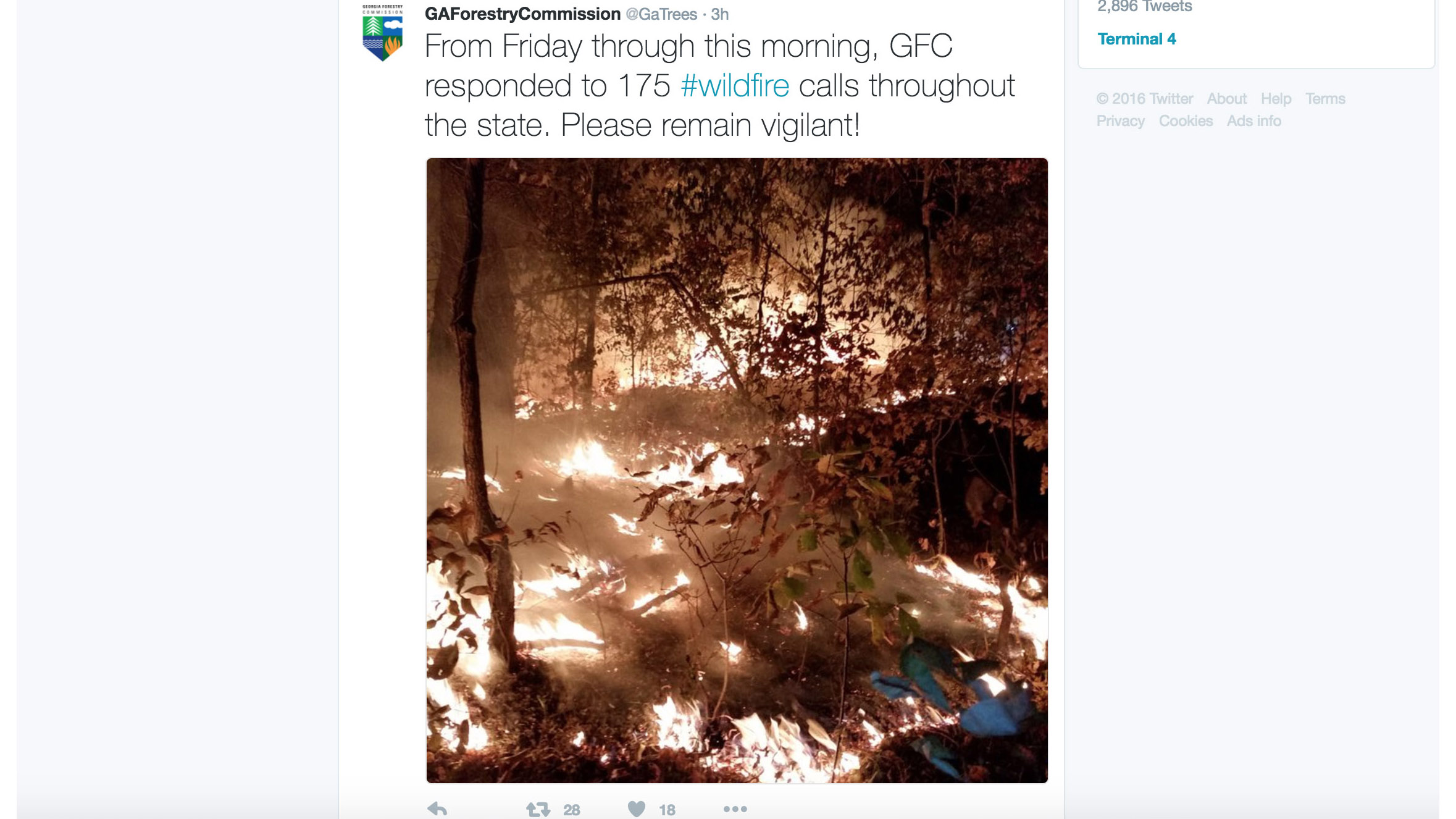
In Georgia, flames from Fannin County’s Rough Ridge fire in the Cohutta Wilderness tore through 23,759 acres, according to an article in The Atlanta Journal-Constitution newspaper. The state responded to more than 175 wildfire calls from Nov. 11 through 13, according to a Georgia Forestry Commission photo caption posted to Twitter.
Reuters reported that the fires in the Georgia mountains could take weeks to extinguish without sufficient rain.
Forestry Commission Spokeswoman Wendy Burnett said more than 28,000 acres were burning in an area about 100 miles north of Atlanta that forced the evacuation of about 60 homes, the news service reported.
Winds kicked toward the south and fanned the acrid smoke past travelers navigating the bustling Hartsfield-Jackson International Airport where the odor was so strong that some thought the terminal was on fire.
Meanwhile in Tennessee, Reuters reported that nearly 16,000 acres have burned in 67 active fires, according to the state Department of Agriculture’s Division of Forestry.
Aviators with the Civil Air Patrol have helped monitor the wildfire situation in two Southern states, public affairs manager Steve Cox told AOPA.
Tennessee Wing aircrews were “flying photo missions to check smoke conditions along Interstate 75 and take pictures of fire sites in middle and east Tennessee,” Cox said. The photographs helped emergency managers make decisions on resources and tactics, Cox said. Kentucky CAP crews identified hot spots in that state when fires popped up there earlier in November.
South Carolina forestry officials posted a news release advising residents to exercise caution from the “pervasive smoky haze that has been intensifying” as fires burn in the three nearby states, although no wildfires were reported in the Palmetto State.
South Carolina Forestry Commission Fire Chief Darryl Jones wrote that the “smoke likely will not dissipate until the Appalachian wildfires are controlled, the northwesterly winds change direction and/or the state receives significant rainfall.”
Charles Hodge, a Spartanburg, South Carolina-based instrument-rated commercial and multiengine pilot said the lack of visibility brought on by the smoke surprised him: “I’ve really never flown in smoke before, and it covered hundreds of miles. You don’t have any visibility straight ahead although you do have some to the side. It was like a film that permeated the entire area.”
Hodge said the thick, hazy conditions reminded him of fog, which he said was “particularly insidious.” He recommended pilots flying in the South near the wildfires exercise caution and be prepared to execute low approaches, which he encountered at two airports on his roundtrip route from South Carolina to Georgia.
“It was kind of like fog but the smoke sort of swirls," he said. "The lesson to be learned is that if you see smoke in the forecast treat it as a true instrument condition because it really is just that.”