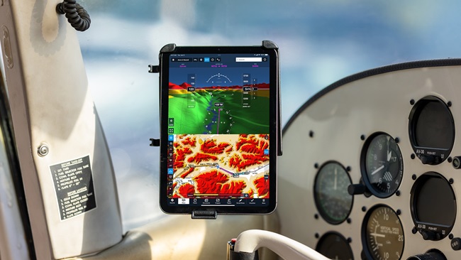
More pilots are turning to apps to replace or serve as a backup to paper charts. The apps highlighted this week take the charts function to the next level by adding tasks including weather, radar, visual hazards, and more. These are not endorsements of any app.
EFB - Charts and Weather for Aviation (free in iTunes, but popular charts and plates subscriptions are $24.99 and $39.99)—This iPhone and iPad app supports paperless operations, and gives pilots access to charts, plates, weather, and other data. Other features include creating multi-point routes and getting guidance; displaying ground speed, altitude, and other instruments; and researching extensive worldwide facility and weather information.
Flightwise Chart Explorer ($4.99 in iTunes and the Windows Store)—This app, optimized for the iPhone 5 and Windows phone, displays VFR sectional charts and IFR en route charts, as well as standard road and satellite maps. Animated Nexrad weather radar is displayed on top of the map, allowing you to see how the weather will affect your flight plans.
Airports 4 Pilots Pro - World Edition ($6.99 in iTunes and $0.99 for a basic version in Google Play)—Get a comprehensive database of public and private airports, heliports, gliderports, balloonports, STOLports, ultralights, and seaplane bases with this smartphone and iPad app. The app database covers nearly 20,000 public and private facilities across the United States, Puerto Rico, Virgin Islands, and Pacific Territories. It includes detailed information on each facility's runways, operations, contacts, services, supplies, frequencies, and more. Top in-app purchases of extra database information range from $0.99 to $49.99.
Reader Plates (free in iTunes)—This iPad app offers users instant access to approaches, arrivals, departures, and airport diagrams, along with en route and sectional charts. Other features include showing visual hazards, allowing draggable route lines and flight planning, and the ability to file and brief flight plans.
AvCharts ($19.99 in iTunes)—Users of this iPad app can view airport diagrams, STARs, SIDs, and approach plates covering the United States. They can also be saved to the iPad for use in the cockpit.
PilotsGuide (free on iTunes, but popular data plans range from $39.99 to $89.99)—Users of this iPhone and iPad app can view their pilots guide pages in sharp detail. Users can view any airport or page in the guide, check weather and additional changes for that airport, or enter their own notes for future reference.
Thanks to those who are sending in the Windows apps. They are greatly appreciated, so keep them coming, along with the Android apps. I’m currently looking for apps in the following categories: checklists, FBOs/services, fuel, instrument simulators, and logbooks. Please send them here. View my complete list of columns here.