Training Tips |
Report the road
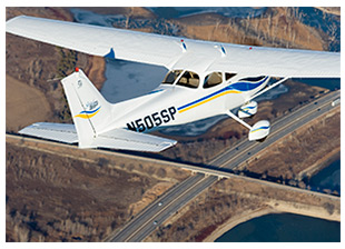
Keep in mind that using pilotage to fly in urban environments can present different challenges than selecting and locating checkpoints did on other cross-countries. And because the communications component of flights into busy airspace takes on critical importance now, you may have to locate the proper checkpoint and then report your position as precisely as possible. That will take great skill and care, with all those buildings, railroads, highways, and interchanges down there. Suppose you are approaching your destination from the west and have been instructed to report at 10 miles west when over a specific highway. Can you tell the many roads apart as they weave their way through the urban sprawl? One pilot who misinterpreted an assigned reporting point—an error that resulted in an airspace incursion—concluded that "being relatively new to the area and unfamiliar with the terrain and landmarks" contributed to the error, the pilot said in a report to the Aviation Safety Reporting System (ASRS). What about weather conditions? A pilot noted the contrasting presentations of a chart and the view from the cockpit in this August 2003 Flight Training magazine article: "The haze rendered many details shown on the sectional chart difficult to pick up until we were relatively close. And, much of the detail that was visible through the haze was not depicted on the sectional chart. For example, there were many more roads than were shown on the chart." Studying aerial images and photos beforehand revealed "the true shape of the town, individual streets, identifiable buildings, parks, and baseball fields." Chapter 15 of the Pilot’s Handbook of Aeronautical Knowledge provides general guidance for selecting checkpoints, and introduces the technique called bracketing to keep you from straying from the desired track. "If possible, select features that make useful boundaries or brackets on each side of the course, such as highways, rivers, railroads, and mountains," it says. Training ProductsSkymark Technologies creates flight logPilot logbook management and record keeping is improved with the Aloft Flight Log, a full-featured electronic logbook for pilots ranging from student to air transport pilot. Designed to streamline pilot logbook management, data entry into Aloft is quick and simplified while still providing advanced customization and efficiency. Aloft supports all FAA, Canadian, and U.K./European pilot record keeping requirements. The logbook is available in three editions: student, private, and commercial. The logbook is free for student pilots who request a serial number. ASA releases new edition of flight review guideASA has released the seventh edition of the Guide to the Flight Review, written by Jackie Spanitz. The guide offers a study and preparation tool for students, pilots, and instructors. The new edition includes current FAA guidance on flight reviews including Advisory Circular (AC) 61-98B and AC 61-91J Wings Pilot Proficiency Program. Other additions include new information on special flight permits, airworthiness directives, electronic flight bags, airport markings and signs, runway incursion avoidance, risk management, and an updated checklist to reflect the current practical test standards. The book costs $12.95. Note: Products listed have not been evaluated by ePilot editors unless otherwise noted. AOPA assumes no responsibility for products or services listed or for claims or actions by manufacturers or vendors. Final ExamQuestionAs you approach your destination airport, you notice that the runway is very wet; a significant rain shower has recently passed. You vaguely remember something about the dangers of dynamic hydroplaning. At what speed does it occur? AnswerThe minimum speed at which dynamic hydroplaning will occur can be computed by multiplying the square root of the main landing gear tire pressure, in pounds per square inch, by nine. For example, the main landing gear tire pressure may be 36 psi. The square root of 36 is six, and six times nine equals 54. In this case dynamic hydroplaning could occur at a speed as low as 54 knots. Be aware that once dynamic hydroplaning starts, the condition can persist well below the minimum initial hydroplaning speed. For more information, see the Pilot's Handbook of Aeronautical Knowledge. Got a question for our technical services staff? Contact AOPA. |
 The cross-country phase is an exciting stage of flight training that pushes back the boundaries of your aviation universe, builds your endurance, and offers a taste of your aircraft's capabilities as a traveling machine. Flights to varied destinations expose you to quiet strips or buzzing terminals—and may take you through numerous airspace classes. (For operations in Class B airspace and at airports located within Class B airspace, make sure you
 Related Articles